High heat continues in central Indiana, rain to come later this week

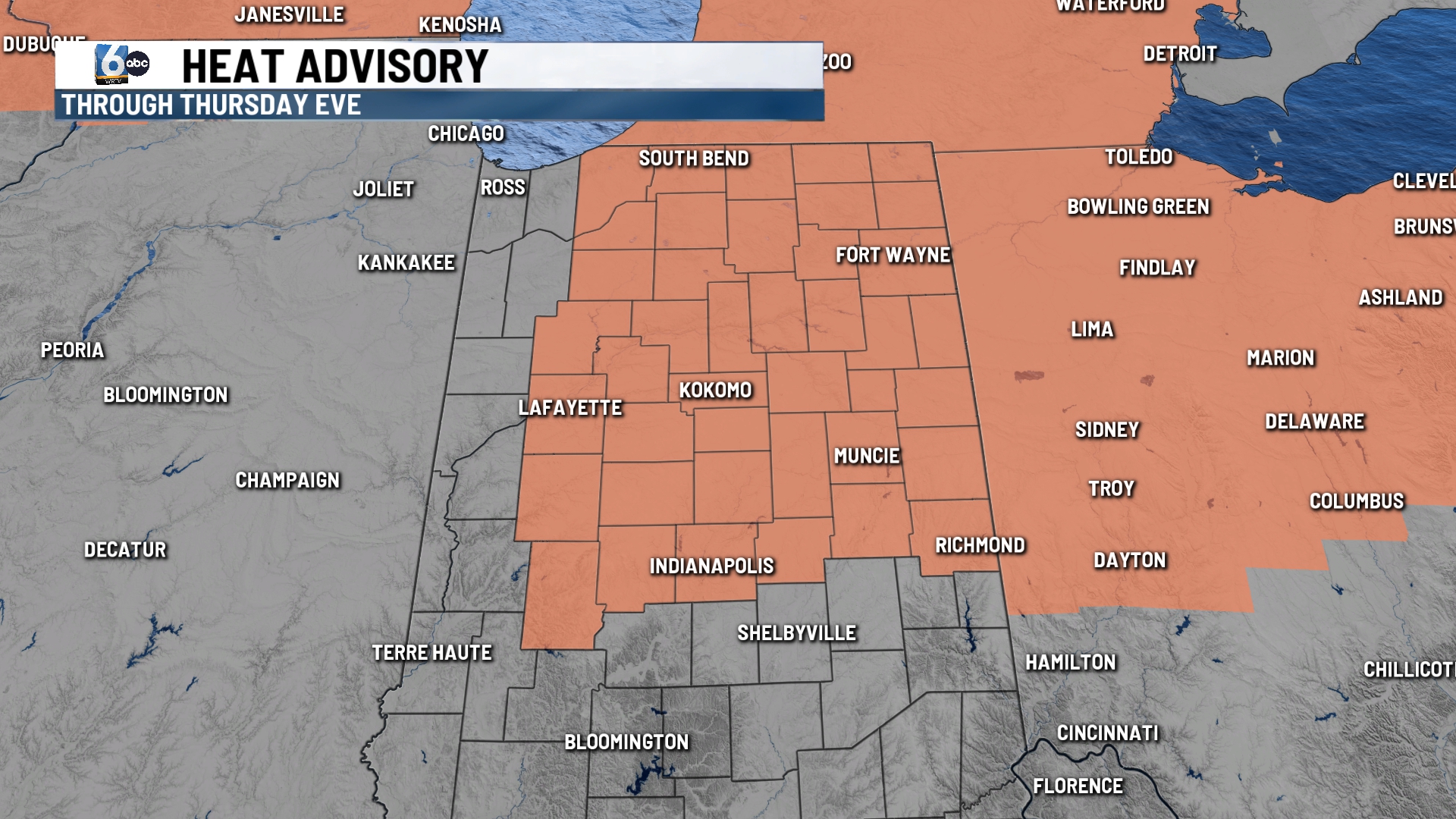
INDIANAPOLIS (WRTV) — A heat advisory is in place along/north of I-70 through Thursday evening with heat indices of 100+ possible.
TONIGHT: Mostly clear skies remain in place. Low temperatures in the mid-70s.
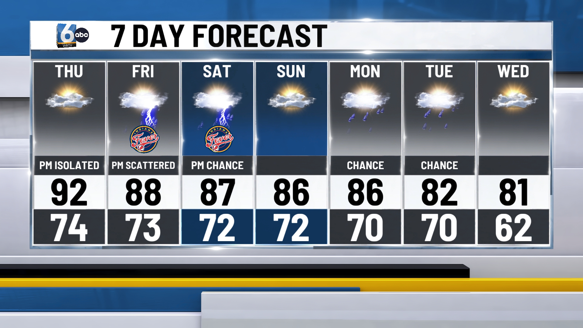
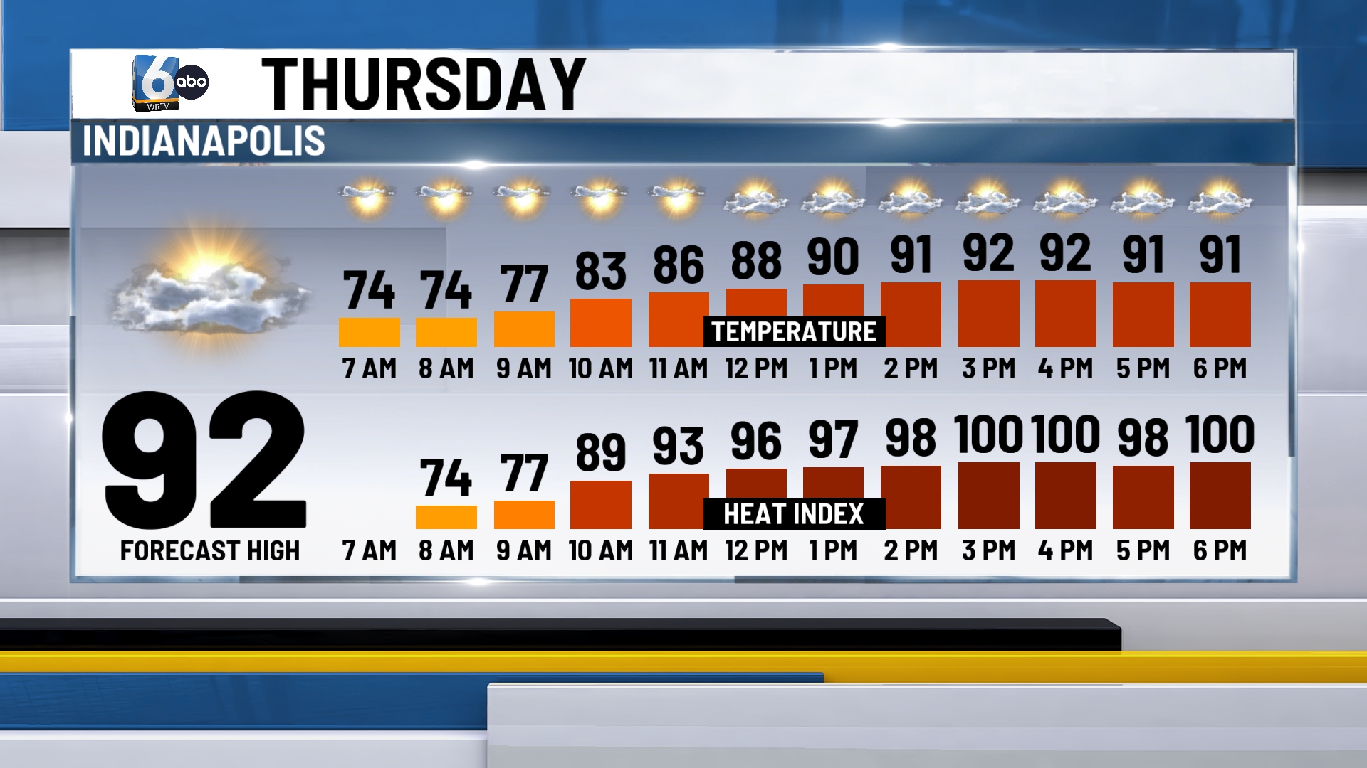
TOMORROW: Partly cloudy skies. Isolated downpours develop in the PM hours mainly along & south of I-70. Not everyone will see these showers. High temperatures in the low 90s. Heat index values over 100 are possible.
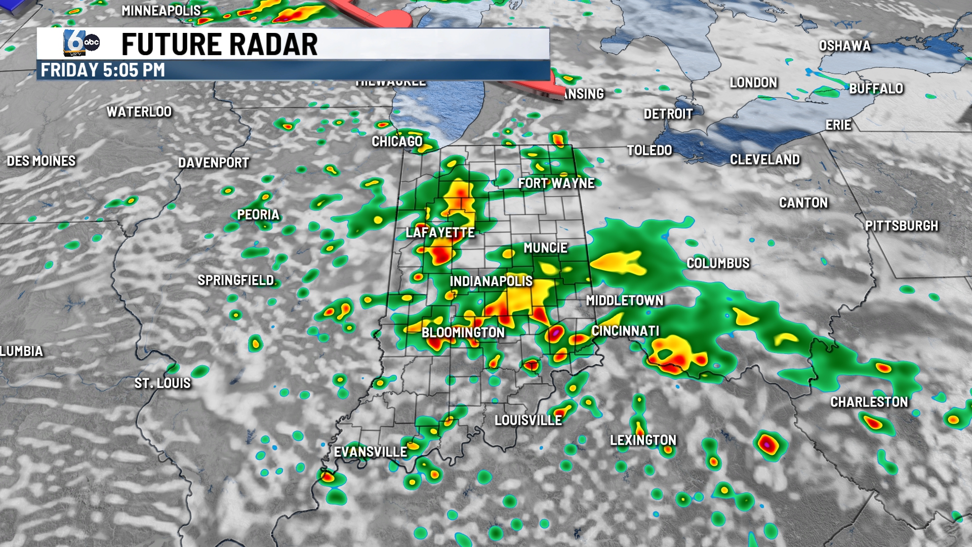
FRIDAY: Scattered showers and storms develop in the afternoon and evening hours. This is the best rain chance of the forecast going forward. Severe weather is not expected. High temperatures in the upper 80s.
7-DAY FORECAST: A few showers and storms are possible Saturday PM. High temperatures back off going into next week. Out-of-control fires in southern Canada continue to burn. We may have to monitor this over the next week. For now, it is in the upper levels of our atmosphere at times, but not super thick.