Waves of strong to severe storms possible through midweek

INDIANAPOLIS (WRTV) – Multiple rounds of storms are possible in the coming days, including a strong line of storms Tuesday evening.
TONIGHT: A severe thunderstorm watch is in place for far eastern Indiana until 8 PM EDT. Isolated pop-up storms are possible early on, mainly north and east of Indianapolis. Most are expected to be dry. Low temperatures in the low 70s.
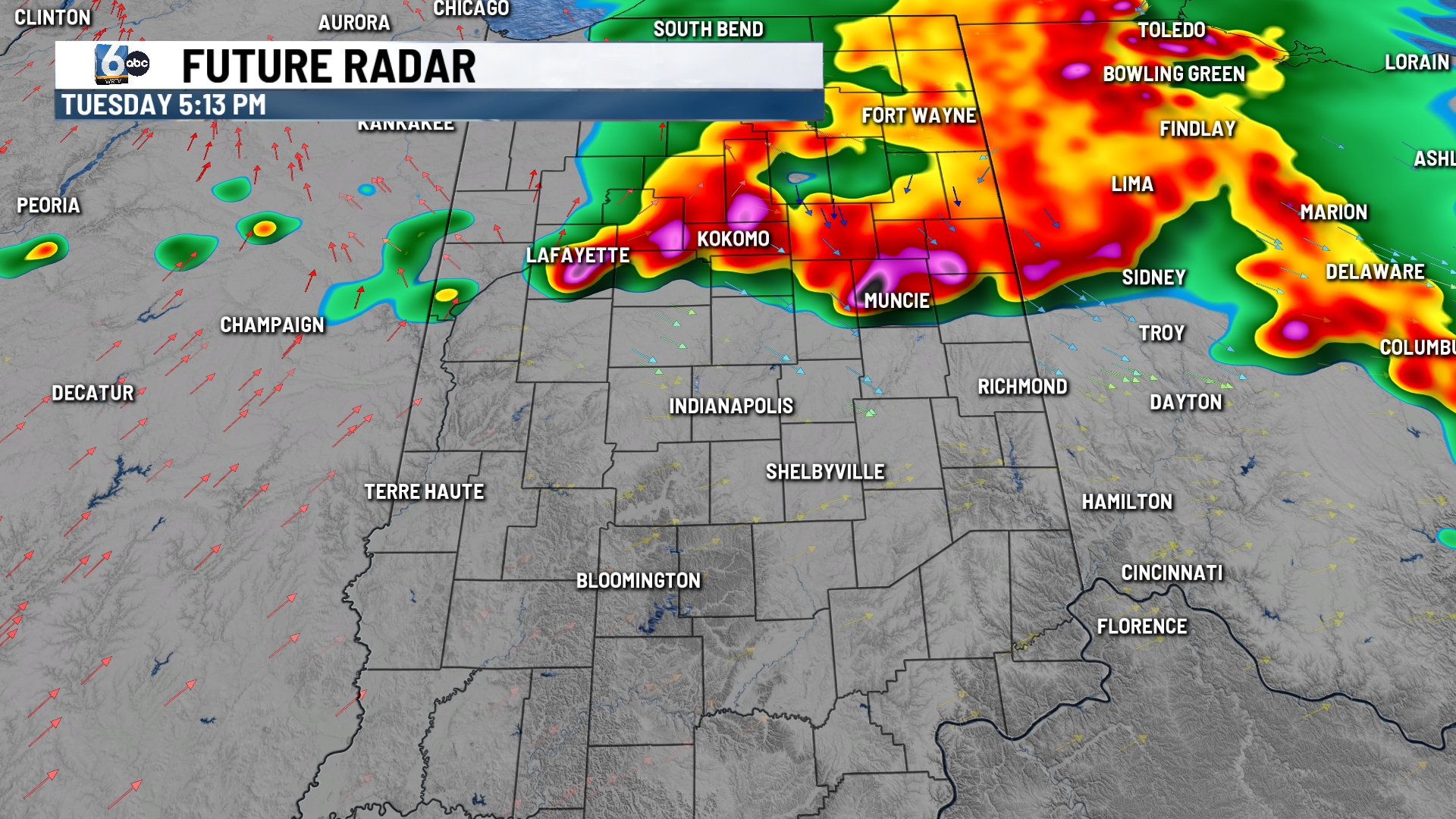
TOMORROW: Spotty rain/storms are possible waking up Tuesday; not everyone gets rain. The morning round could have some isolated stronger storms, but the concern is for round 2 later in the day.
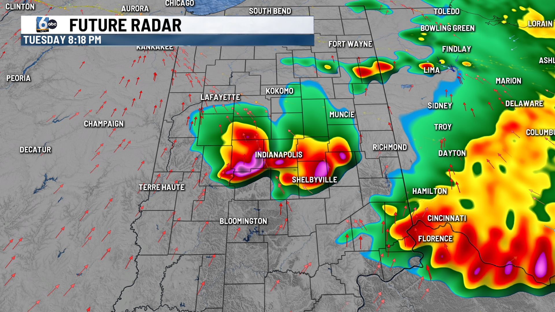
From there, a break in the action is expected for the middle portions of the day. A cluster of storms drops in from the north or northwest in the window of 3 PM – 9 PM EDT for central Indiana.
A good portion of Indiana is at an enhanced (3/5) risk of severe storms. Damaging wind is the main concern. High temperatures in the upper 80s.
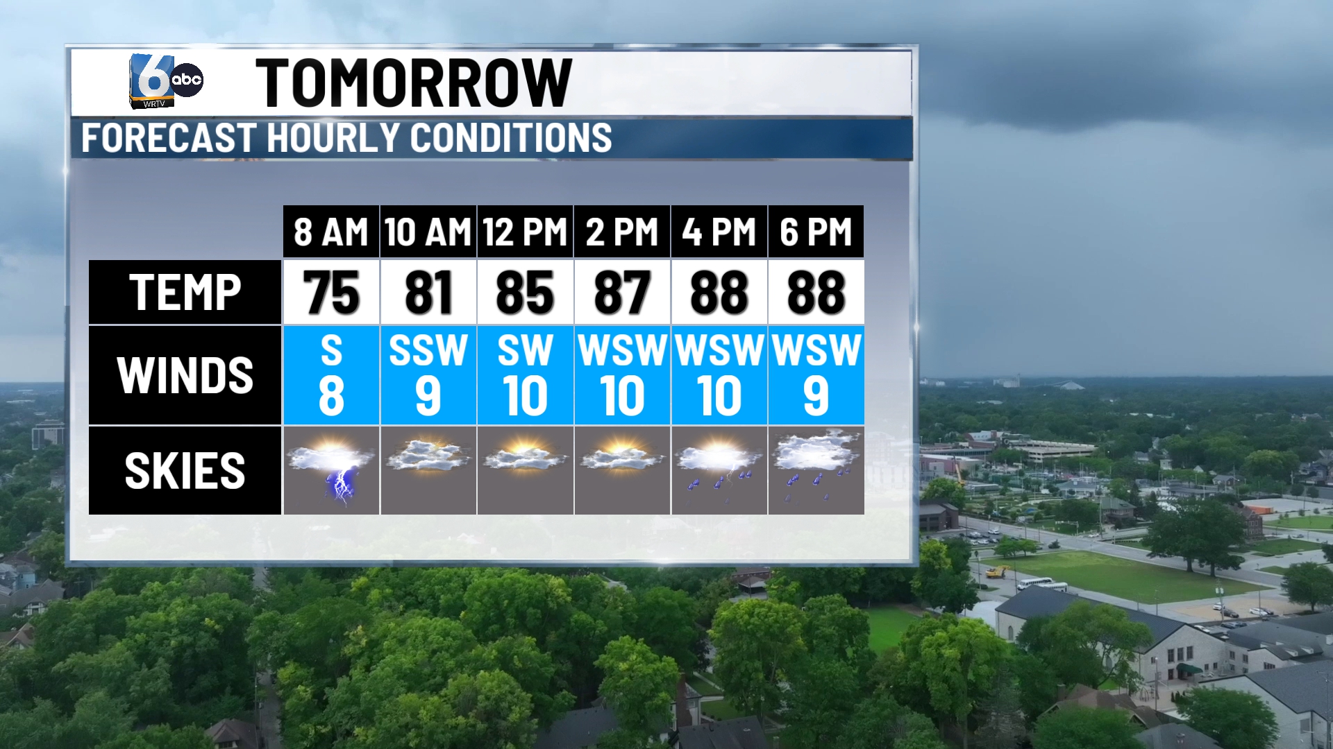
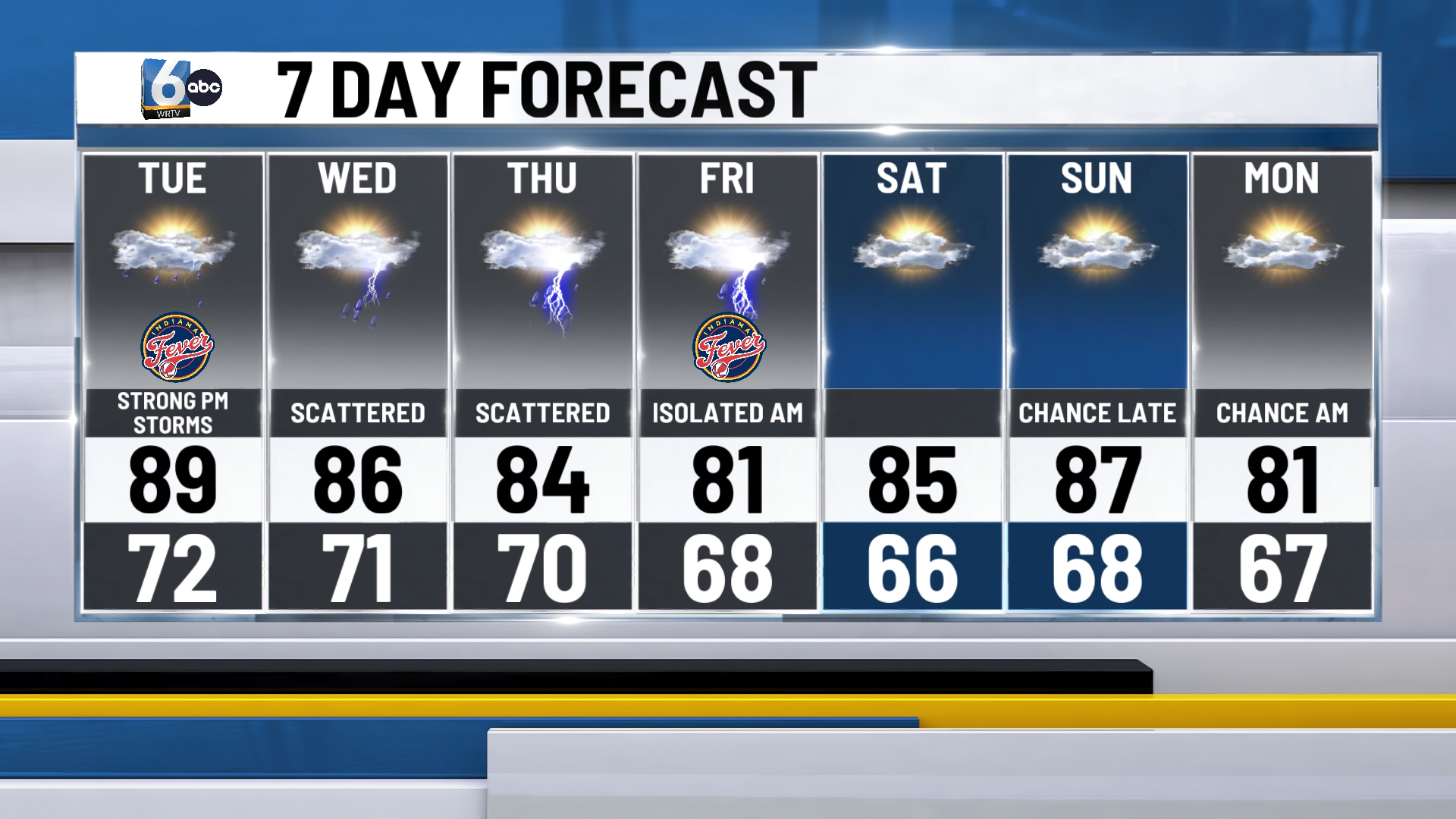
WEDNESDAY: Scattered showers and storms possible. High temperatures in the mid-80s.
7-DAY FORECAST: Rainfall totals will climb quickly in the coming days. A good chunk of central Indiana could see 2-4″ of rain through Friday, with higher amounts in eastern Indiana. Temperatures this week will consistently be in the 80s under a humid air mass.