


Soggy and cool start to the weekend, monitoring PM Storm chances
INDIANAPOLIS (WRTV) — Widespread rain showers with embedded downpours are moving through the state this morning.
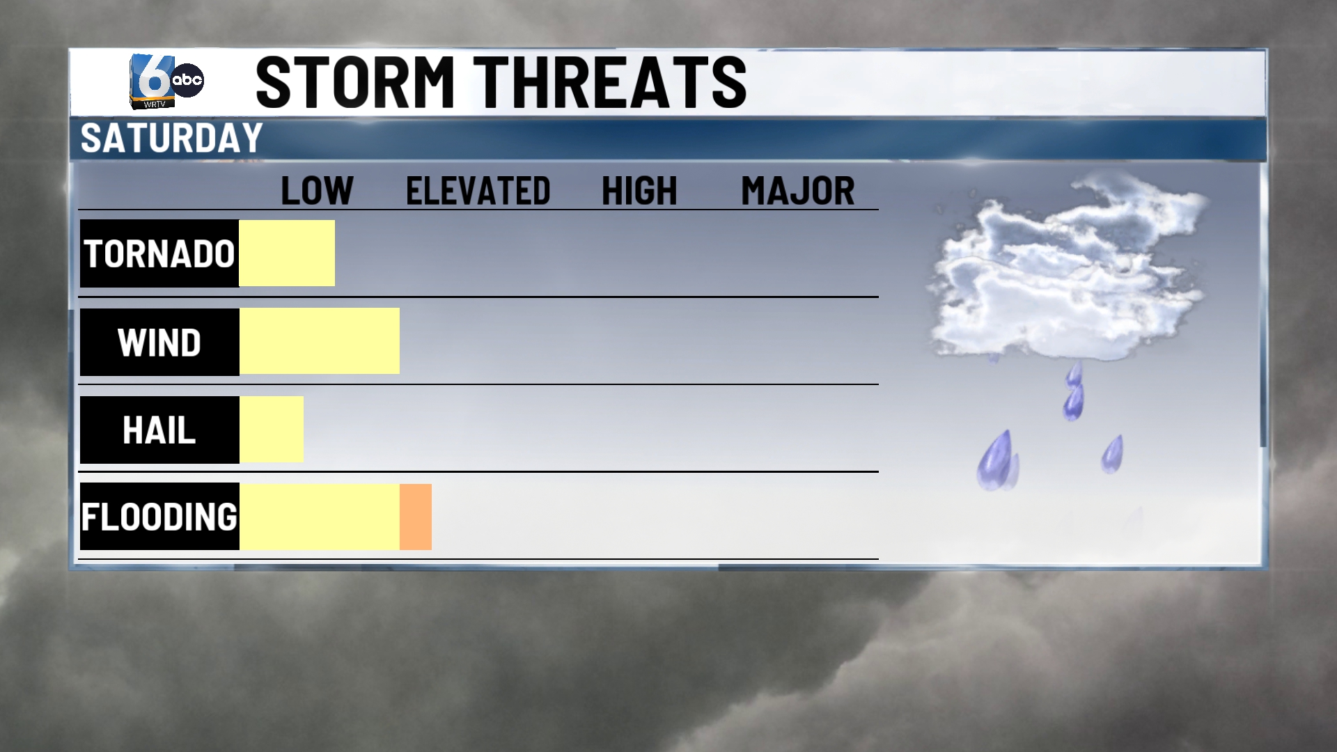
TODAY: We have the chance for scattered showers and storms. Officially, most of the state is under a level 1 risk for severe weather with a level 2 risk for SE Indiana. Main impacts will be damaging wind potential and a chance for minor flooding. 0.5-2″ of rain is the expectation by the end of the day Sunday, but some could push higher than that, especially in northern Indiana, prompting the flooding risk. There is a low-end risk for a quick spin-up tornado. Highs today will only manage the mid-70s, but it will feel sticky with dew points in the mid-60s.

TONIGHT: lingering showers and downpours, especially across northern Indiana. Otherwise cloudy with lows in the mid to upper 60s.
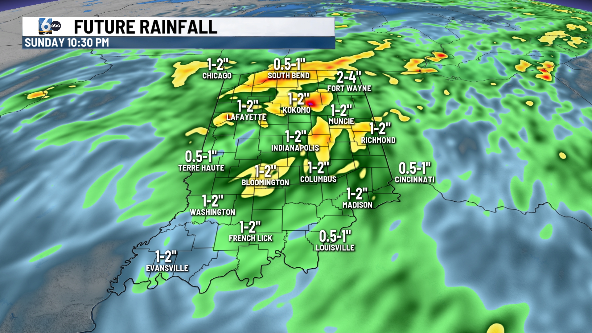
TOMORROW: Cloudy, overcast skies with a few lingering showers and isolated brief downpours. Temperatures will again be in the mid to upper 70s.
MONDAY: Mostly cloudy with temperatures in the upper 70s to around 80. There is a chance for a stray shower or two, but most stay dry.
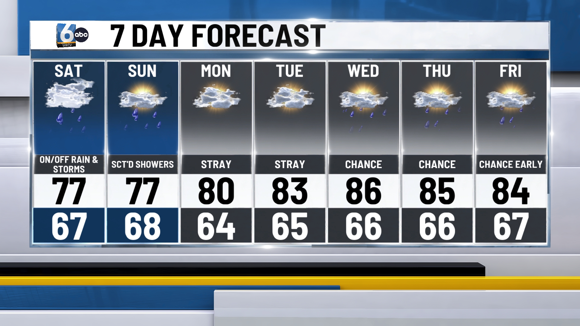
7-DAY FORECAST: A chance of a stray shower remains for Tuesday, with better rain chances on the way for Wednesday and Thursday. Temperatures will get warmer throughout our first week of August, heading back to the mid and upper 80s by week’s end.
