


Showers and storms bring heavy rain this weekend

INDIANAPOLIS (WRTV) – Enjoy this nice Friday. Showers and storms move into the state later tonight and stick around all weekend.
We may see some heavier pockets of rain setting up across parts of central Indiana. Temperatures stay below normal for both Saturday and Sunday.
TODAY:
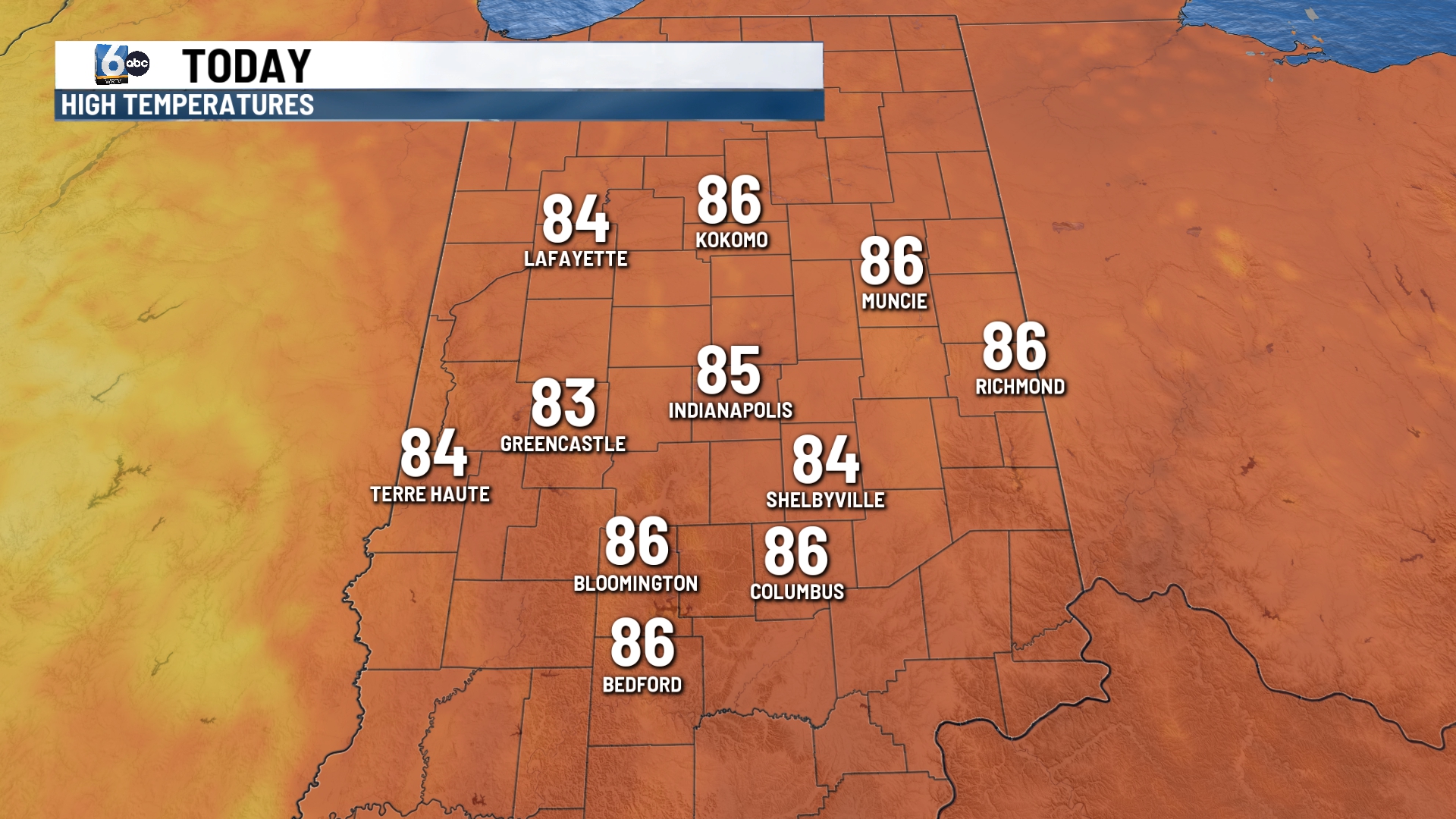
Dry through much of your Friday with clouds increasing during the day. It will feel a little more humid throughout the day. Temperatures will climb into the middle 880s which is right around normal for this time of the year.
Rain moves into the state later tonight.
TONIGHT:
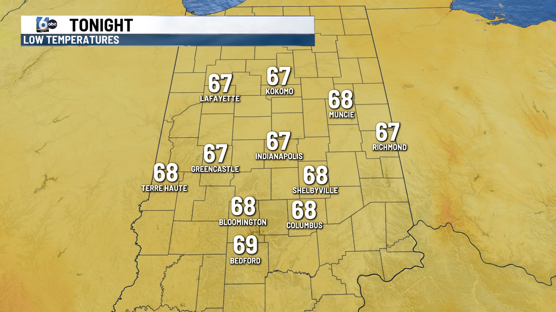
Look for cloudy skies during the evening hours. Rain develops overnight and sticks around for the weekend.
TOMORROW:

Rain begins the day and will continue on and off the day. We may see a few thunderstorms and a few of those may be on the stronger side. We have a level 1 out of a level 5 severe weather risk across parts of central Indiana. Gusty winds and heavy rainfall will be the primary threats.
Due to the rain and cloud cover temperatures will stay in the 70s. Humidity does increase so it will feel a little uncomfortable.
7 DAY EXTENDED FORECAST:
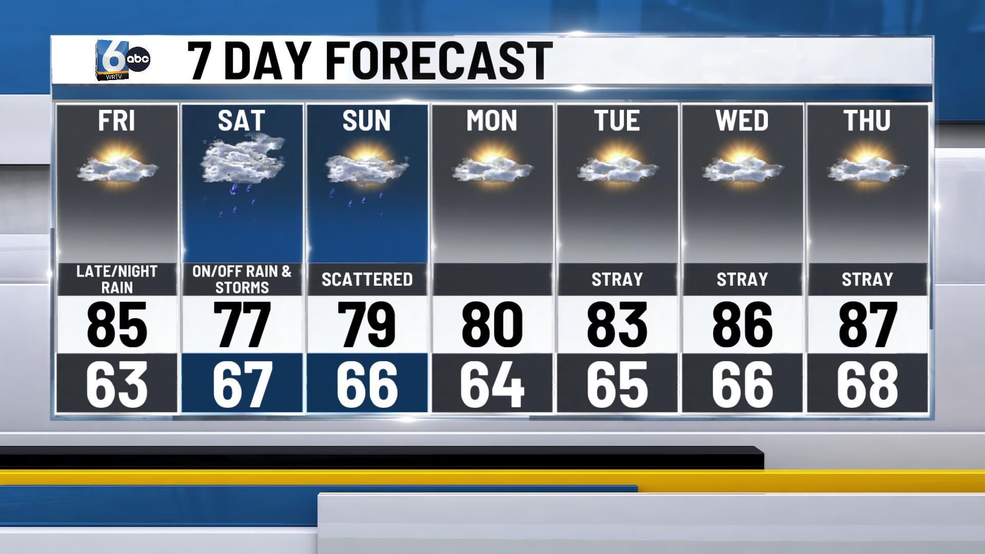
Scattered rain chances will be possible on Sunday, especially early in the day. Temperatures stay in the 70s for the end of the weekend.
Temperatures climb into the 80s for much of next week. It stays humid with a stray shower possible in the afternoon.
