


Heat wave continues with spotty storms possible in northern Indiana

INDIANAPOLIS (WRTV) — Temperatures continue to be into the low and middle 90s today and Friday. Spotty storms will be possible through the end of the week and a few isolated storms may be on the stronger side.
TODAY:
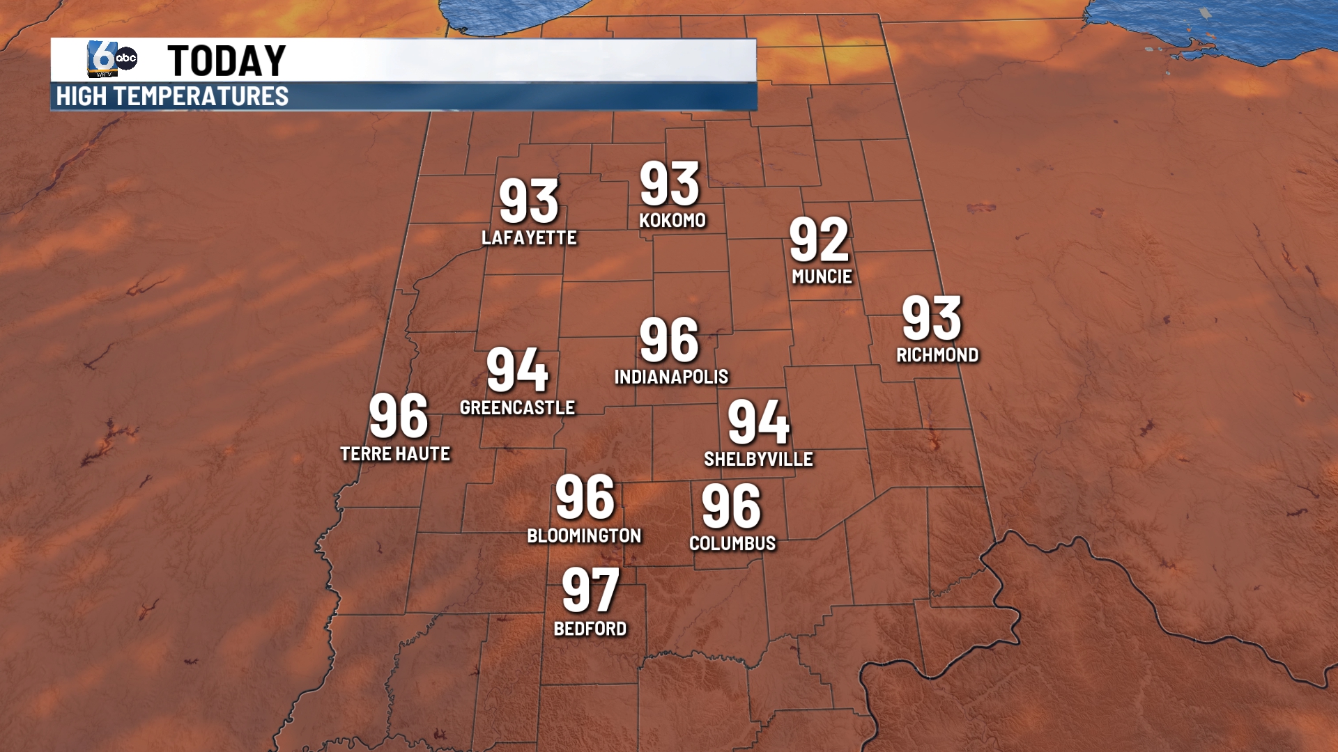
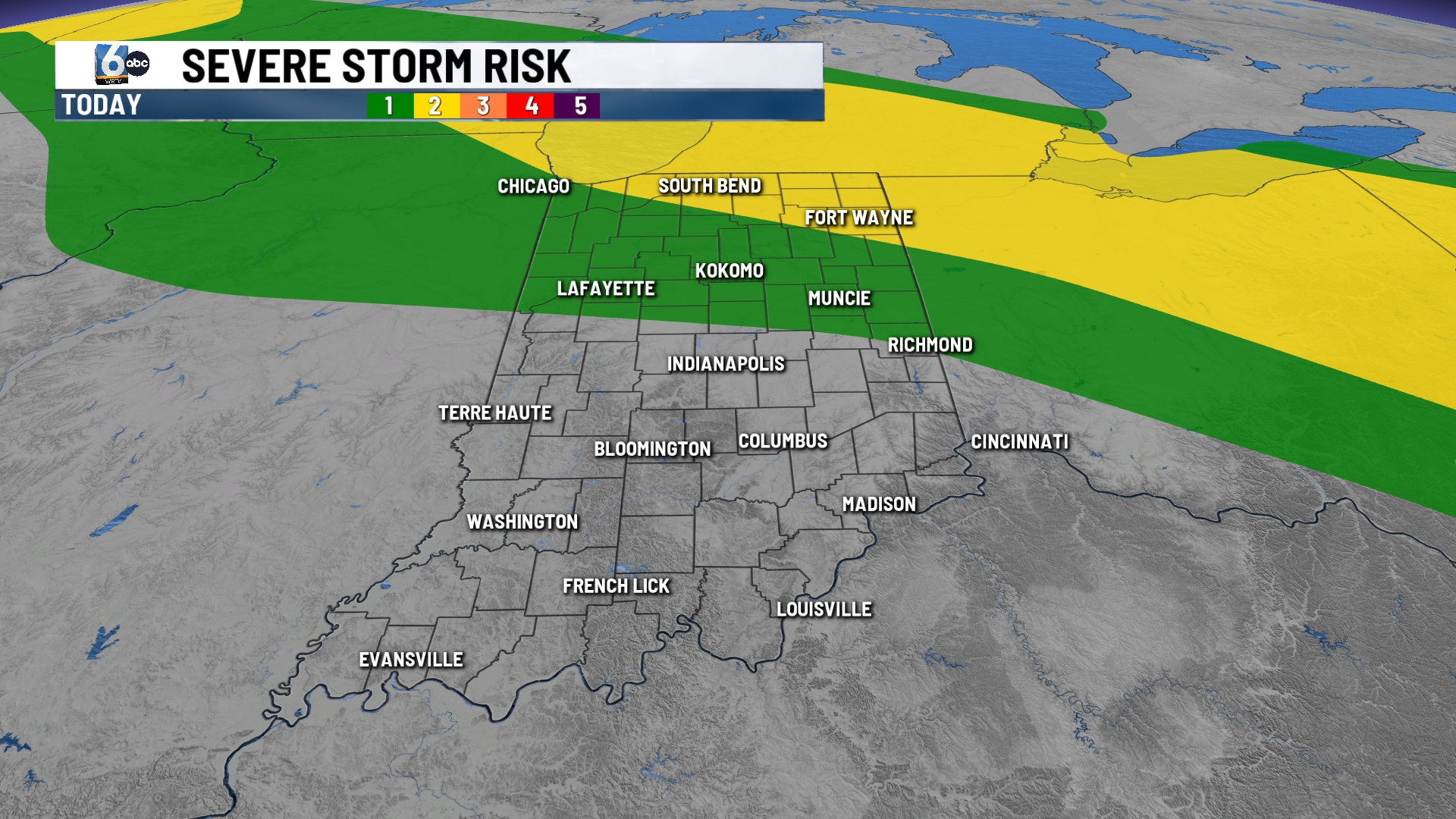
Heat indices will be into the triple digits again today. Heat advisory in place for today for all of Indiana. Highs climb into the low and middle 90s with sunny skies and high humidity. A spotty shower or storm is possible for northern Indiana. A level 1 out of 5 risk for a strong storm is possible with gusty winds being the main threat.
TONIGHT:
Mild, muggy with lows in the middle 70s.
TOMORROW:
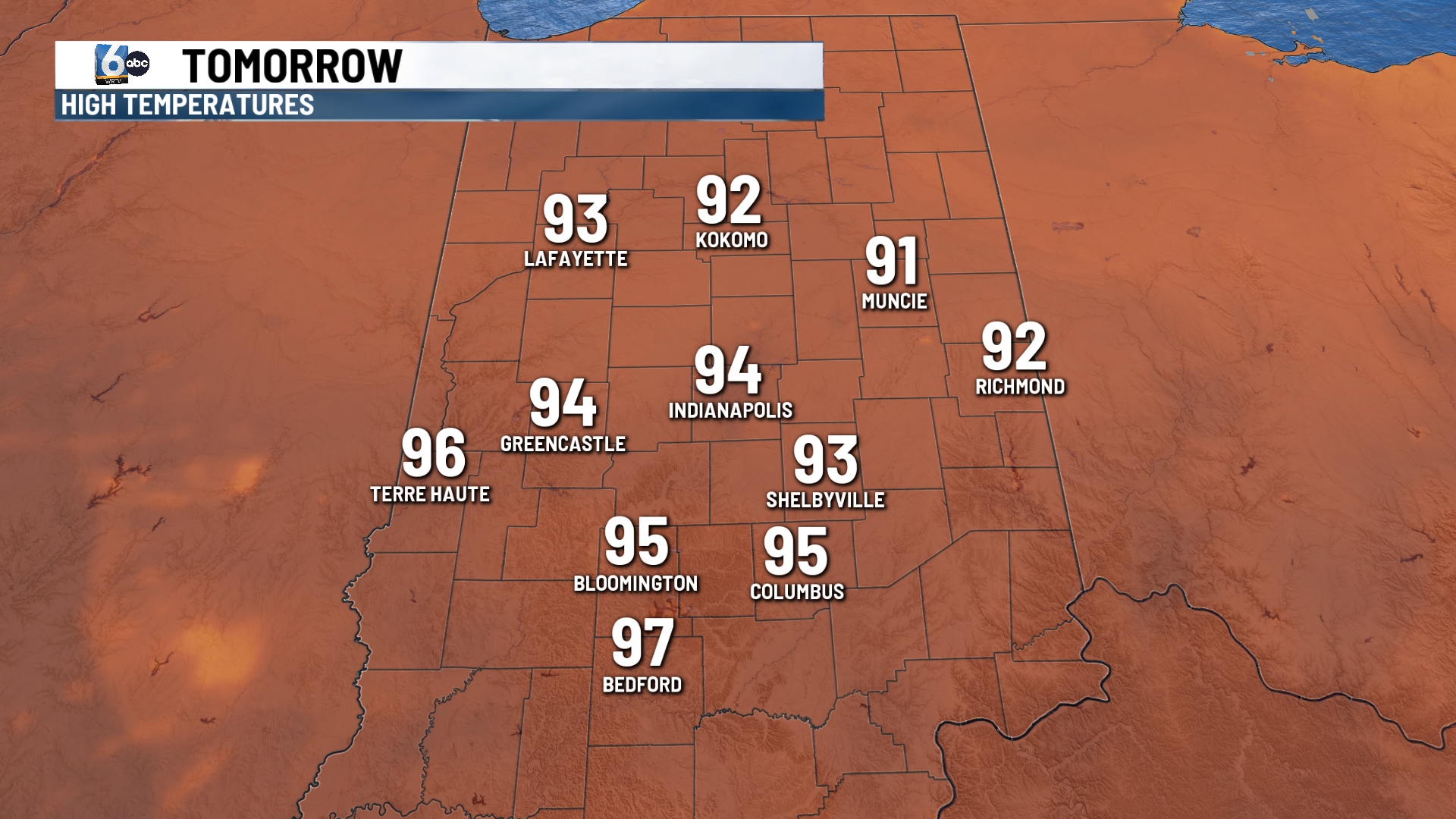
Heat advisory has been extended into Friday evening. Temperatures stay into the low and middle 90s with heat index values into the triple digits. We may see a few spotty showers and storms across the state. A level 1 out of 5 of severe weather risk is in place for most of central Indiana.
7 DAY EXTENDED FORECAST:
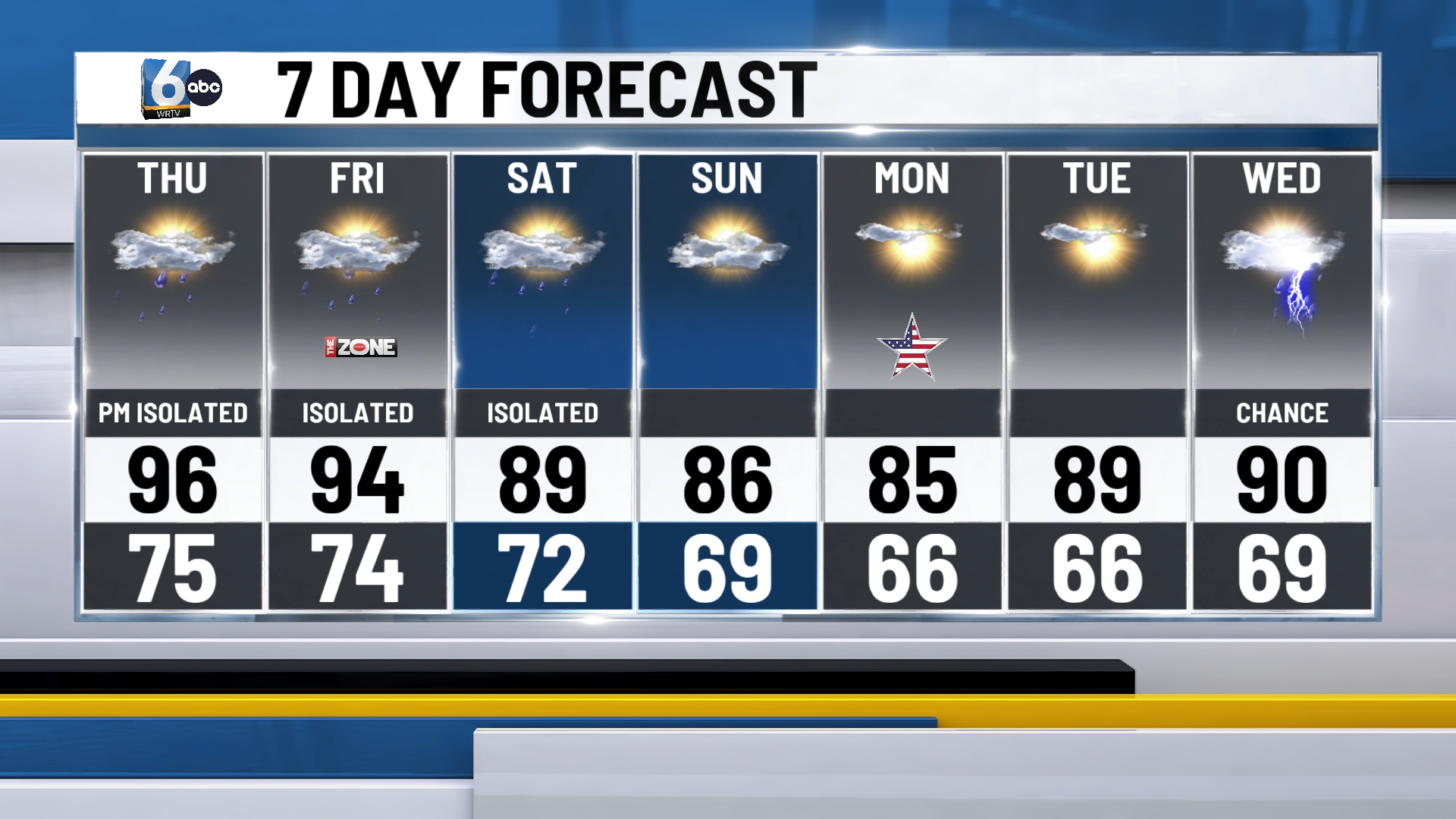
Temperatures drop into the middle and upper 80s for the holiday weekend. A spotty shower or storm is possible.
Sunny and dry for Labor Day.
