Alert Day Thursday: highest temperatures and humidity of week
Headlines
- HEAT ADVISORY STATEWIDE 11 AM – 8 PM THURSDAY
- TRIPLE DIGIT HEAT INDEX
- STILL HOT & HUMID THROUGH THE WEEKEND
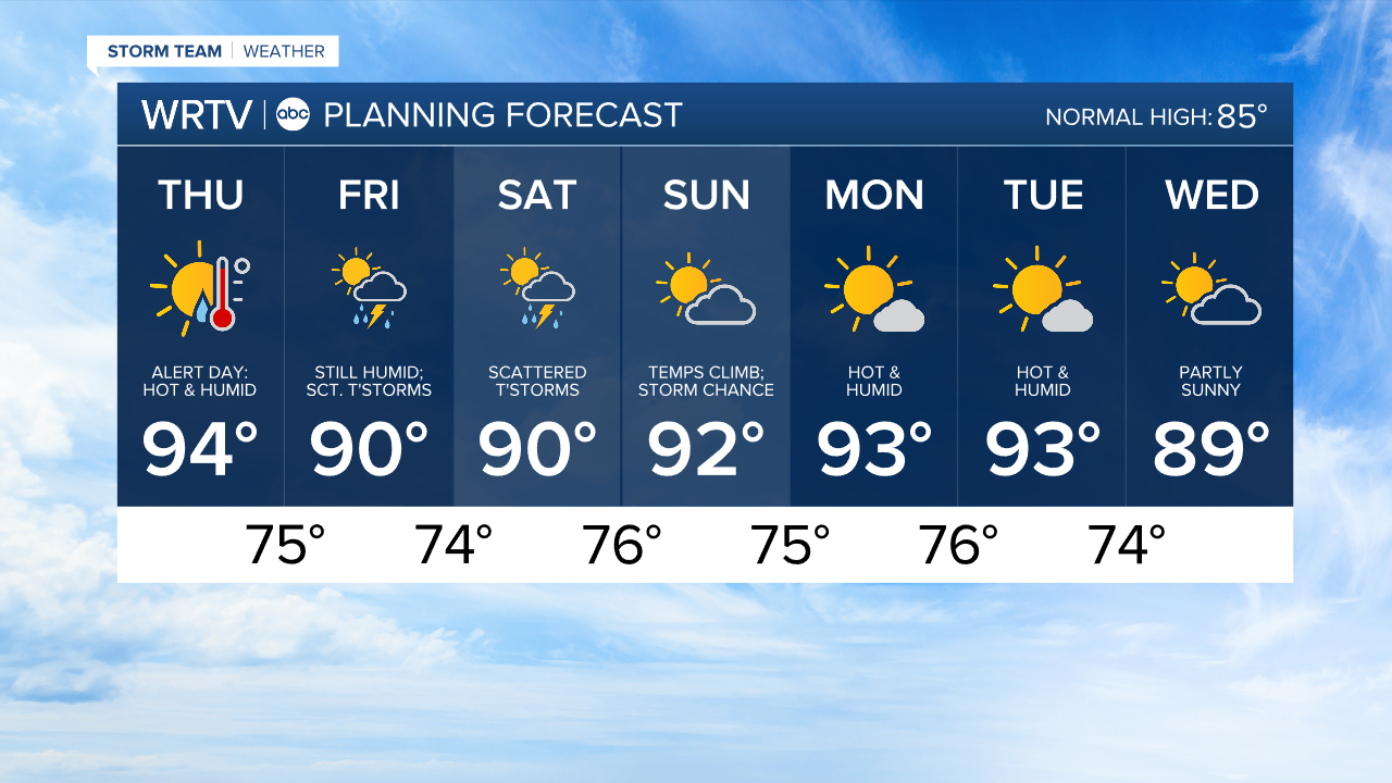
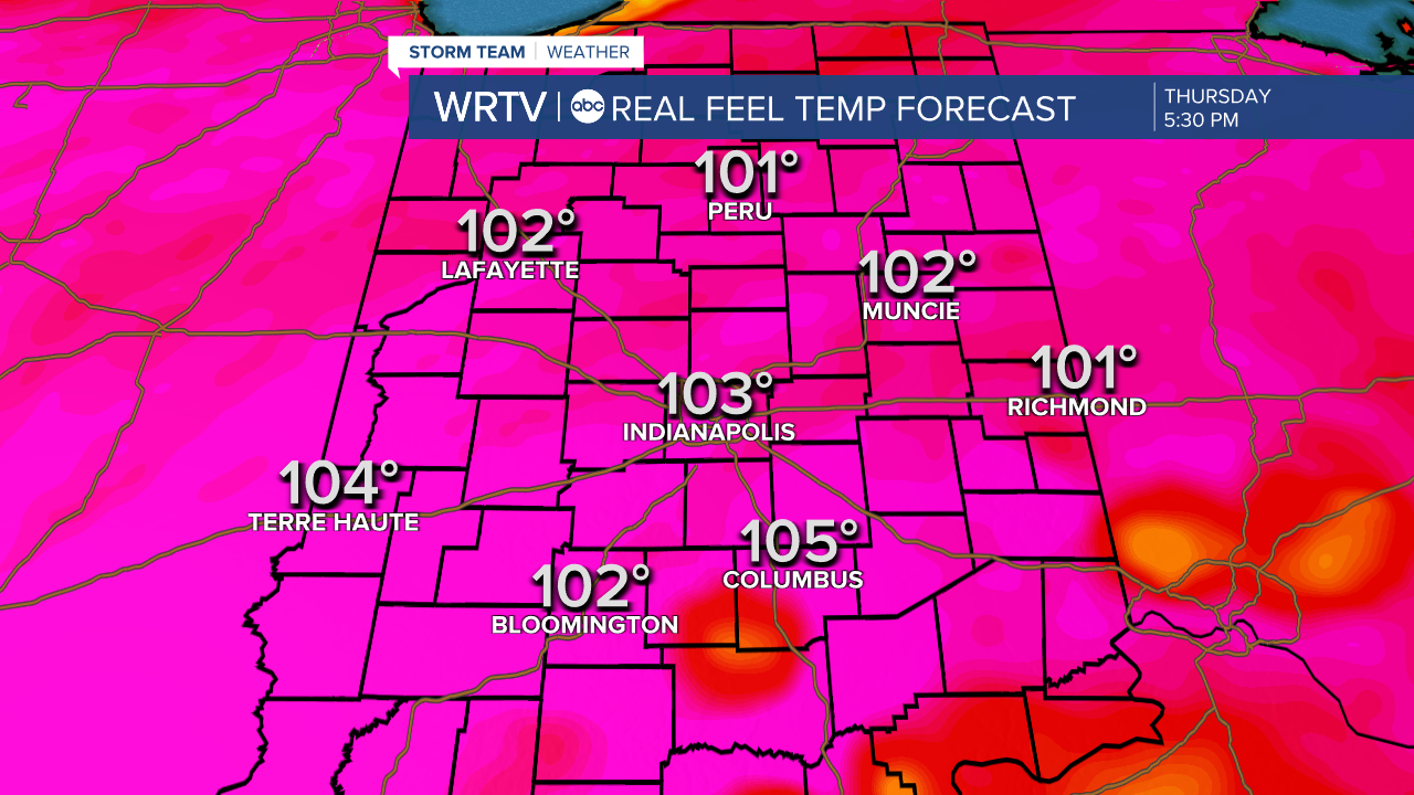
Thursday is the hottest, most humid day of the week. Highs climb into the mid 90s. Heat indices could climb 100-105° across Indiana. Take frequent breaks from the heat if you have to be outdoors today.
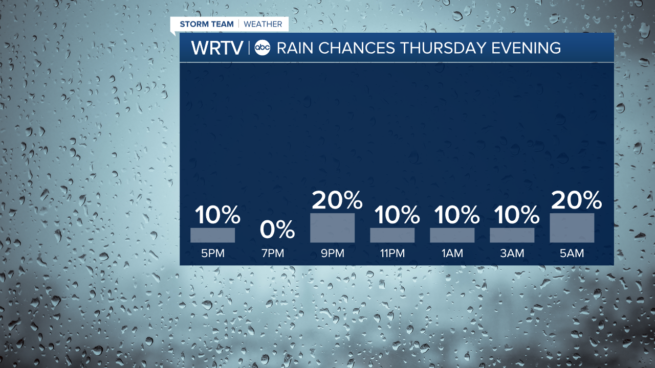
The day is mainly dry with a mix of clouds and sun. A few isolated thunderstorms are possible this evening. No severe weather is expected. Many will stay completely dry.
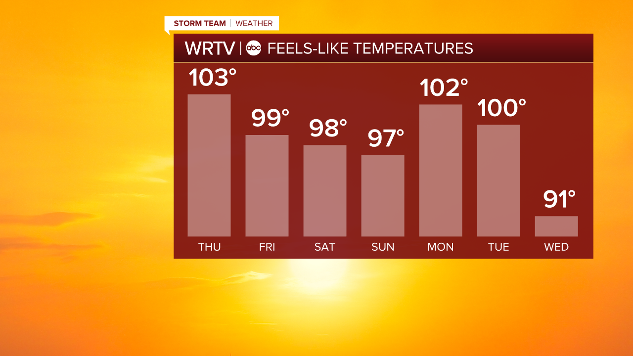
Friday’s high temperatures are closer to 90°, but it will still feel like the 95-100° range in the afternoon. Expect some scattered storms Friday, especially in the afternoon and evening.
This weekend is still hot and humid, with highs staying in the 90s. Monday and Tuesday may bring triple digit heat indices once again.
Indianapolis Weather Forecast:
Today: Alert Day. Hot, humid. PM storm chance. High: 94°
Overnight: Warm. Few thunderstorms possible. Low: 75°
Friday: Still humid. Scattered thunderstorms. High: 90°
Indianapolis 7-Day Weather Forecast