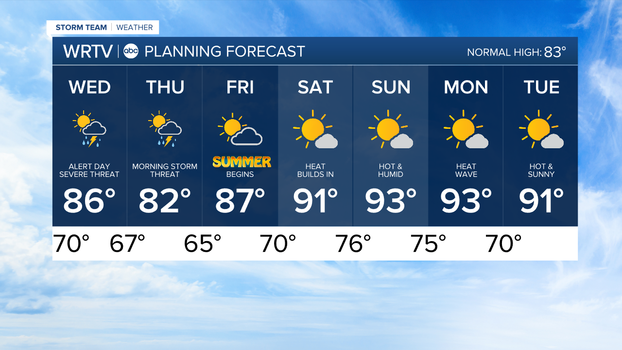
ALERT DAY WEDNESDAY for severe storms to a weekend heat wave
Headlines
- ISOLATED DOWNPOURS OVERNIGHT
- SEVERE STORMS LIKELY WEDNESDAY
- FIRST 90s OF THE YEAR THIS WEEKEND
Wednesday will be a WRTV ALERT DAY, as severe weather is likely in the afternoon and evening. Temperatures will climb into the mid to upper 80s ahead of the front.
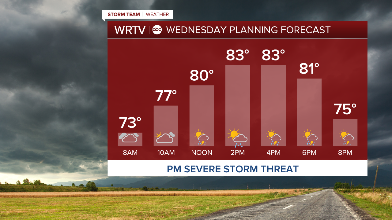
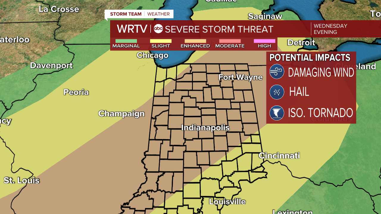
The main threat will be damaging winds, but there is also a chance of tornadoes. The tornado threat will be conditional on how conditions unfold tonight and tomorrow morning. Hail is also possible, but the highest likelihood for warnings will be for wind gusts exceeding 70 mph. Most of the state is under an enhanced risk of severe storms.
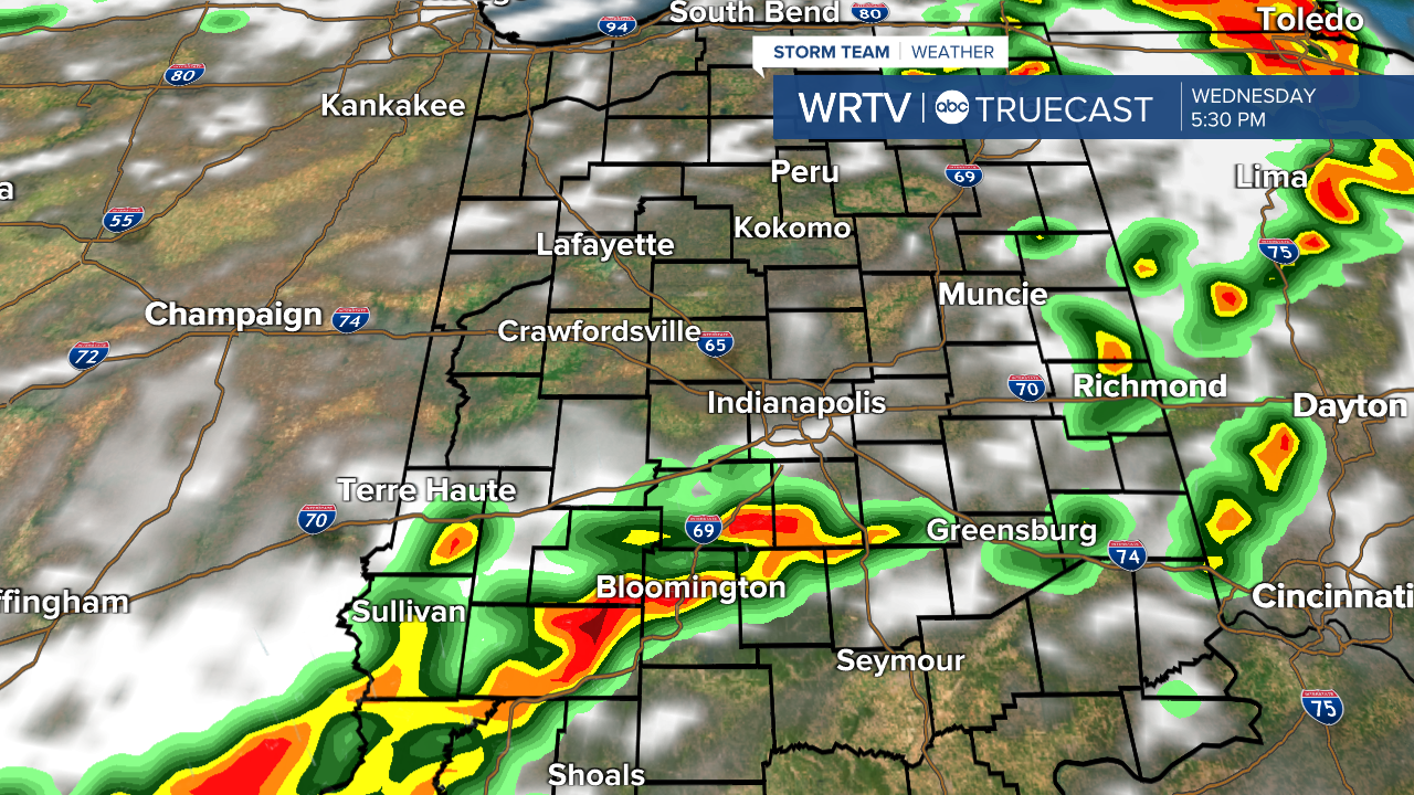
Below is a what models are projecting radar to look like around 6pm Wednesday.
Once the storms move out early Thursday morning, we will turn our attention to the first big heat wave of the year. This will bring temperatures into the 90s starting on Saturday, and it looks like they could persist through at least Tuesday or Wednesday of next week. Heat index values will exceed 100°F in the afternoon.
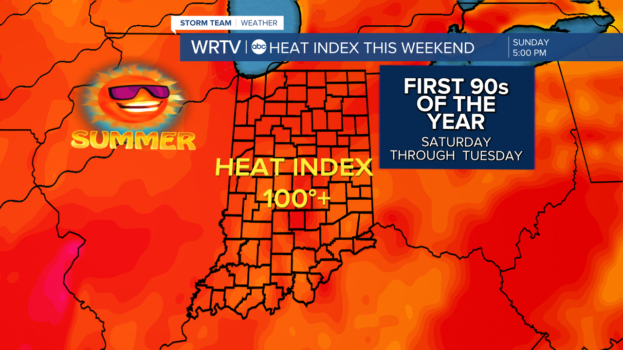
The weekend also looks dry for a change.
Indianapolis Weather Forecast:
Overnight: Spot downpour possible Low: 70°
Wednesday: ALERT DAY. Severe storms likely High: 86°
Thursday: Partly cloudy. Storms early. High: 82°
Friday: Partly cloudy. High: 87°
Indianapolis 7-Day Weather Forecast