Winter Weather Advisory Friday for another round of accumulating snow
Headlines
WINTER WEATHER ADVISORY FRIDAY
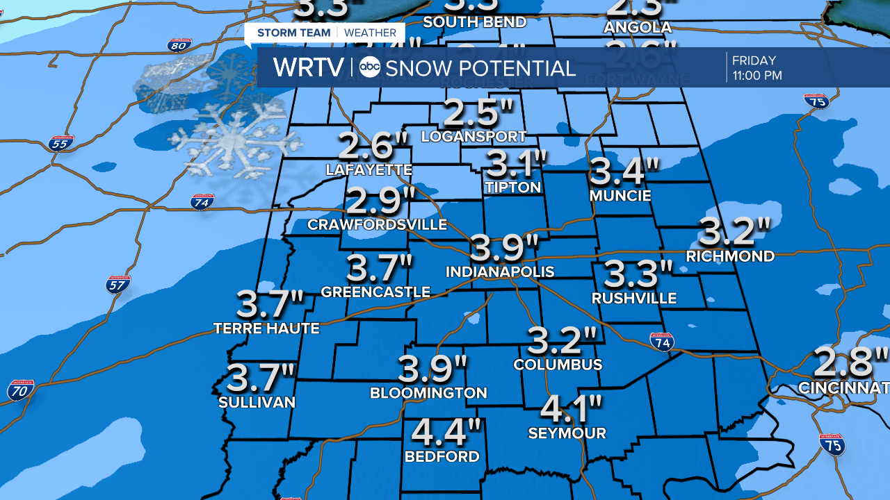
2″ – 4″+ SNOWFALL POTENTIAL
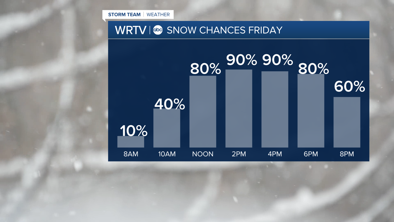
Our Friday gets off to a cold and dry start. We’re not expecting any snow for the morning drive. However, snow chances ramp up quickly as the morning goes along. Widespread snow covers much of Central Indiana by noon. Expect the evening drive to be tricky as snow continues. Lowered visibility and slick spots could cause problems. Widespread snow winds down by midnight, but a few snow showers could linger into the overnight.
A Winter Weather Advisory goes into effect at 4 AM Friday for Central Indiana. A widespread 2″ to 4″ of snow is likely. A few spots could see locally higher totals. This should be a fluffy snow with temperatures in the middle to upper 20s. South winds are forecast around 10 mph.
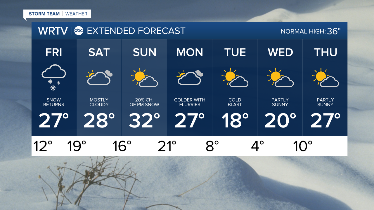
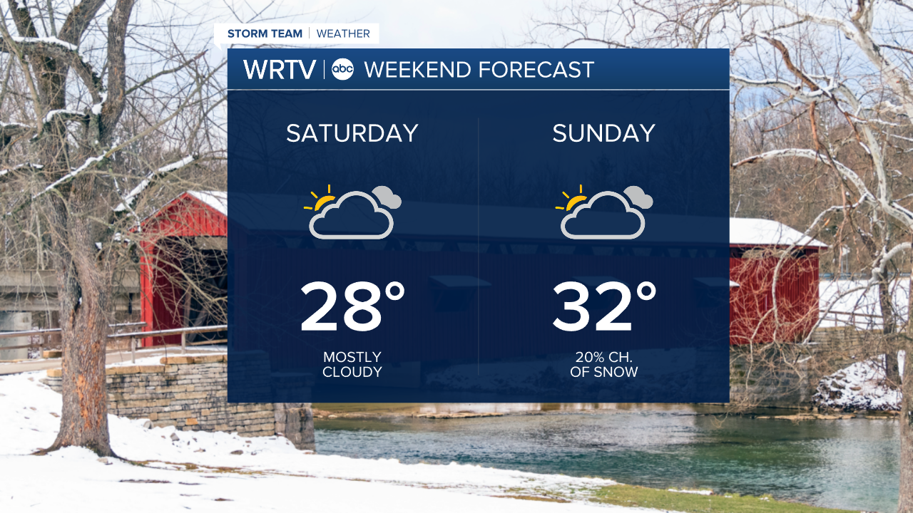
There’s a chance temperatures reach the freezing mark Sunday. This will be a fleeting trip to 32 degrees. Much colder air follows again next week.
Indianapolis Weather Forecast:
Friday: Snow likely. High: 27°
Saturday: Mostly cloudy. High: 28°
Sunday: 20% ch. of snow. High: 32°
Monday: Mostly cloudy with flurries. High: 27°
Indianapolis 7-Day Weather Forecast