Heat advisory continues into Tuesday; relief on the way late this week
Headlines
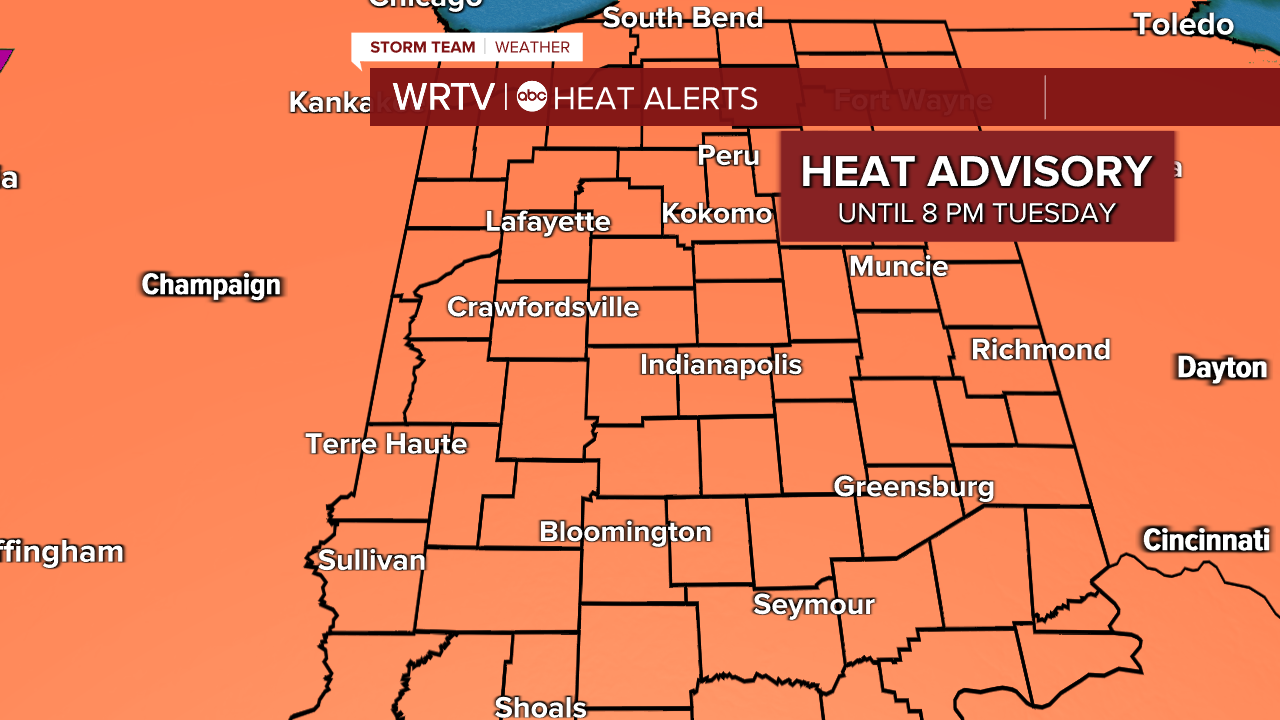
- HEAT ADVISORY NOW – 8 PM TUESDAY
- STORM CHANCES WEDNESDAY & THURSDAY
- HEAT FINALLY BREAKS LATE THIS WEEK
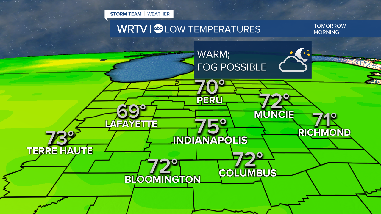
Heat stays in the forecast as we look to Tuesday. The morning starts warm. Some clouds will try to clear by morning, but a bit of patchy fog may develop.
Tuesday is another hot, humid day, with triple digit heat indices possible once again. The heat advisory will last until 8 p.m. Tuesday. Most of the day looks dry, but an isolated thunderstorm in the evening is not out of the question.
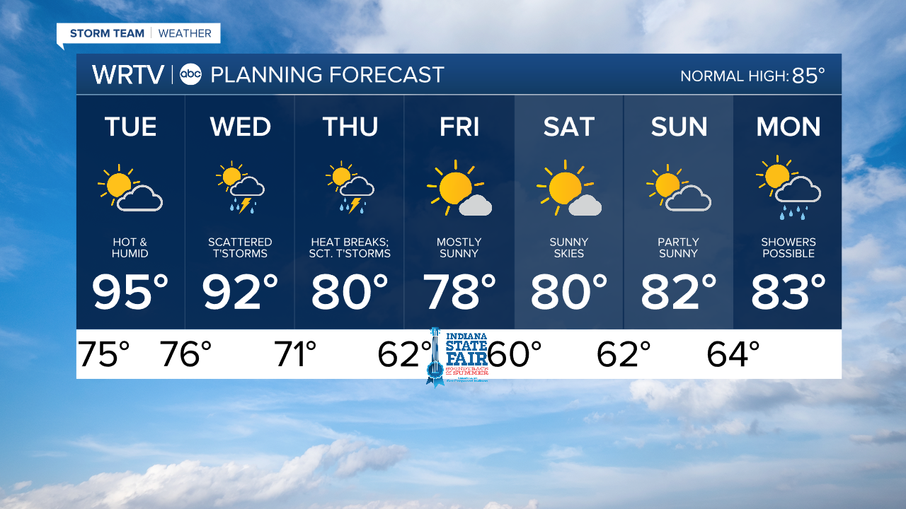
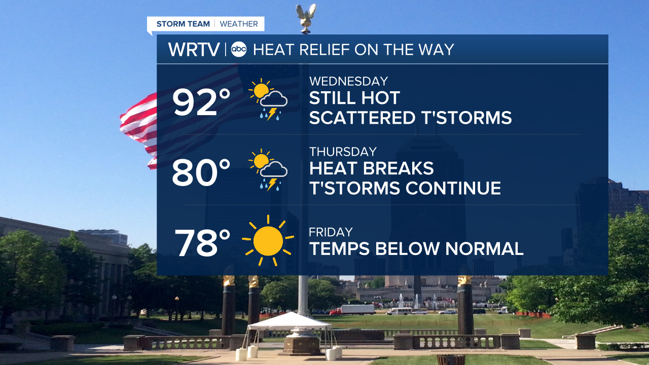
Scattered thunderstorms are more likely Wednesday and Thursday. Behind the storms, we finally will get some cooler air (and lower humidity). Highs Thursday are near 80°, and highs could stay in the upper 70s Friday. This will set the scene for a beautiful weekend with sunshine and highs near 80°.
Indianapolis Weather Forecast:
Overnight: Dry & warm. Fog possible. Low: 75°
Tuesday: Hot & humid. High: 95°
Wednesday: Scattered thunderstorms. High: 92°
Indianapolis 7-Day Weather Forecast