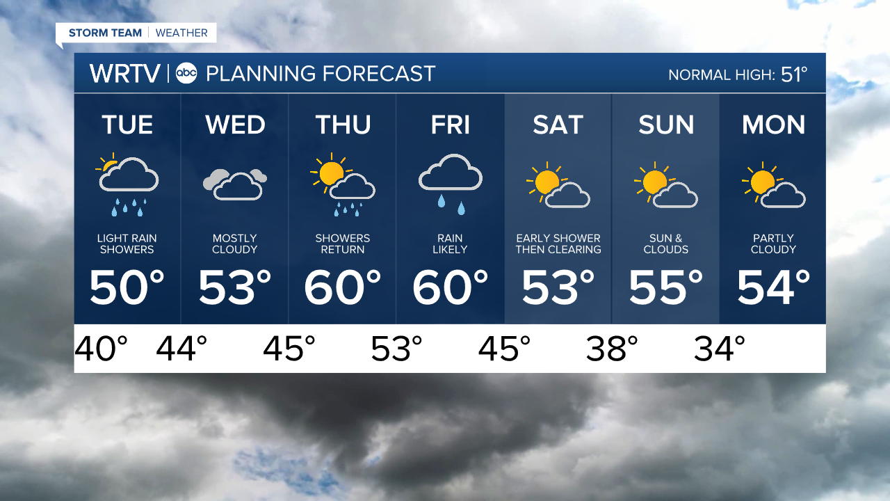
Numerous rain chance throughout the week as the weather pattern remains active
Headlines
- ACTIVE WEEK OF WEATHER
- RAIN OVERNIGHT INTO THE TUESDAY AM COMMUTE
- MORE RAIN THURSDAY & FRIDAY
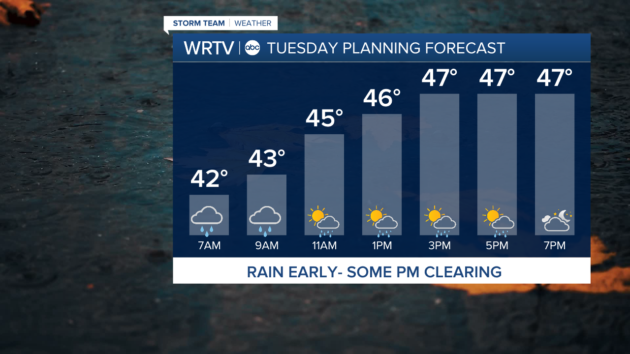
If you have plans this evening, it will be dry and you won’t need to worry about rain gear. However, overnight and into the morning commute, a cold rain will be falling, so plan ahead. The rain will eventually taper off to more scattered showers later in the day.
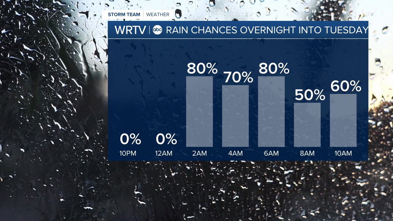
Temperatures will be above freezing for everyone overnight, so we won’t have to worry about any wintry precipitation here in central Indiana. However, if you are driving to the northern part of the state, you might encounter a mix of precipitation. Any significant accumulating snow will remain in Michigan.
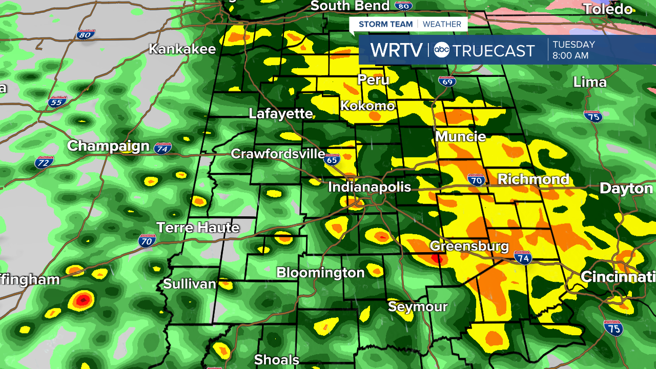
Here is snapshot of what radar might look like tomorrow morning around 8 am.
Another round of rain will move in on Thursday and Friday, and this round will likely be a bit heavier. Tonight, the highest totals will probably stay under 0.50”, but many areas by the end of the week are likely to see over an inch of rain.
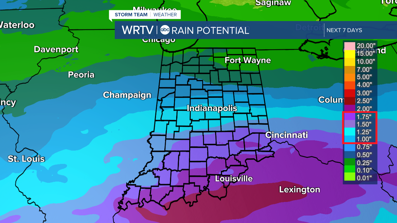
Add it all up and some areas in southern Indiana will see over 2″ of rain with totals lowering as you work north.
Indianapolis Weather Forecast:
Overnight: Rain. Low: 40°
Tuesday: Morning rain then sct. showers. High: 50°
Wednesday: Cloudy skies. High: 53°
Thursday: Rain develops. High: 60°
Friday: Rain likely. High: 60°
Indianapolis 7-Day Weather Forecast