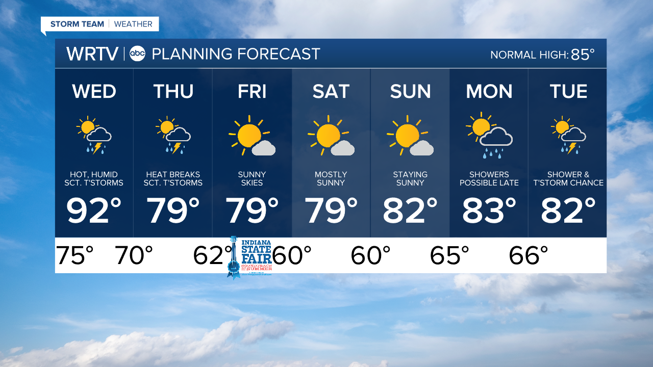
One more hot day Wednesday; relief from the heat starts Thursday
Headlines
- HEAT ADVISORY 10 AM – 8 PM WEDNESDAY
- STORMS WEDNESDAY & THURSDAY
- RELIEF FROM HEAT TO END THE WEEK
Wednesday is hot and humid, again. Triple digit heat indices are possible. The day starts sunny, with more clouds late in the day.
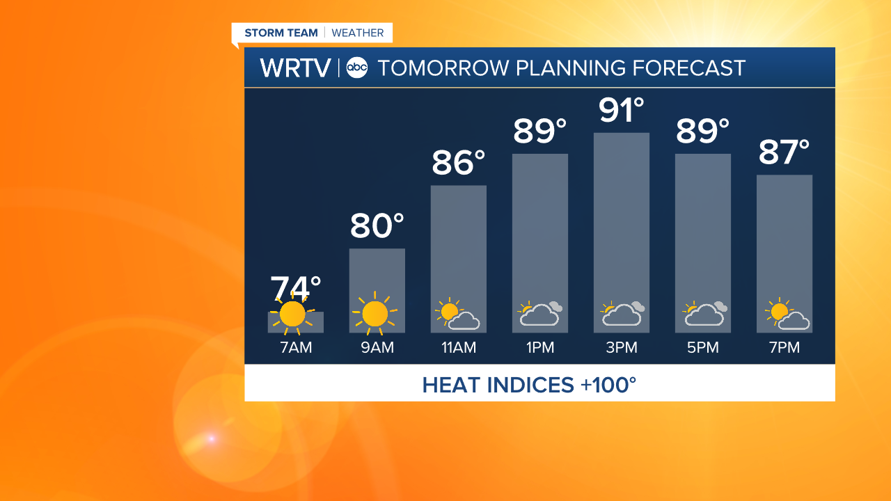
Isolated thunderstorms are possible Wednesday afternoon, with more widespread storms likely late Wednesday evening. These storms will have downpours. Localized flooding could become a concern. Gusty winds could also accompany these storms.
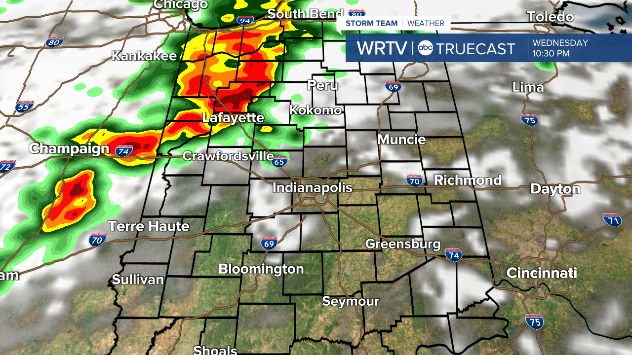
Thursday morning we could see some lingering storms. Following the storms, cooler air rushes into the area. Highs stay in the upper 70s Thursday and Friday.
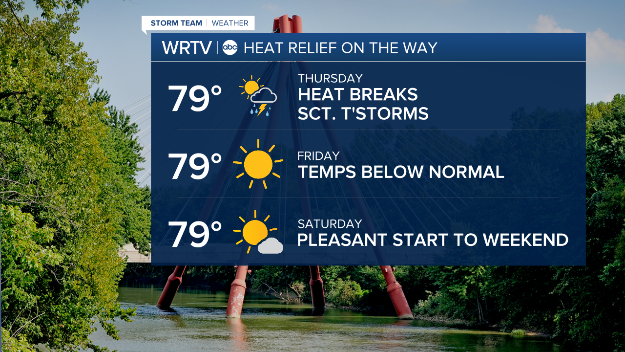
An early check of the weekend shows highs near 80° both days with lots of sunshine, dry weather, and low humidity.
Indianapolis Weather Forecast:
Overnight: Mostly clear. Fog possible. Low: 75°
Wednesday: Hot & humid. PM scattered thunderstorms. High: 92°
Thursday: Lingering thunderstorms. Heat breaks. High: 79°
Indianapolis 7-Day Weather Forecast