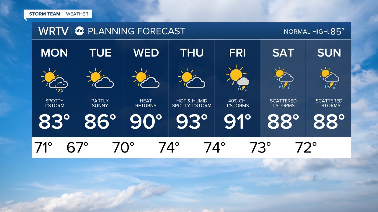
Rain across southern areas ends overnight. Spotty storm chance Monday.
Storms brought heavy rain to areas south of a Terre Haute to Greensburg line. The severe threat has ended, and the active weather will continue to push south overnight. Areas of flooding remain possible.
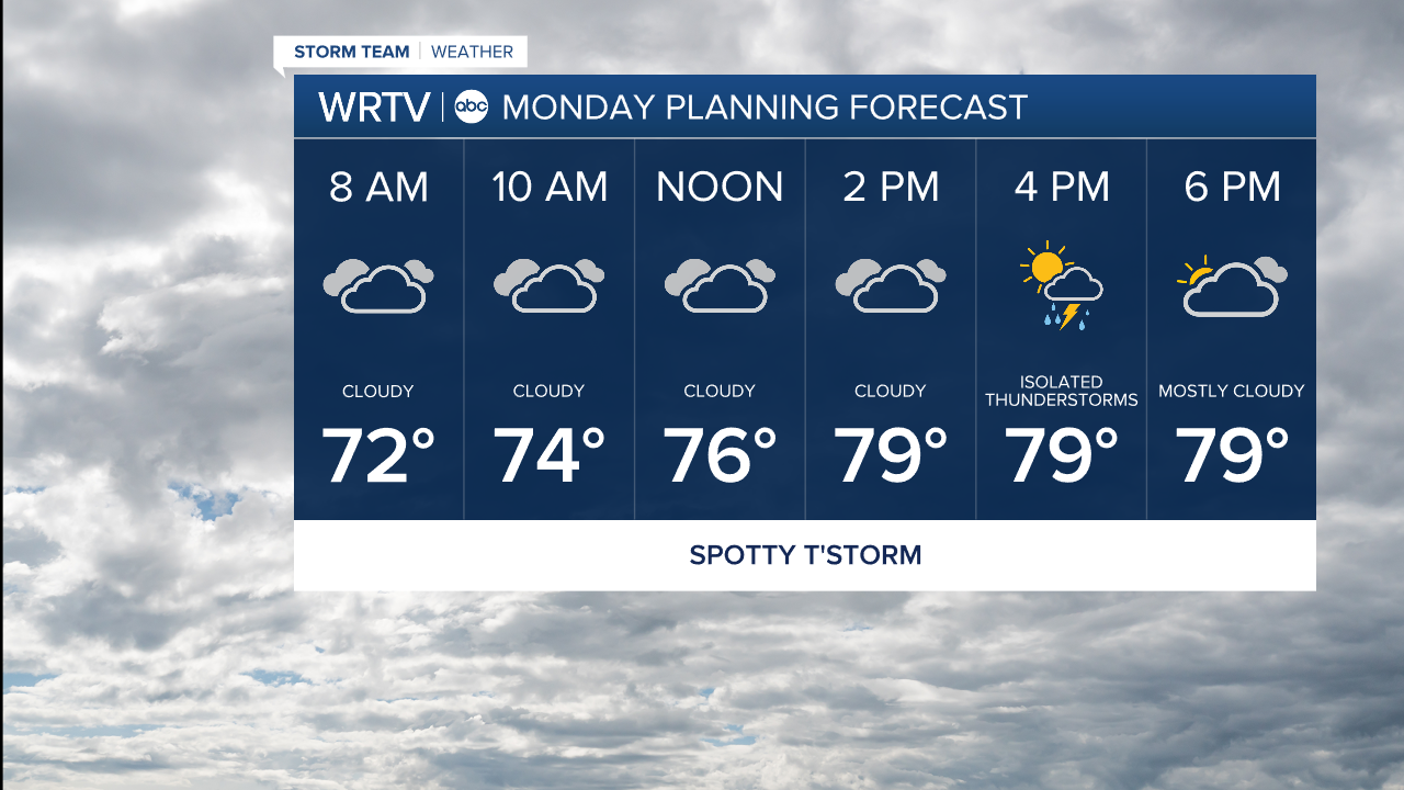
Any lingering storms should push out of the area early Monday morning. There’s just a small chance for a spotty storm the rest of the day. We’re expecting more clouds than sun, which will hold highs into the lower 80s.
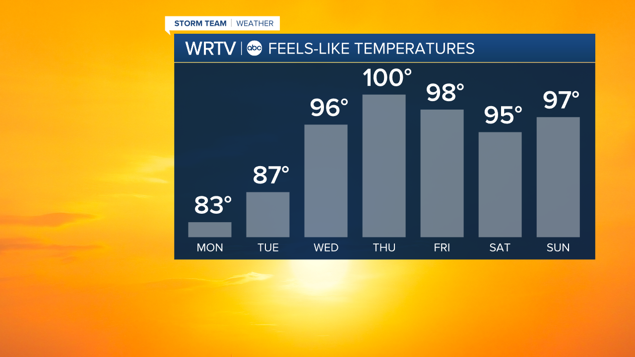
The summer heat makes a quick return. Afternoon highs reach into the lower 90s for the second half of the week. We’re also expecting very high humidity levels. That means it’s likely to feel like about 100° to end the week.
Indianapolis Weather Forecast:
Monday: Mostly cloudy. Spotty storm possible. High: 83°
Tuesday: Partly sunny. High: 86°
Wednesday: Partly sunny, hot & humid. High: 90°
Indianapolis 7-Day Weather Forecast