Big temperature drop overnight; slick roads possible Monday morning
Headlines
- BIG TEMPERATURE DROP & FLASH FREEZE POSSIBLE
- WIND ADVISORY CONTINUES TONIGHT AND MONDAY
Now that thunderstorms have cleared out of the area, we are entering into a much colder period of time. Temperatures will fall near 20° by early Monday.
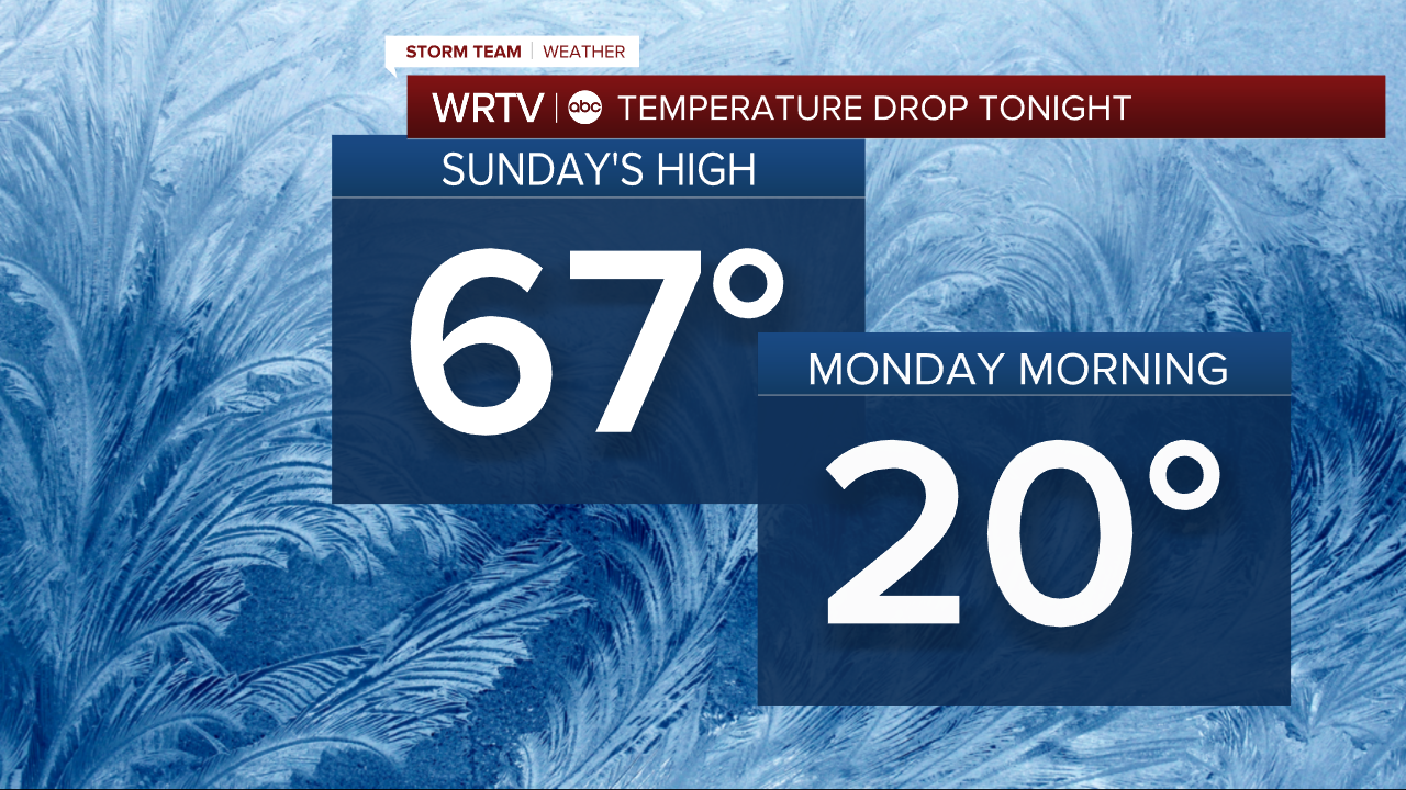
Because of the temperature drop, any wet spots on the roads left untreated could freeze. Roads could be slick during the Monday morning commute. Plan on it being slow-going, and give yourself extra drive time.
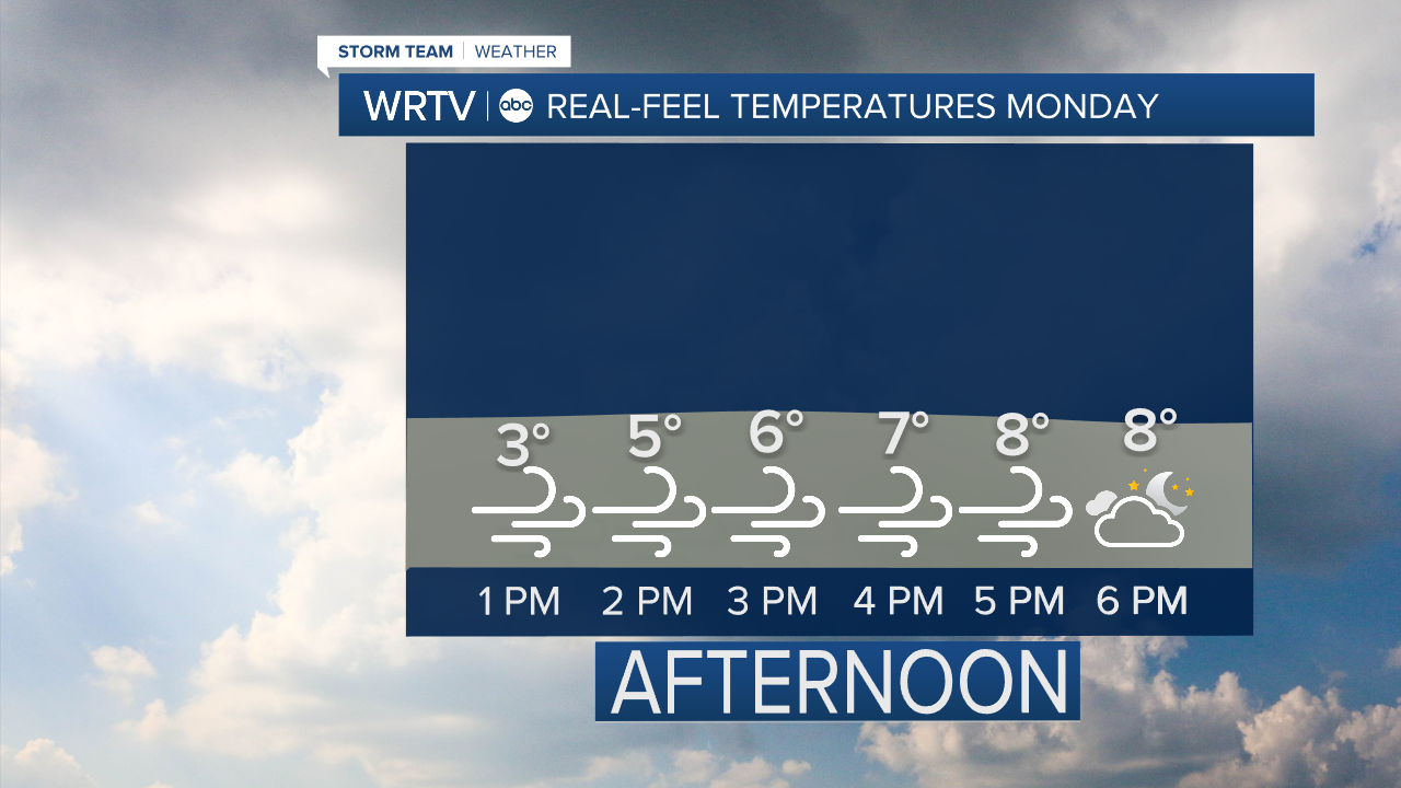
A wind advisory is in place until 5 p.m. Monday, as wind gusts over 40 mph are possible at times through the day.
A few flurries are possible Monday morning, but accumulating snow does not look likely. It will stay cold and windy with highs in the mid 20s. Wind chills will feel even cooler.
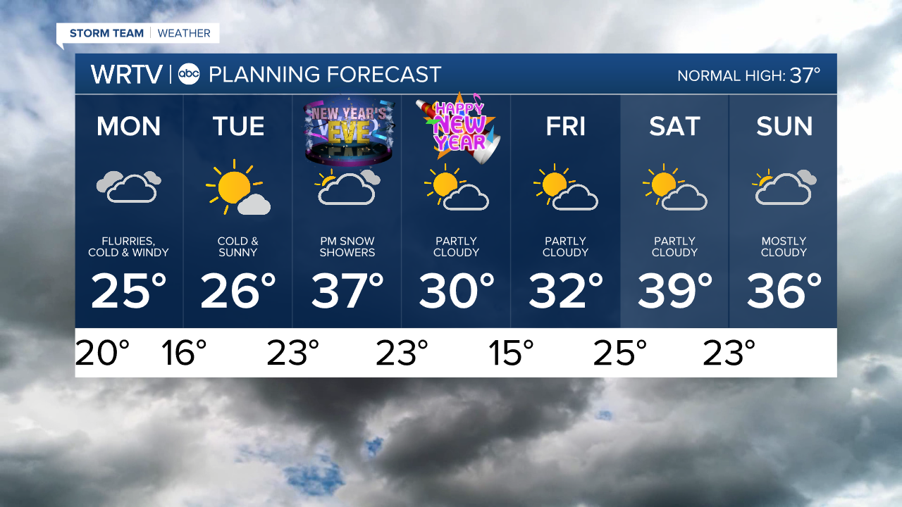
The rest of the week, temperatures will not warm much, although highs are back in the 30s to end the week.
If you have New Years Eve plans, be aware that a round of snow showers does look possible Wednesday overnight into early New Year’s morning.
Indianapolis Weather Forecast:
Overnight: Windy with falling temperatures. Flash freeze possible. Low: 20°
Monday: Flurries. Cold and windy. High: 25°
Tuesday: Mostly sunny and breezy. High: 26°
Indianapolis 7-Day Weather Forecast