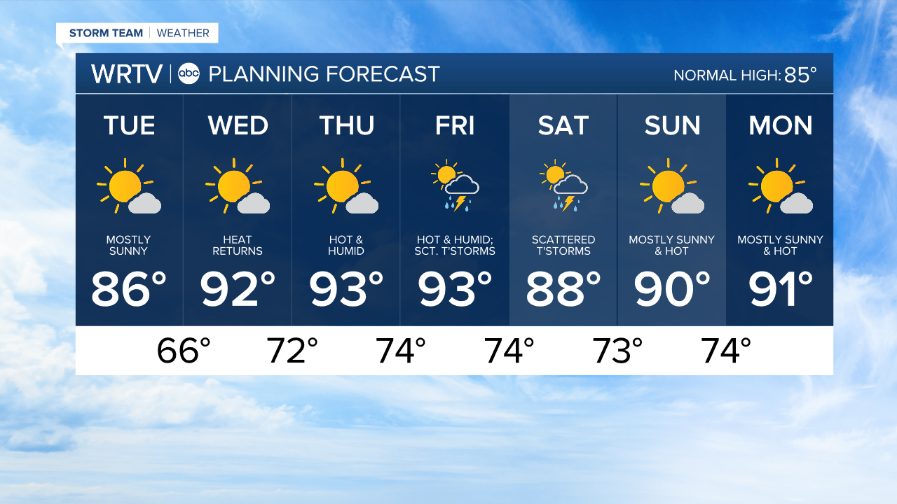
Tuesday the nicest day of the week; turning up the heat and humidity starting Wednesday
Headlines
- PLEASANT SUMMER WEATHER TUESDAY
- HOT & HUMID STRETCH STARTS WEDNESDAY
- TRIPLE DIGIT HEAT INDICES POSSIBLE
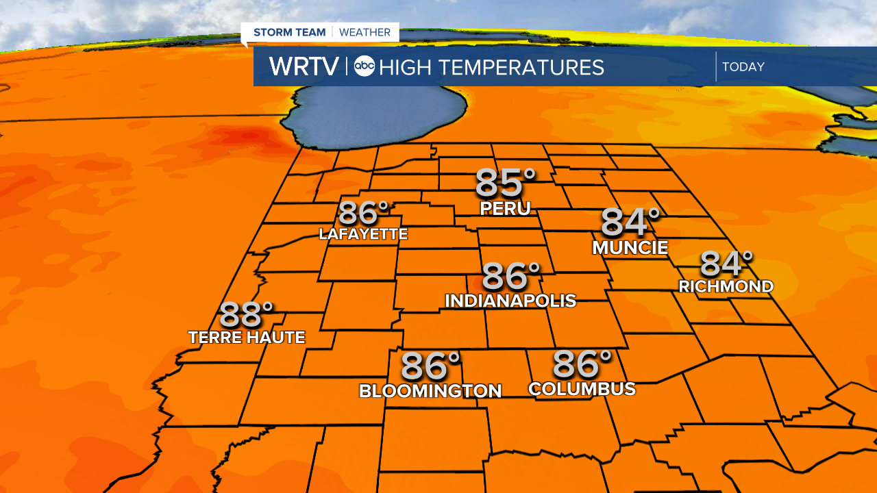
Enjoy a pleasant, summer-like day Tuesday. This afternoon we’ll see dry, sunny weather. High temperatures are in the mid 80s, which is near normal for mid-July.
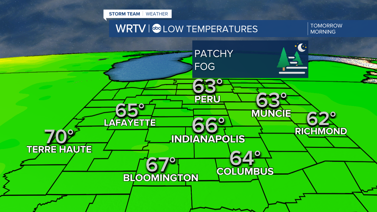
Tuesday night into Wednesday morning, temperatures will fall into the low or mid 60s. Enjoy the mild start, because the rest of Wednesday gets hot.
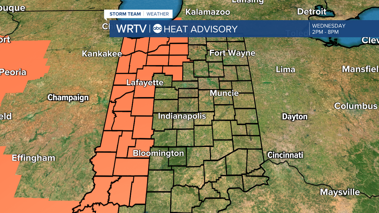
A heat advisory will be in place Wednesday from 2 p.m. until 8 p.m.
The heat is just getting started Wednesday; we have an extended period of hot, humid weather. Heat indices could climb into the triple digits. Thursday looks the hottest.
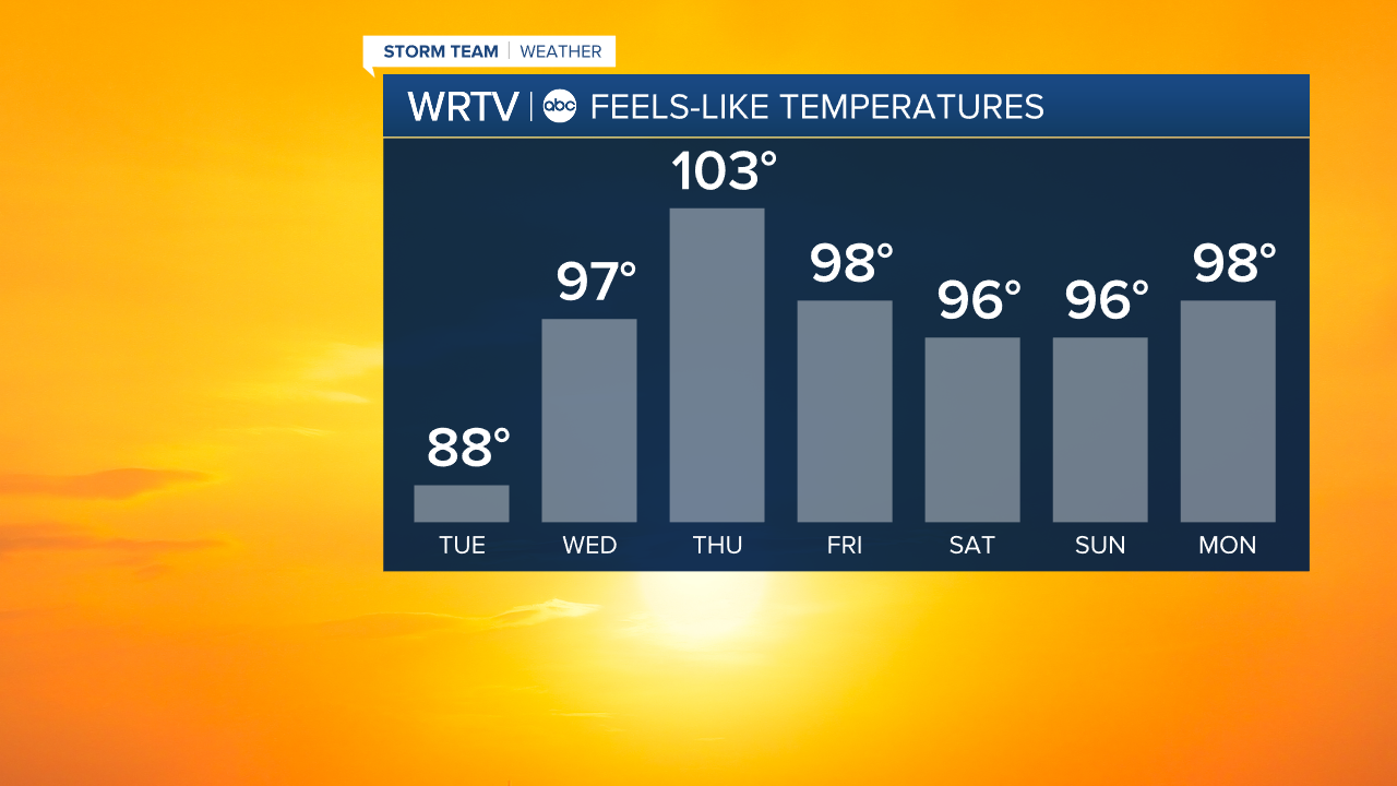
Remember to take lots of breaks if you have to be outdoors, wear light colored clothing, and drink plenty of water before going outdoors. Temperatures likely stay in the 90s into next week.
There are a few storm chances Wednesday night into Thursday, but our best storm chances look like Friday and Saturday for now.
Indianapolis Weather Forecast:
Today: Mostly sunny. High: 86°
Overnight: Mostly clear. Patchy fog possible. Low: 66°
Wednesday: Hot & humid. Heat indices +95° possible. High: 92°
Indianapolis 7-Day Weather Forecast