

INDIANAPOLIS (WRTV) — Showers and storms cross central Indiana later this evening. Our hot & humid air mass sticks around through Thursday.
TONIGHT:


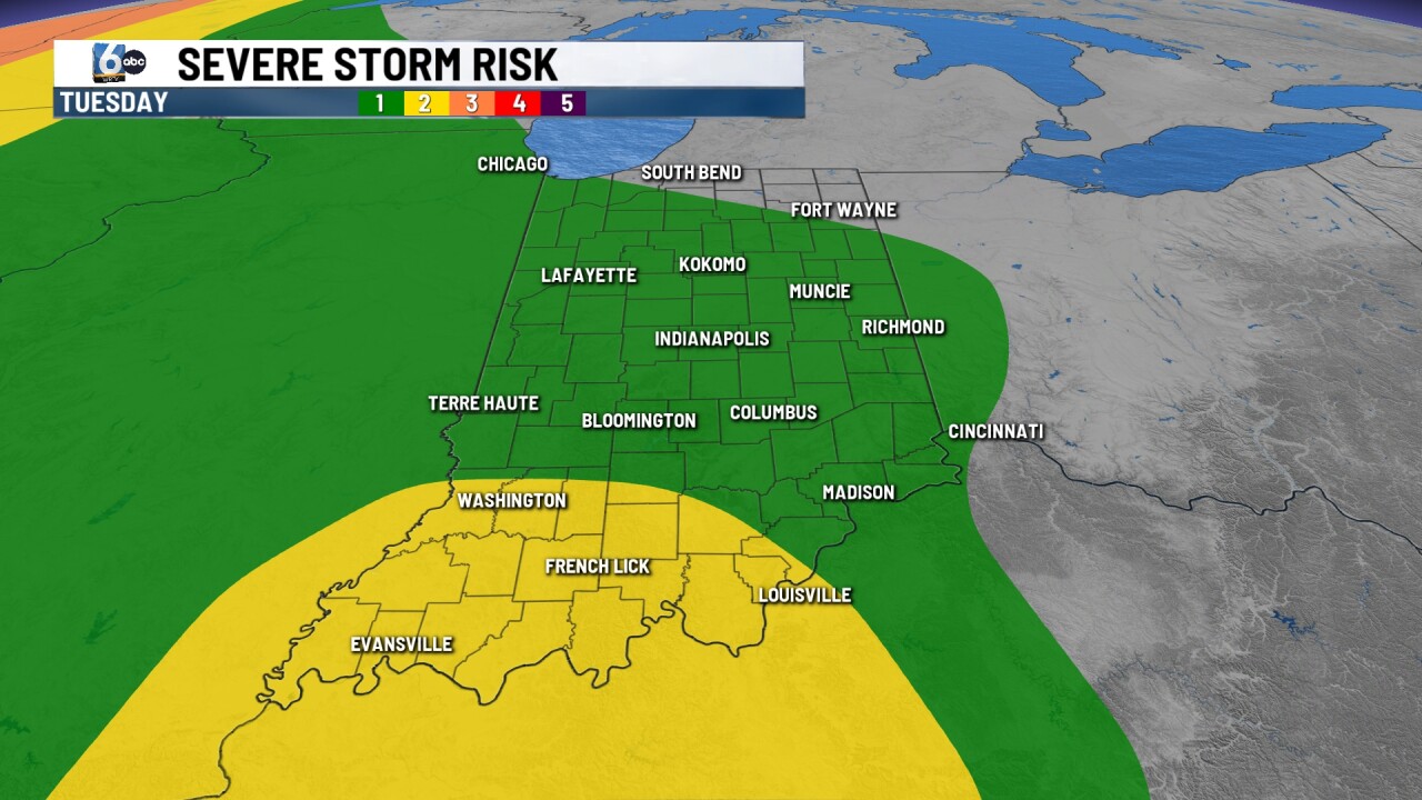
Scattered thunderstorms will redevelop in north-central Indiana this evening before clustering up and moving further south. We will be monitoring for flooding, with gusty winds also possible. Severe threat is a 1/5 along I-65 and west for most in central Indiana. Timeframe is broadly 5 PM - 11 PM EDT. Spotty downpours may linger in the early morning hours, mainly south. Low temperatures in the low 70s.
TOMORROW:
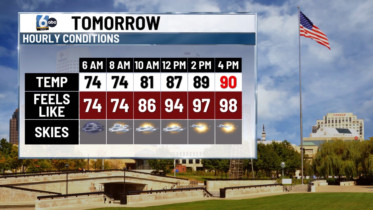

Isolated downpours/storms mainly south, waking up. Skies clear out to partly cloudy for the afternoon with a hot & humid air mass in place. High temperature near 90 degrees, with the feels-like or heat index in the upper 90s and near 100.
THURSDAY:

An isolated chance of a storm is possible in the early morning hours. It will be another hot, humid, & partly cloudy day. However, stronger storms may be possible going into Thursday night. A slight (2/5) risk of severe storms is posted with all modes of severe storms on the table. The line will likely weaken without the fuel of the sun so timing will be crucial. High temperature near 90 degrees with the heat index around 100.
7-DAY FORECAST:
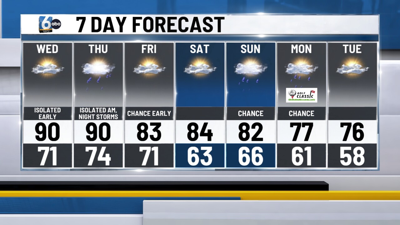
A cold front crosses early Friday, providing some relief from the humidity. Friday PM and Saturday are looking like good days to get outside, with both days in the low to mid-80s.
