

INDIANAPOLIS (WRTV) — Another mild and muggy morning across much of the state. Spotty showers and thunderstorms will be possible, with rainfall and gusty winds as the main threats. Really intense heat for the middle part of the week before less humid air works in for the weekend.
TODAY

Warm and humid once again today with temperatures climbing into the lower 80s. It will feel uncomfortable as high humidity values stick around today. We will see a chance of showers and a thunderstorm later this afternoon and into the early evening hours.
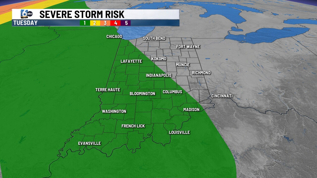
Those scattered showers and thunderstorms could produce some heavy rainfall and gusty winds. There is a level one out of a level five severe weather risk as the thunderstorms develop and push across parts of Indiana.
TONIGHT
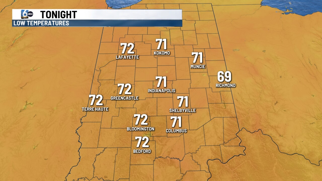
If you are heading to the Indianapolis Indians game this evening, be prepared for muggy conditions. We will see a spotty shower or thunderstorm late in the evening. Temperatures will only fall to around the lower 70s.
TOMORROW

Early morning showers may be possible on your Wednesday. During the afternoon, it turns hot and humid. We could see our first 90-degree reading of the summer. With high humidity, temperatures will feel like the triple digits. Be sure to stay hydrated and get in the shade when you can.
7 DAY EXTENDED FORECAST

Another hot day on Thursday with temperatures approaching the 90-degree mark. We will see high humidity values and feel-like temperatures once again into the mid and upper 90s.
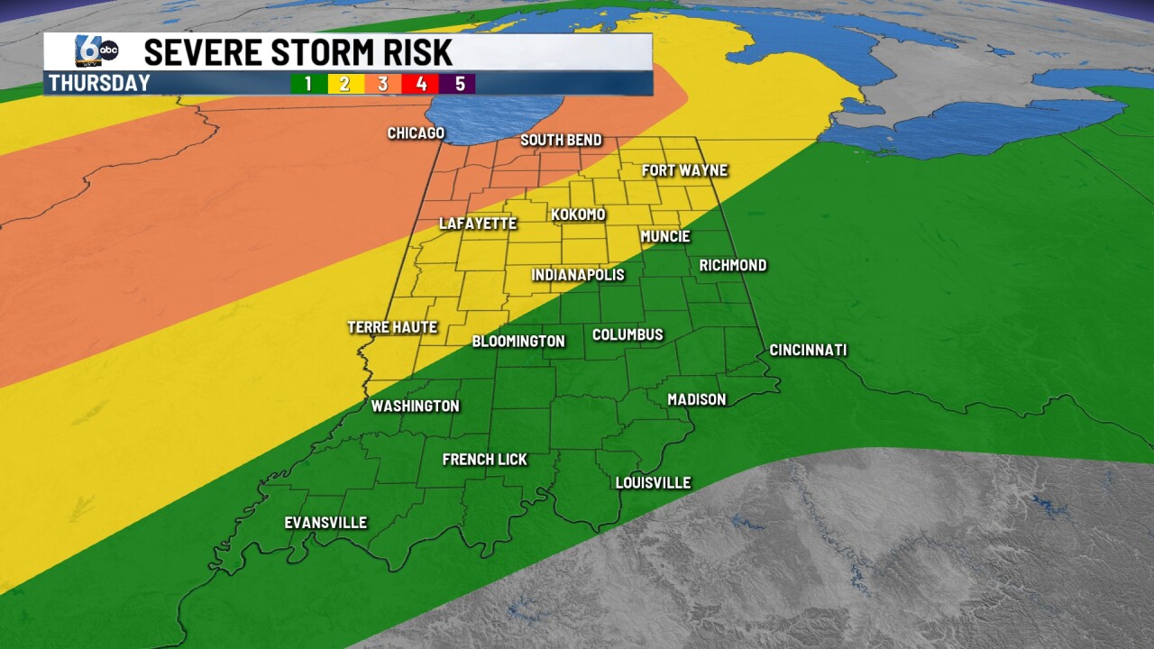
A cold front moves through late Thursday, producing a good chance of showers and thunderstorms late Thursday night into the overnight hours. Some of these thunderstorms will be on the stronger side with all severe weather modes in play.
Once the cold front moves through, we will see less humid conditions for your Friday. Temperatures will be into the lower 80s for the weekend with lower humidity values in place.
