


A holiday heat advisory with storms possible

INDIANAPOLIS (WRTV) — An Extreme Heat Warning expires at 8 PM EDT this evening. A Heat Advisory then goes in place through Saturday evening.
TONIGHT:
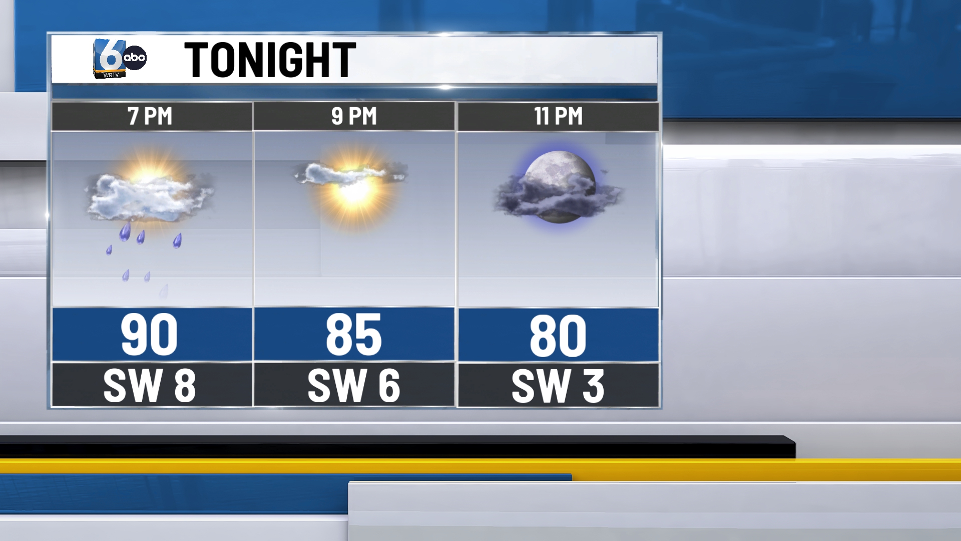
The majority of central Indiana will likely remain dry this afternoon/evening. However, very isolated showers and storms can’t fully be ruled out. Better odds of showers and storms are in north-central and northern Indiana. Low temperatures in the low 70s.
TOMORROW/FOURTH OF JULY:
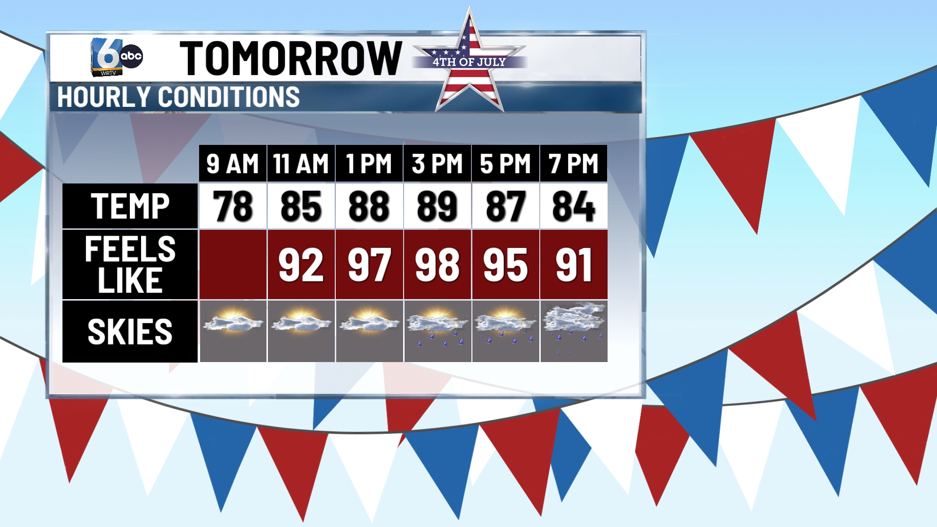
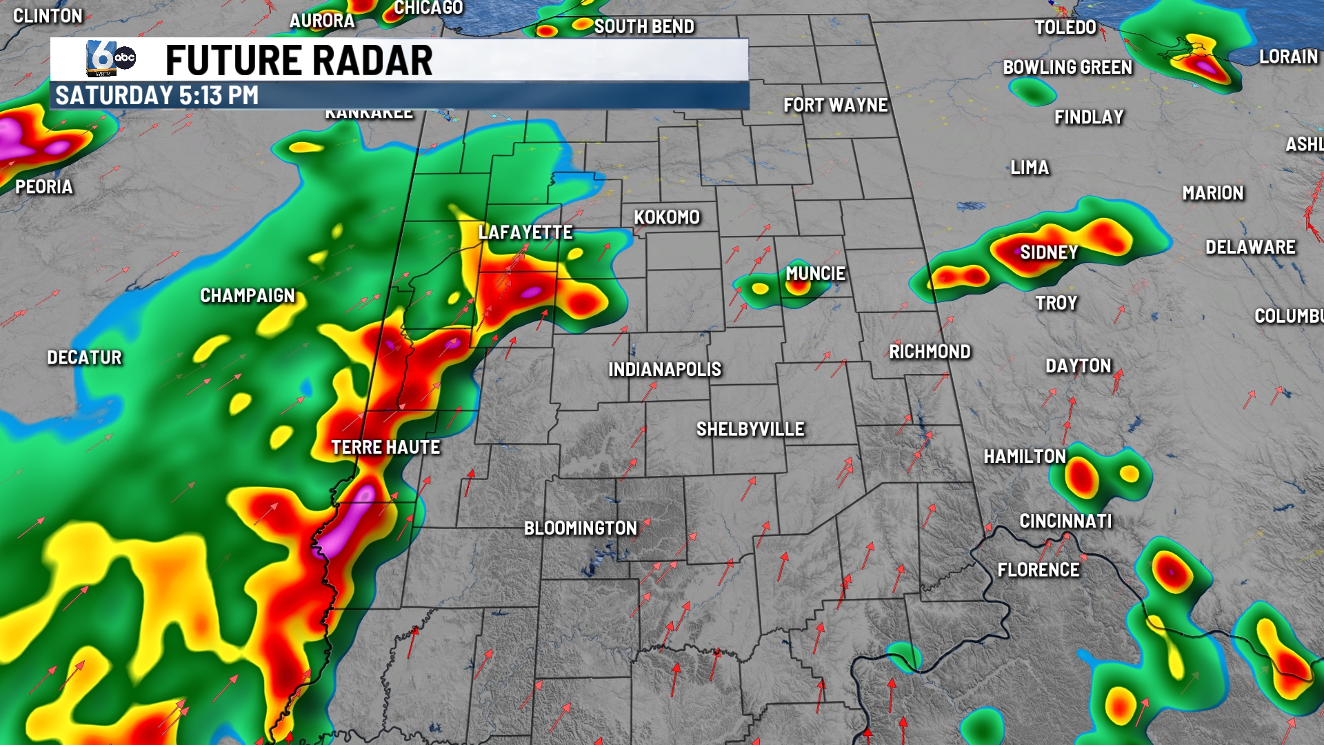
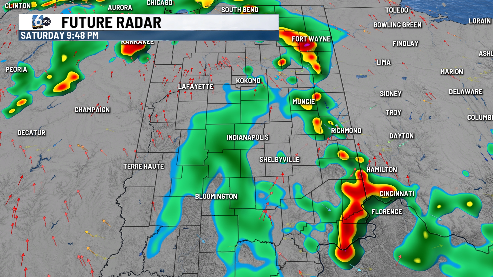
Partly cloudy skies. Scattered pop-up showers and storms are anticipated for the late afternoon and evening hours. Severe threat is low, and we will see how quickly storms exit going into the overnight hours for fireworks. High temperatures in the low 90s. Heat indices could reach the triple digits, but that depends on the coverage of rain.
SUNDAY:
Chance of showers & storms. Odds are slightly higher through the afternoon and evening hours. High temperatures in the upper 80s.
7-DAY FORECAST:
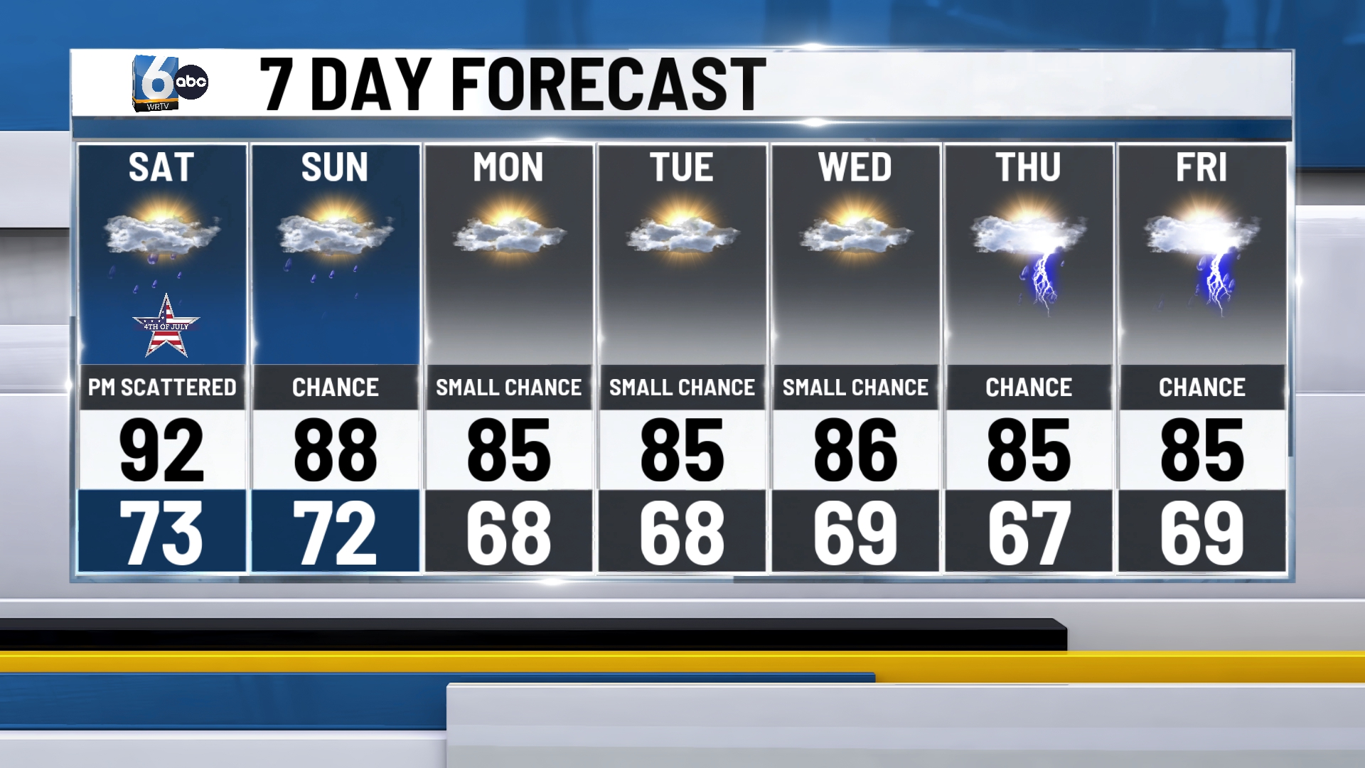
Temperatures will be closer to average next week, but humid air remains in place. Small afternoon rain chances stick around daily with more organized activity later on in the week.
