Another round of rain and storms tonight

INDIANAPOLIS (WRTV) — Scattered showers and storms are expected this evening into the overnight.
TONIGHT: Severe threat looks fairly low, however we cant rule out a gusty storm or two. The main impact will be the heavy rainfall potential. A Flood Watch is in effect until 8 a.m. Thursday morning for central and north central Indiana where 1-3″+ of additional rainfall is possible. Lows in the mid 60s.
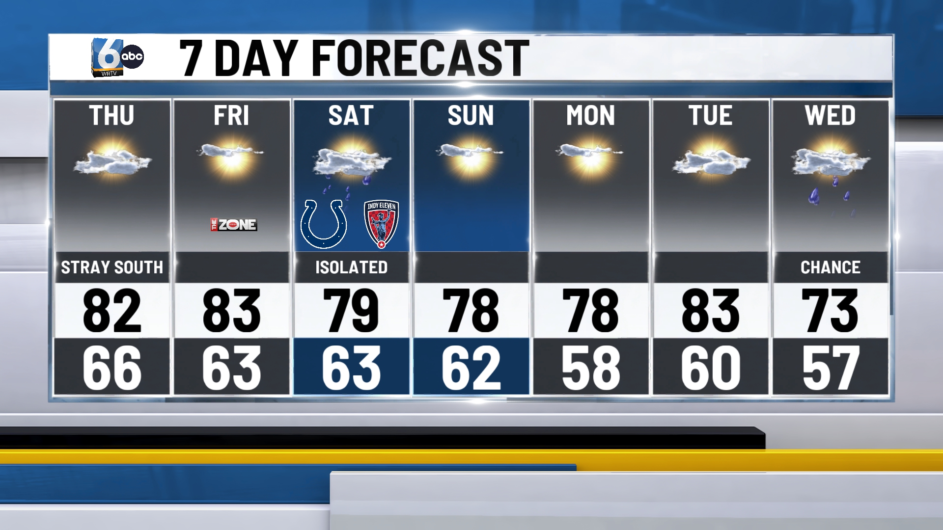
TOMORROW: Besides an isolated shower across southern Indiana Thursday morning and evening, our day looks dry under a mix of sunshine and clouds. Temperatures will top out in the low 80s.

TOMORROW NIGHT: Mostly clear, but watch for some patchy fog. Lows in the low to mid 60s.
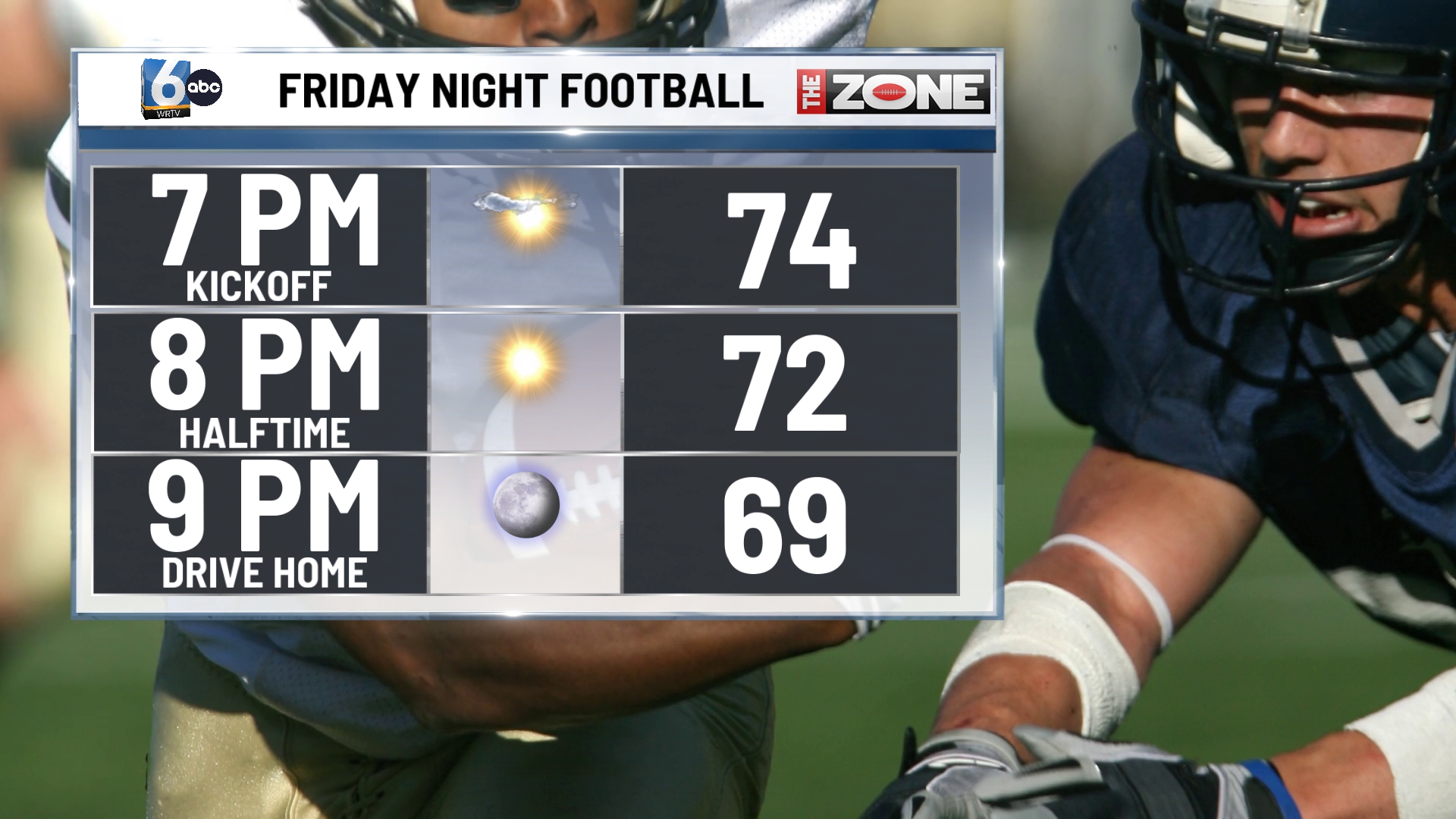
FRIDAY: Mostly sunny with temperatures in the low 80s. Looking great for week 1 of high school football under clear skies and temperatures in the mid 70s for most of the game.
SATURDAY: A few isolated showers and downpours are possible somewhere around the state so keep that in mind as you head out for the Cols preseason game. For the most part our day looks dry under partly to mostly cloudy skies. We expect highs to remain in the low 80s.
7 DAY FORECAST: Extended stretch of dry and cool weather will take is from Sunday through Tuesday. The next best chance for rain and storms arrives late Tuesday into Wednesday.