Flooding and heavy rain chances continue

INDIANAPOLIS (WRTV) — Even with ongoing flooding and river levels at major flood stage, more rain and storms is on the way to finish out the weekend across Central Indiana.

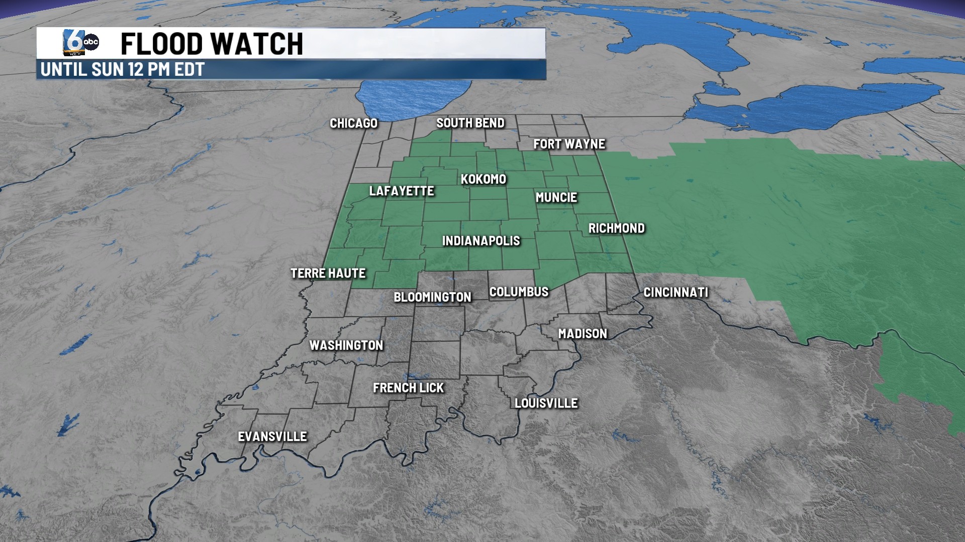
FLOOD WATCH:
A Flood Watch will remain in effect until noon Sunday as another 0.5-2”, locally 2”+ rainfall, is expected to fall across the area.
TONIGHT:
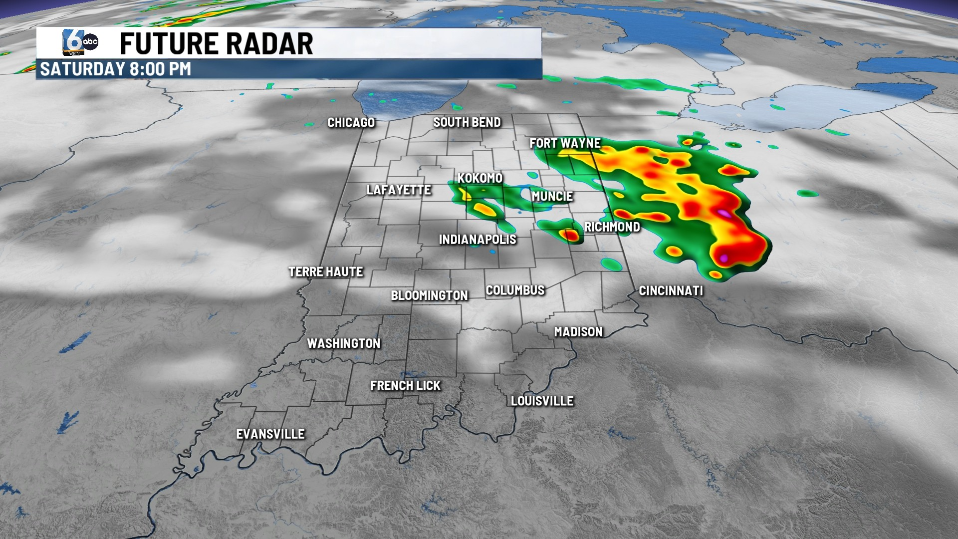
An initial round of showers and storms will continue to work out of the area early this evening. Another round of storms will arrive after midnight for Muncie and north. An additional 1-2” is expected for Kokomo through Muncie.
STORM RISKS:
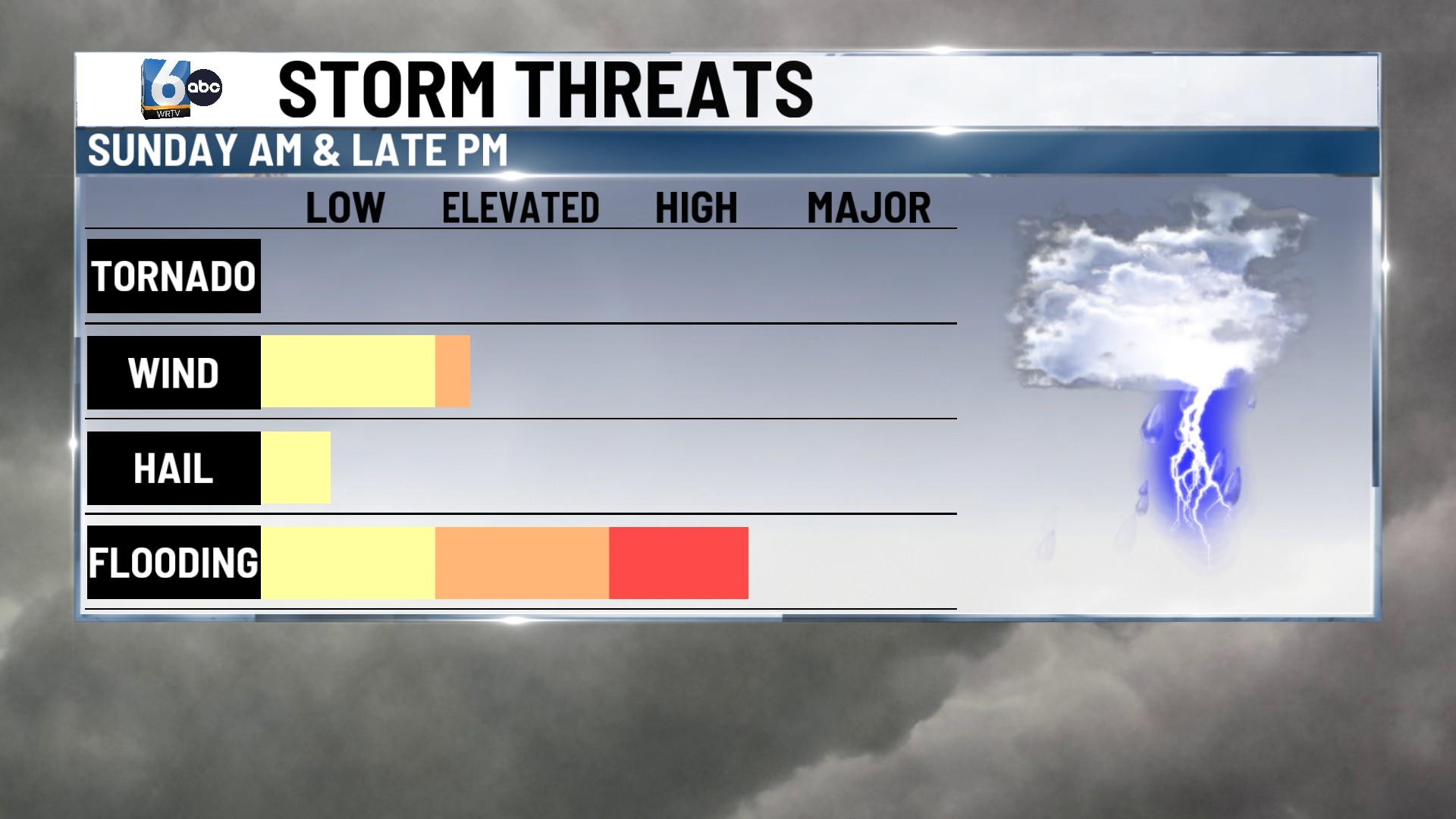
Heavy downpours and increased flooding are the main concern at High. Small hail cannot be ruled out with gusty winds. Winds embedded within thunderstorms are not expected to be overly severe. However, with how over-saturated the ground is, it won’t take even a severe wind gust to knock over/uproot small or dead trees.
SUNDAY:
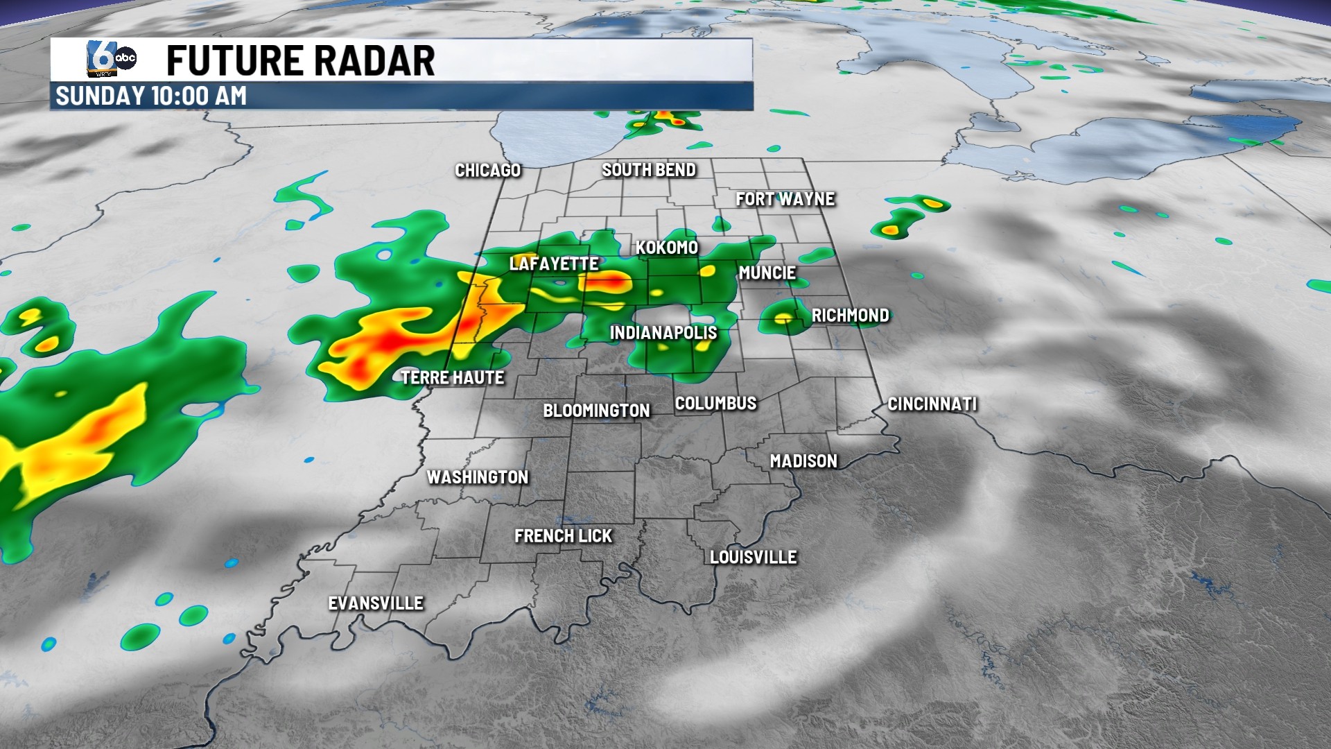
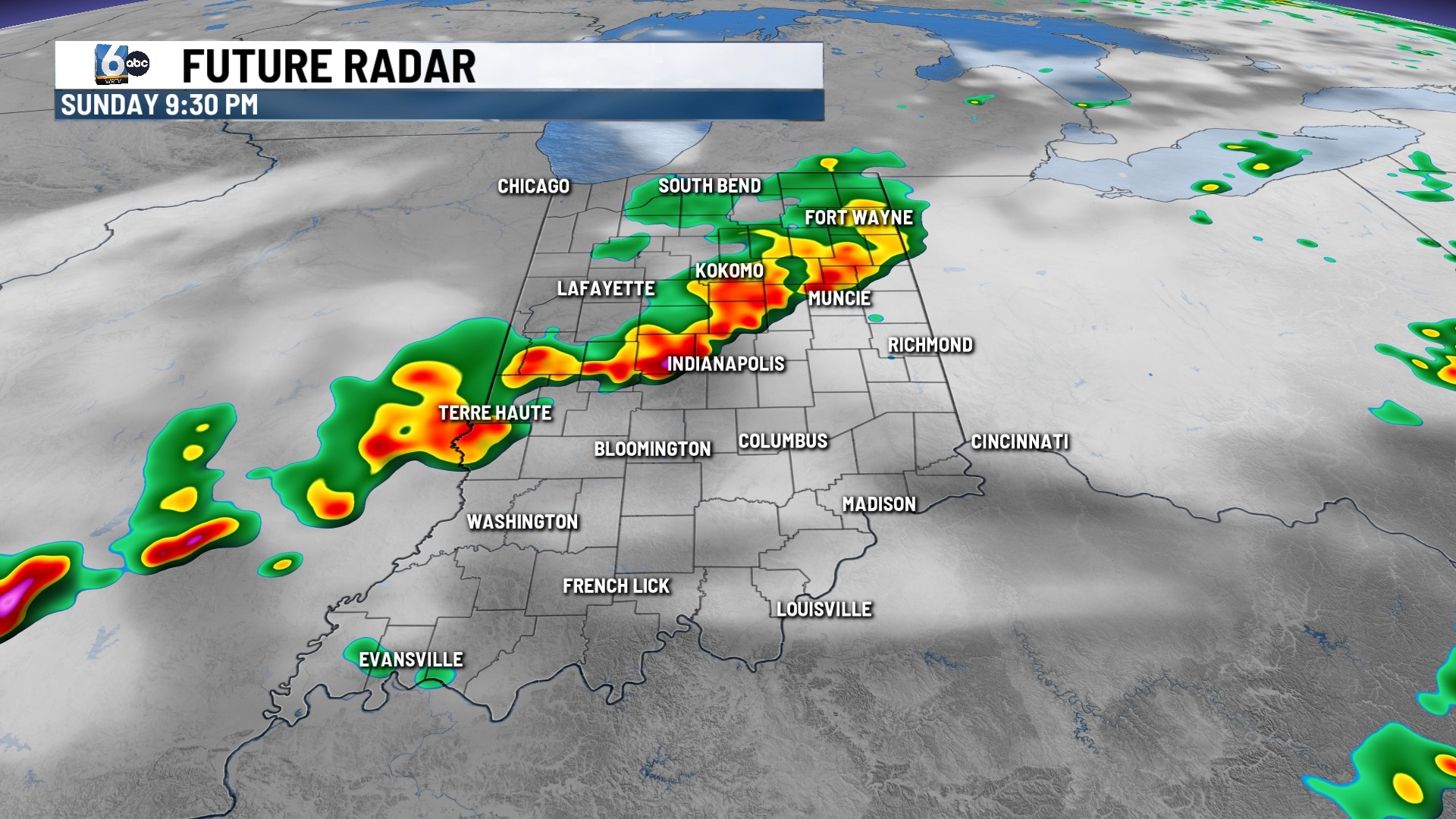
A few showers and storms will work back in prior to lunchtime but are not expected to be as heavy as the initial wave. A third wave will arrive in the late afternoon/evening hours. This will be the best potential for strong to low end.
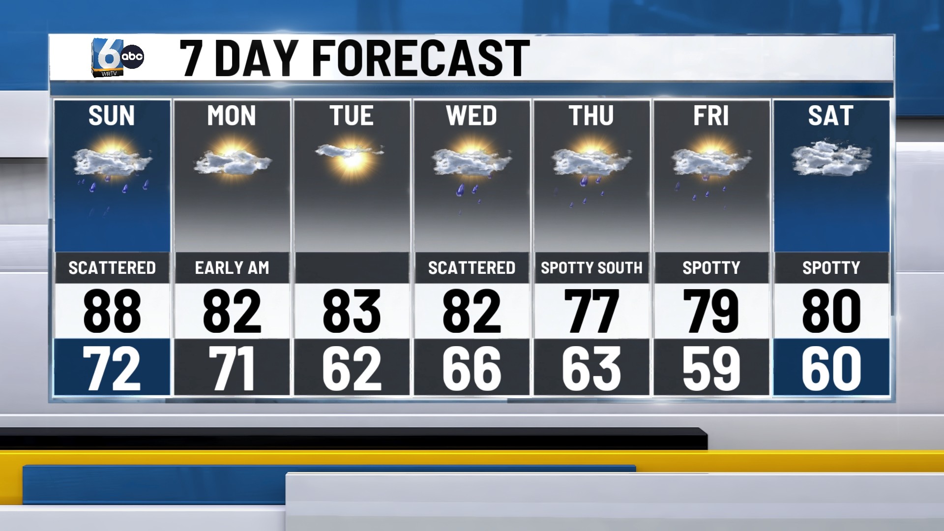
7-DAY FORECAST:
Outside a spotty shower or two first thing Monday morning, the start to the new week will be dry. Most of Monday will be dry as high pressure settles into place allowing for a dry and sunny Tuesday.
Our next system will arrive Wednesday with a weak cold front. This will bring another round of showers and storms and will cool temperatures back below normal.
A few more rain chances will linger Thursday through Saturday, with the best chances south of I-70.