


Foggy start with more heavy rain later today

INDIANAPOLIS (WRTV) — Areas of fog this morning with visibility reduced to less than a mile. Dry for the first part of the day but more moderate to heavy rain develops later this afternoon and evening. Heavier pockets of rain are possible across areas that have already been hit with significant rainfall.
TODAY:
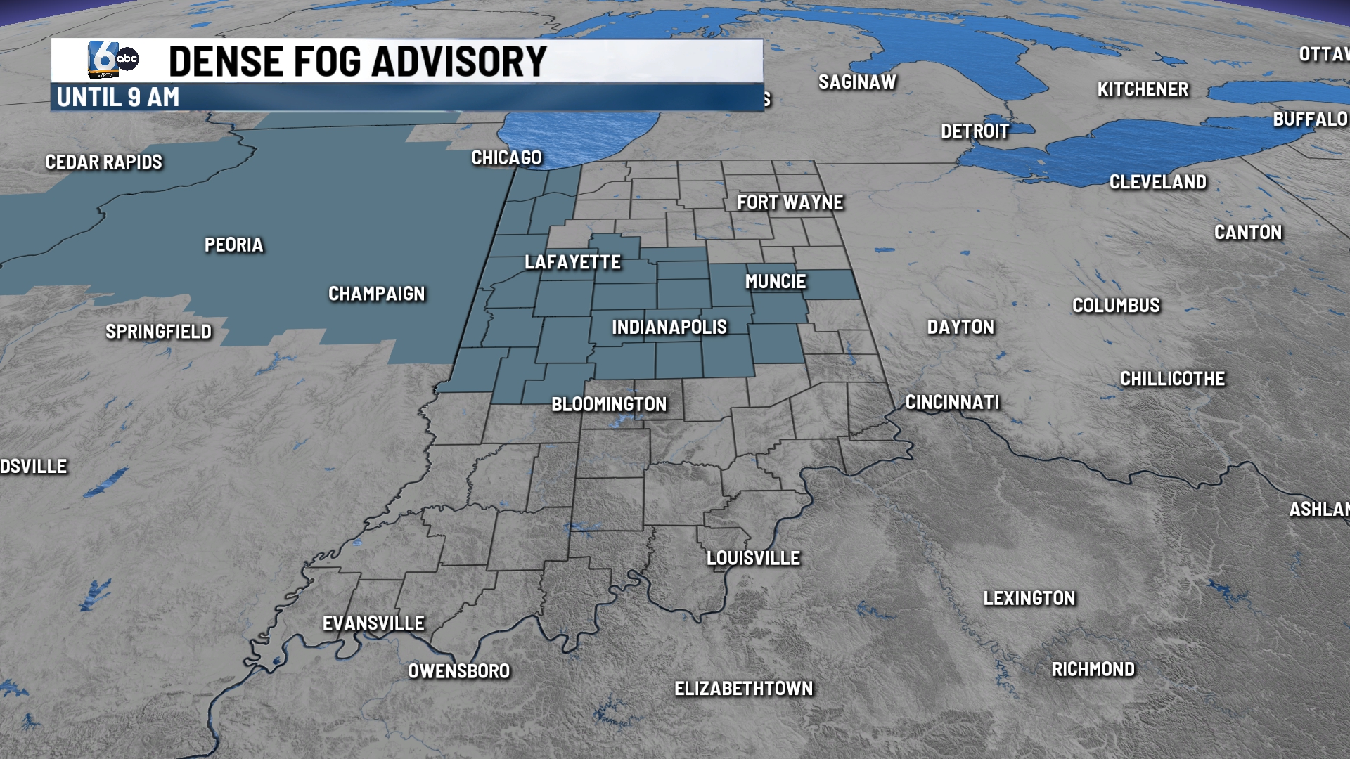
A dense fog advisory is in place for the I-70 corridor until 9am. We may see a few peeks of sunshine later this morning before another round of rain develops this afternoon. Dry for the first part of the day but rain moves into the state any time after 3 p.m.
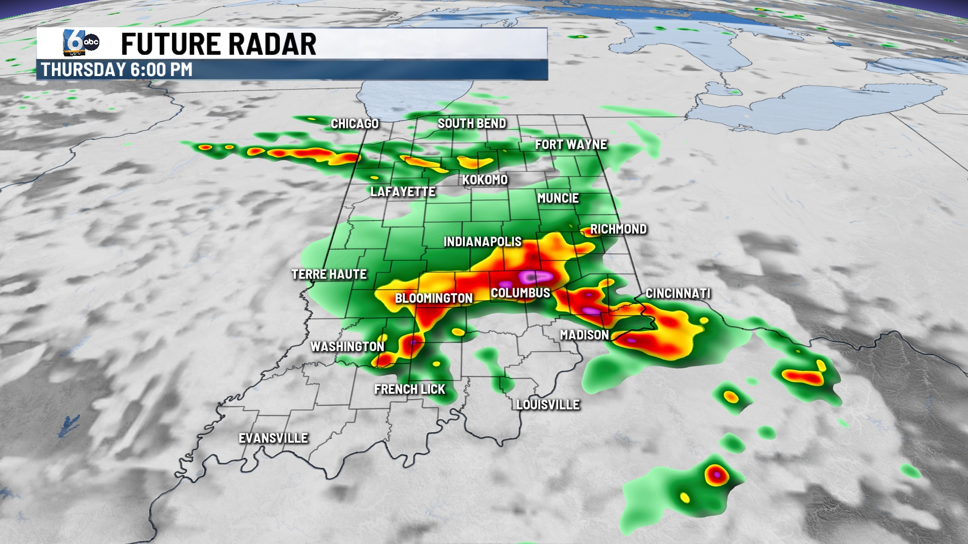
Showers and thunderstorms will be likely with some of them being on the stronger side. Gusty winds and heavy rainfall will be the primary threats. Some locations could pick up another 2-4 inches of rainfall.
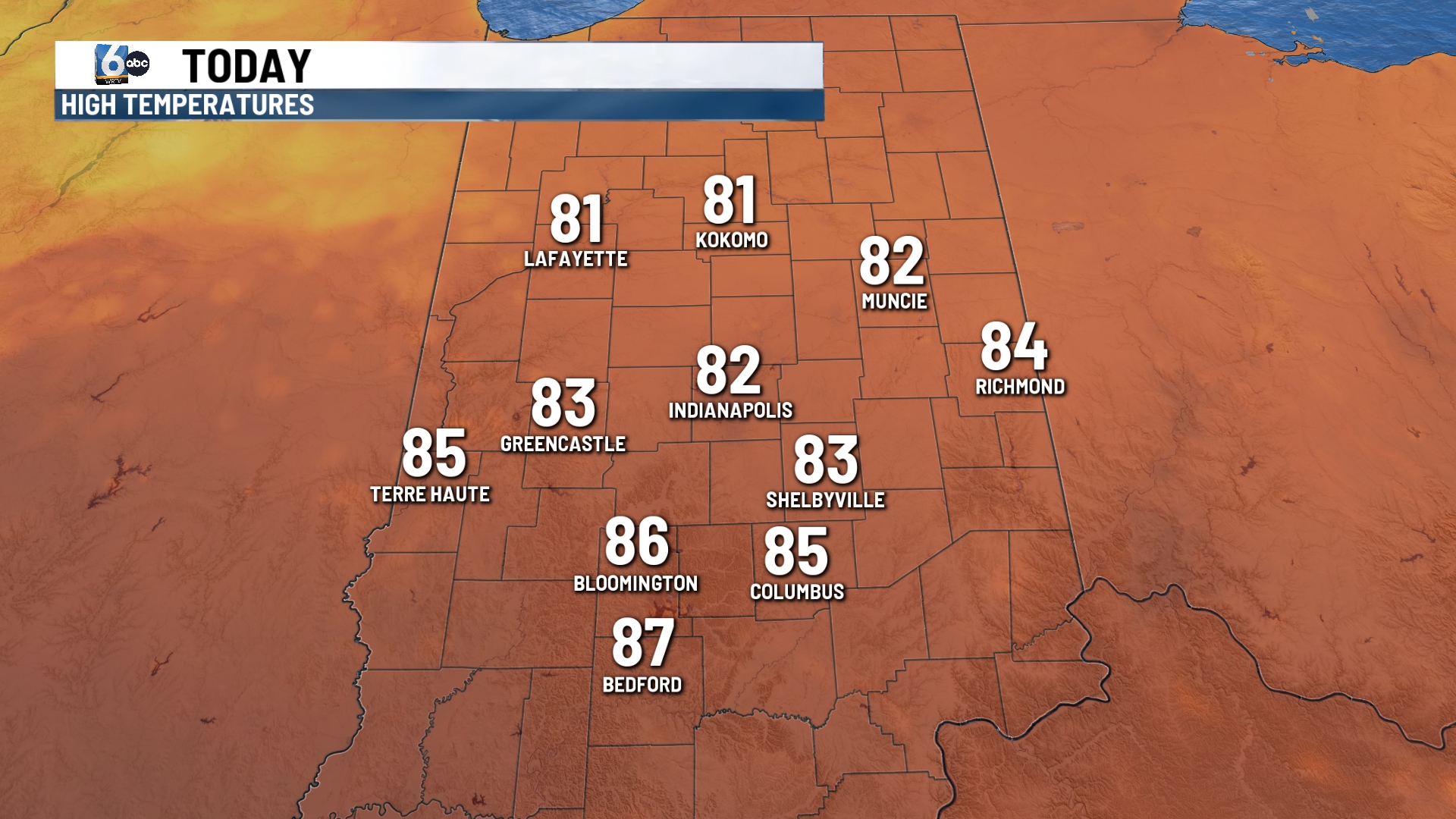
Highs will climb into the lower 80s.
TONIGHT:
Moderate to heavy rain likely. Lows will fall into the lower 70s.
TOMORROW:
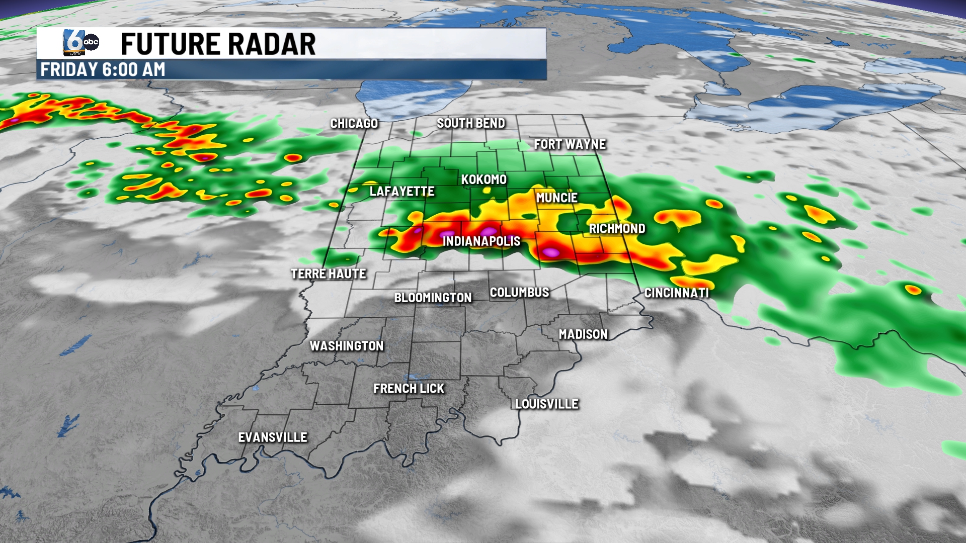
Heavy rainfall to start Friday morning. The rain turns into scattered showers later in the day. Mostly cloudy with highs in the lower and middle 80s.
7 DAY EXTENDED FORECAST:
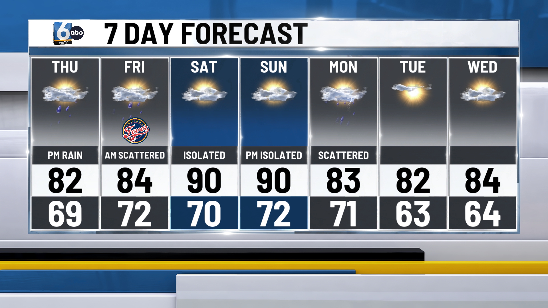
It becomes hot and humid for the weekend. Highs climb near 90 both Saturday and Sunday. An isolated shower can’t be ruled out but many dry hours over the weekend.
Less humid and lots of sunshine for the first part of next week.
