


Hot, humid with strong thunderstorms this afternoon

INDIANAPOLIS (WRTV) — Strong thunderstorms today with all severe weather modes in place throughout the state. Hot and humid conditions with feels like temperatures into the triple digits. Much better weather for the middle part of the work week.
TODAY:
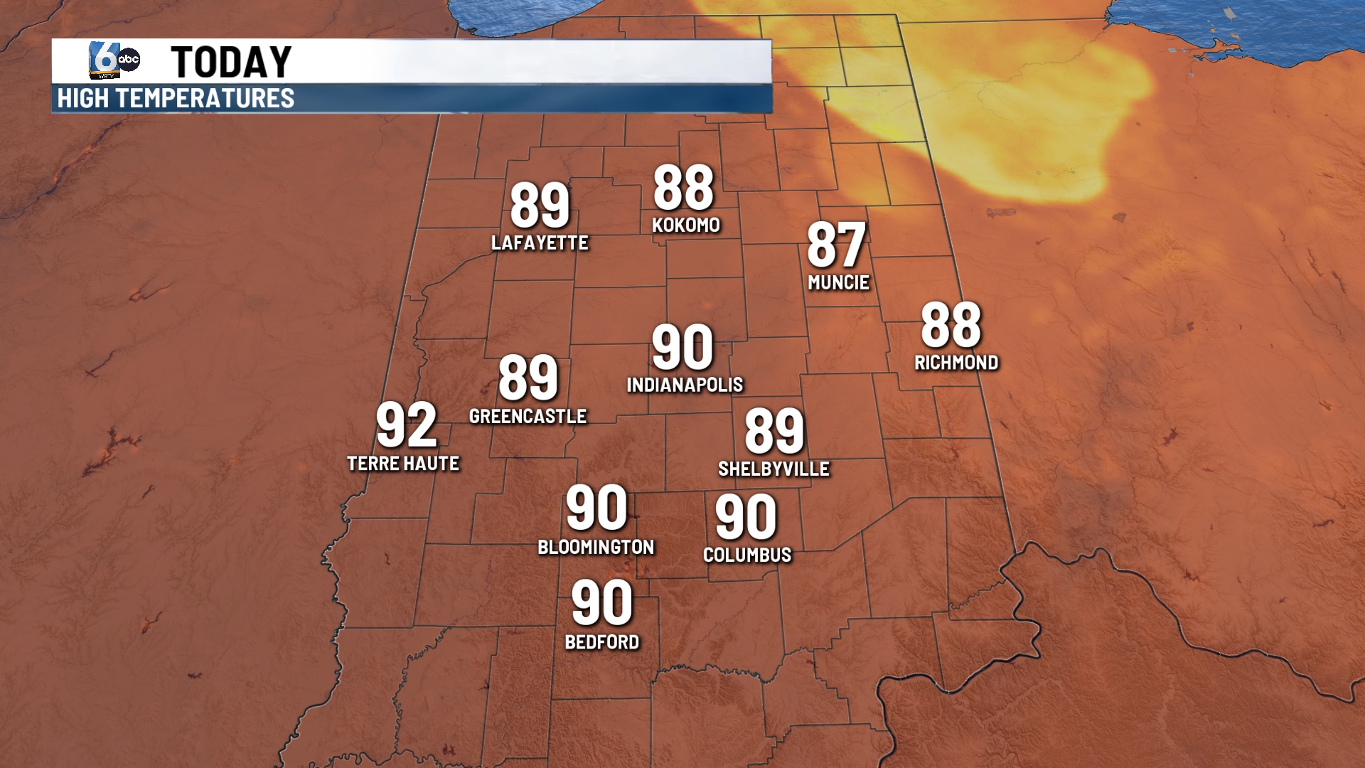
Strong to severe thunderstorms are likely later this afternoon. We are under a level 3 out of a level 5 that these thunderstorms will be severe. All severe weather modes are in place for the state. Damaging winds, hail, flooding rains and even a quick spin up tornado are all possible. The best chance for the storms to roll through will be after lunch into the evening commute.
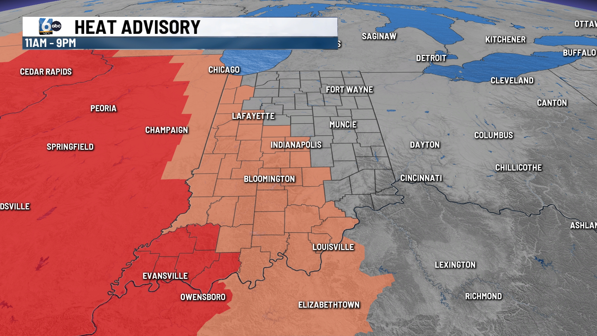
In addition to the storms, it will be hot and very humid. A heat advisory in effect from 11 a.m. until 9 p.m. Heat indices will be well above 100 and may reach 110 in some spots.
TONIGHT:
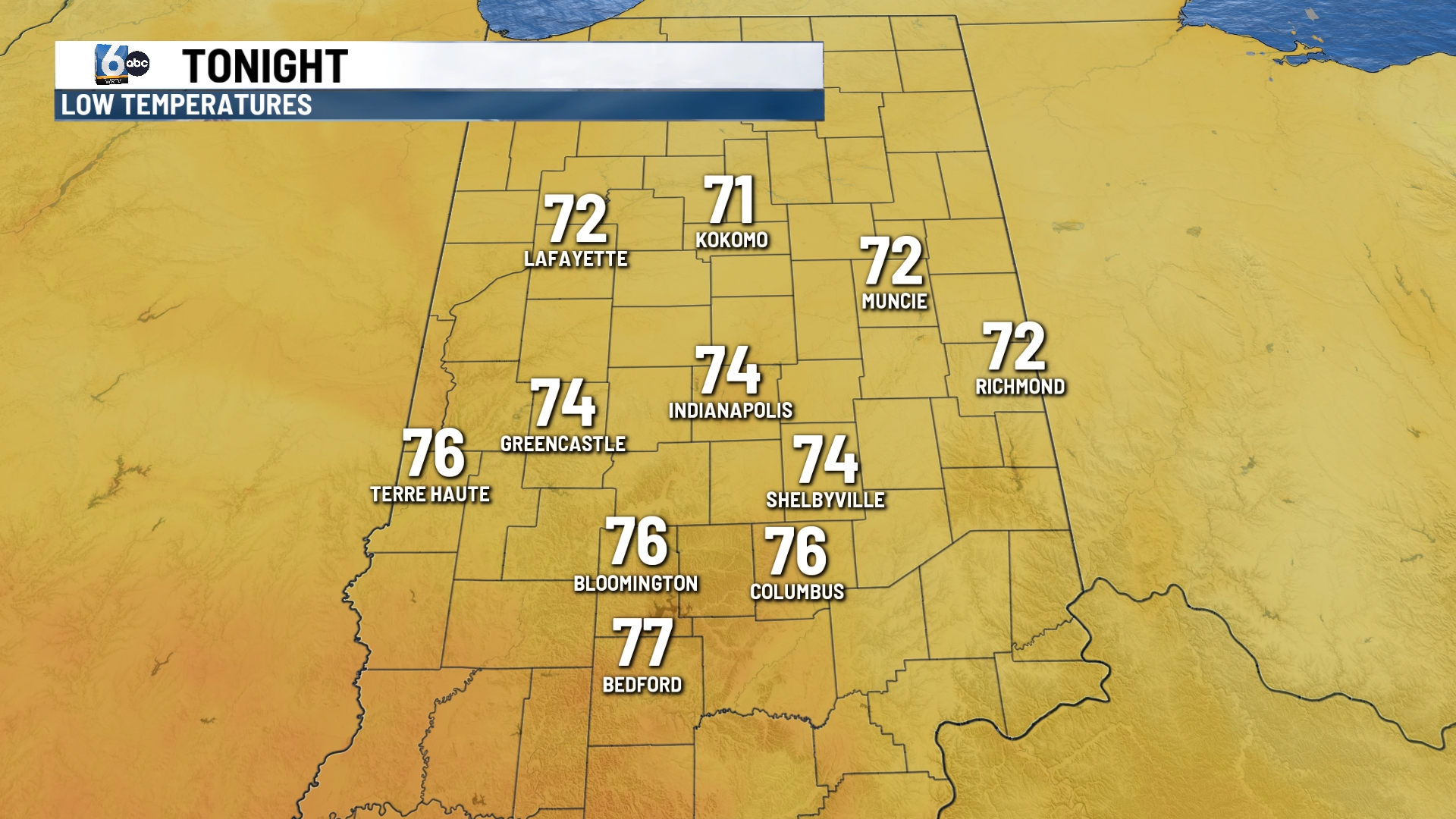
Strong thunderstorms come to an end later this evening. An isolated shower or storm may be possible after midnight.
It will be mild and muggy with lows in the low and middle 70s.
TOMORROW:
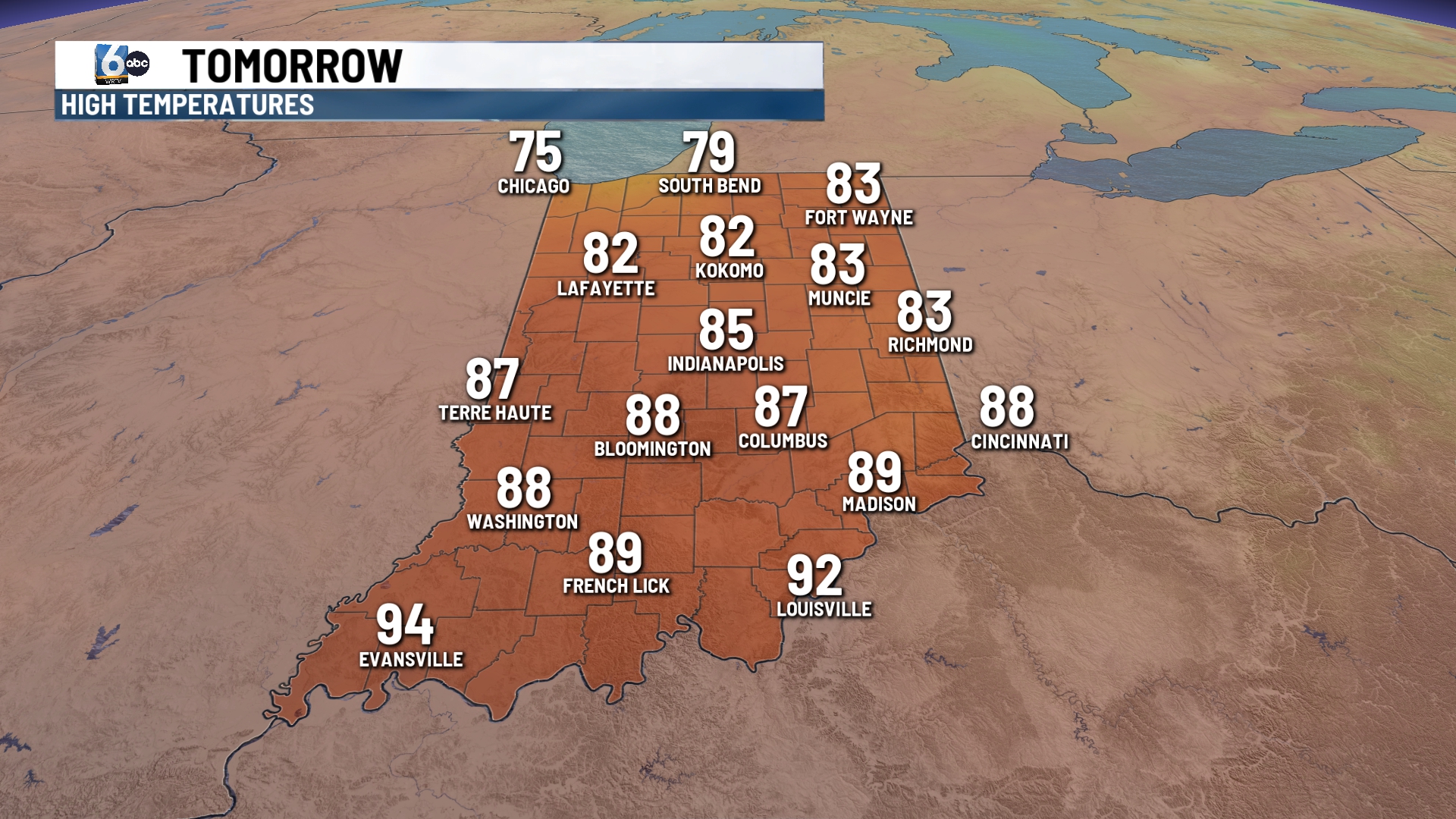
Much better weather on Tuesday. Look for partly cloudy skies, breezy conditions with highs near 85. Humidity values drop a little.
7 DAY EXTENDED FORECAST:
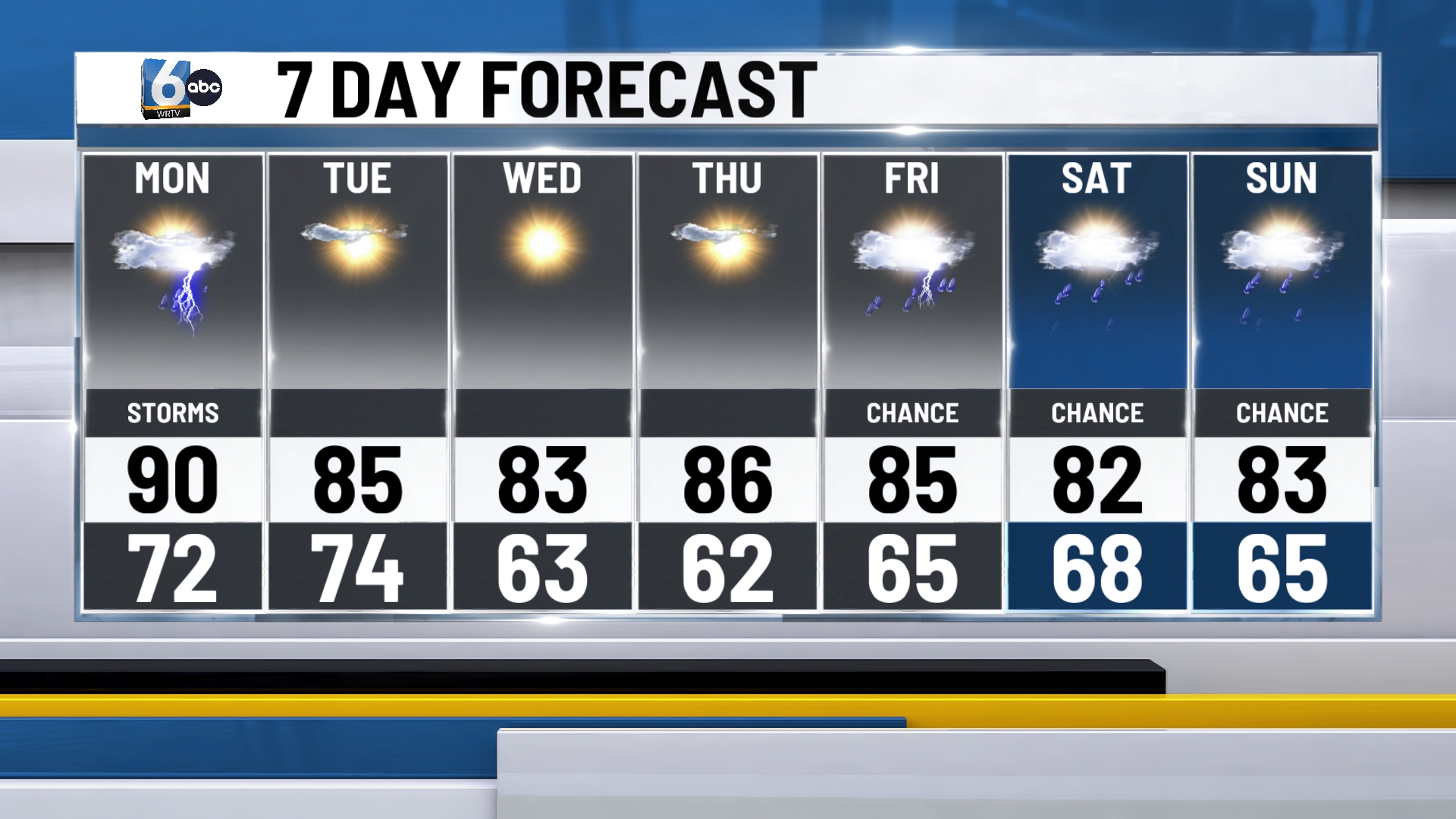
The middle part of the work week will be quiet. Sunshine, lower humidity values and lower temperatures. Highs will be in the middle 80s.
More rain chances move in Friday and linger into the weekend. Highs will be in the lower and middle 80s.
