


Major severe storm risk through early morning for central Indiana

INDIANAPOLIS (WRTV) — Have a way to get watches and warnings this evening/tonight. Severe storms are likely in central Indiana.
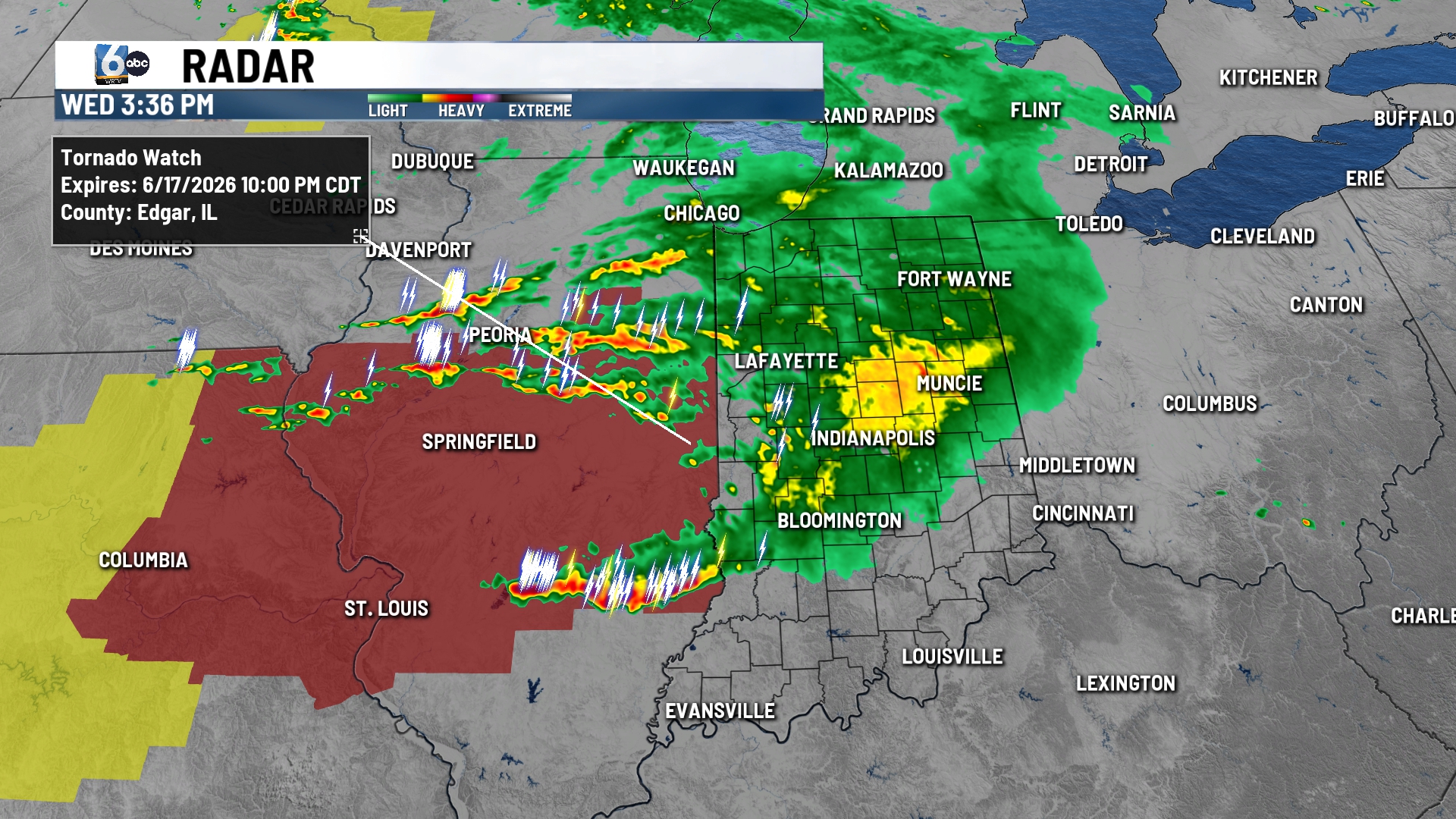
THIS EVENING/TONIGHT:
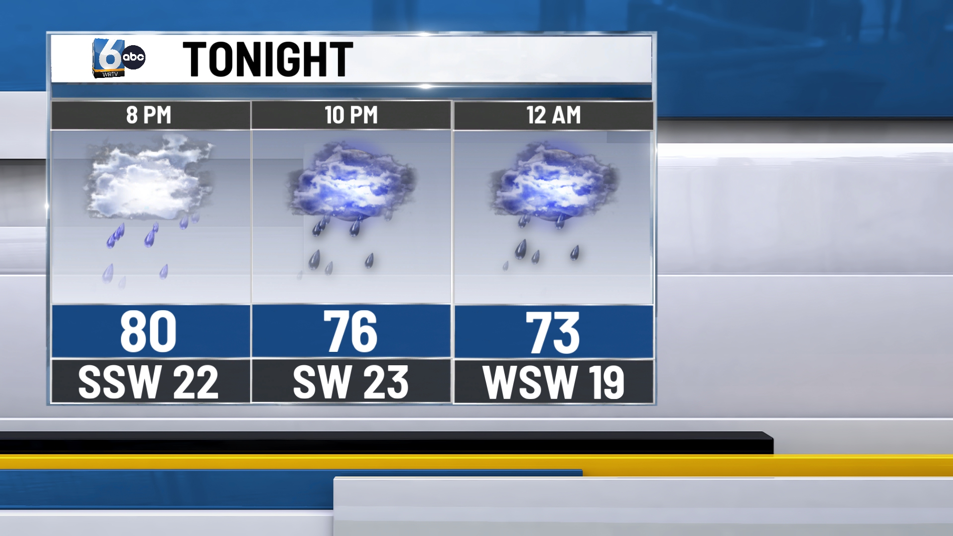
Indianapolis, stretching into western Indiana, has been added to the moderate (4/5) risk. The first round of rain has been impacting central Indiana this afternoon. Our severe storms will develop later this evening as our atmosphere destabilizes behind this initial round.
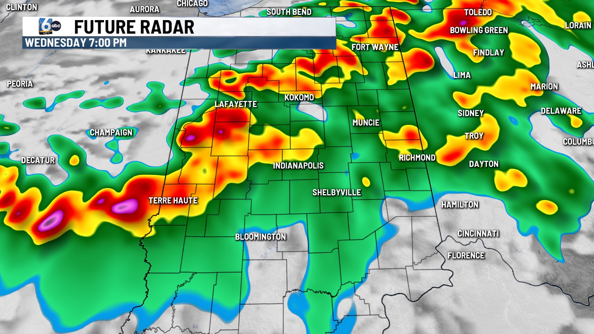
A line of supercells likely forms first in Illinois before traveling into central Indiana. It is unclear if this will be a line segment or still a line of supercells into our area. All threats of severe weather are on the table, including damaging wind, strong tornadoes, large hail, & flooding. Severe storms exit to the south in the early morning hours. Low temperatures in the mid to upper 60s.

TOMORROW:

Mostly sunny skies. High temperatures in the mid to upper 70s.
FRIDAY:
Mostly sunny skies remain in place for yet again for another nice day. High temperatures in the mid to upper 70s.
7-DAY FORECAST:
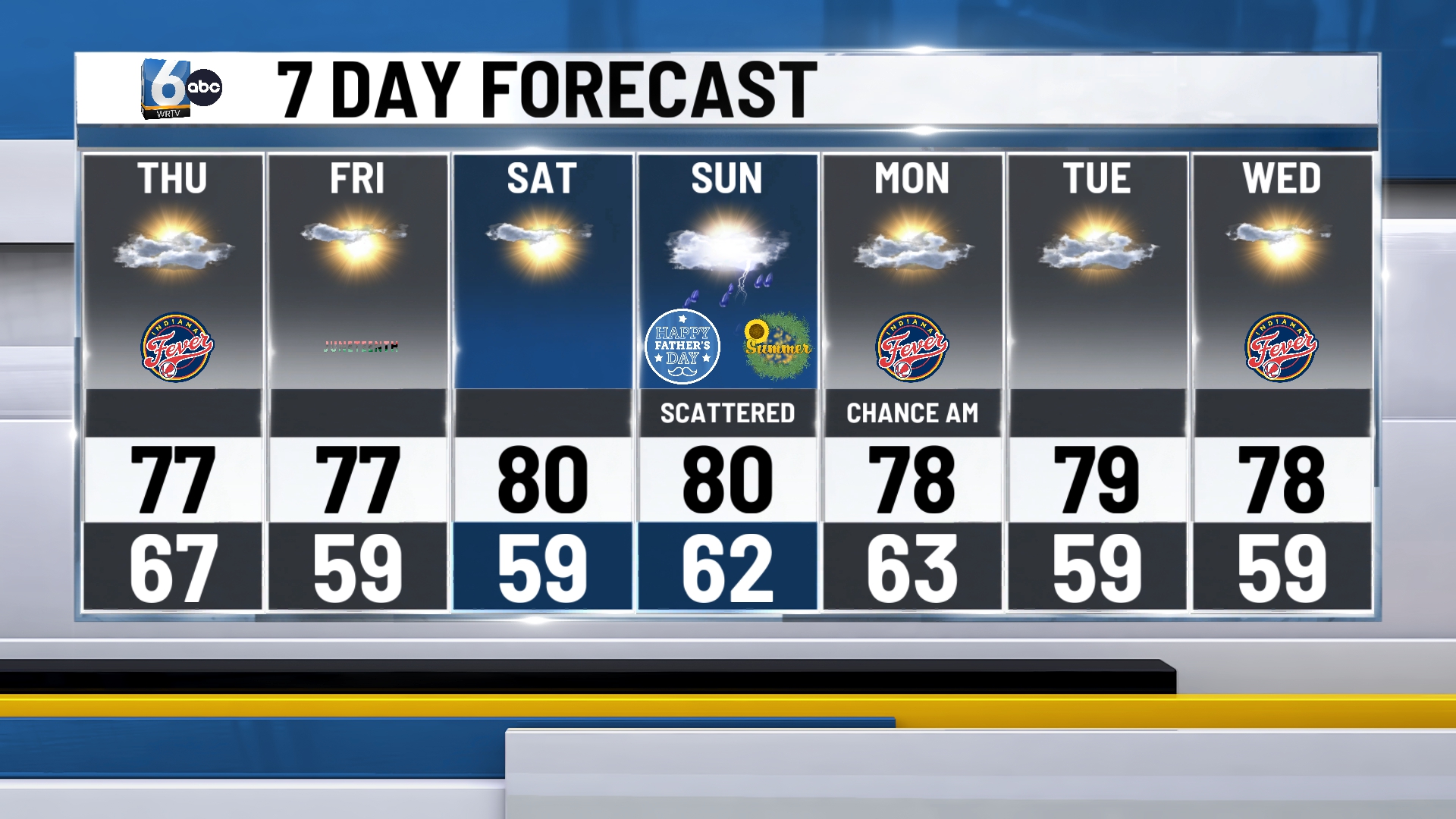
Scattered showers and storms should be anticipated at some point on Sunday. After this round, mainly dry conditions are expected early to the middle of next week.
