


More strong storms today

INDIANAPOLIS (WRTV) – Another round of strong storms will be possible today. Heavy rainfall and gusty winds will be the primary threats however a quick spin up tornado is also possible. More rain chances continue through the end of the week.
TODAY:
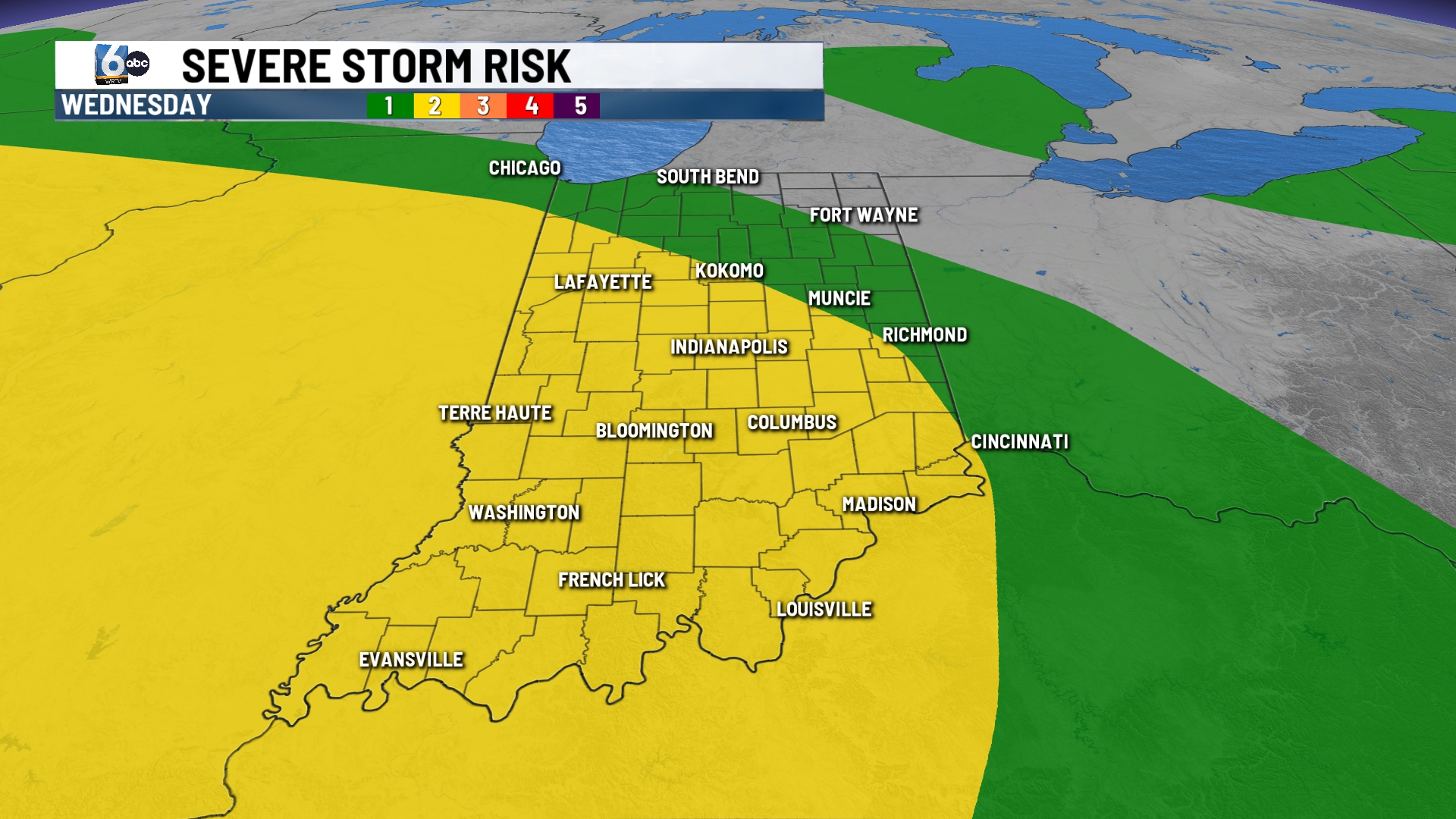
Heavy rainfall with flooding is occurring this morning in eastern Indiana. More storms fire up on and off during the day. Some of the storms may be strong with gusty winds and heavy rainfall. A tornado can’t be ruled out in western Indiana. A level 2 out of 5 severe weather risk is in place for much of Indiana today.
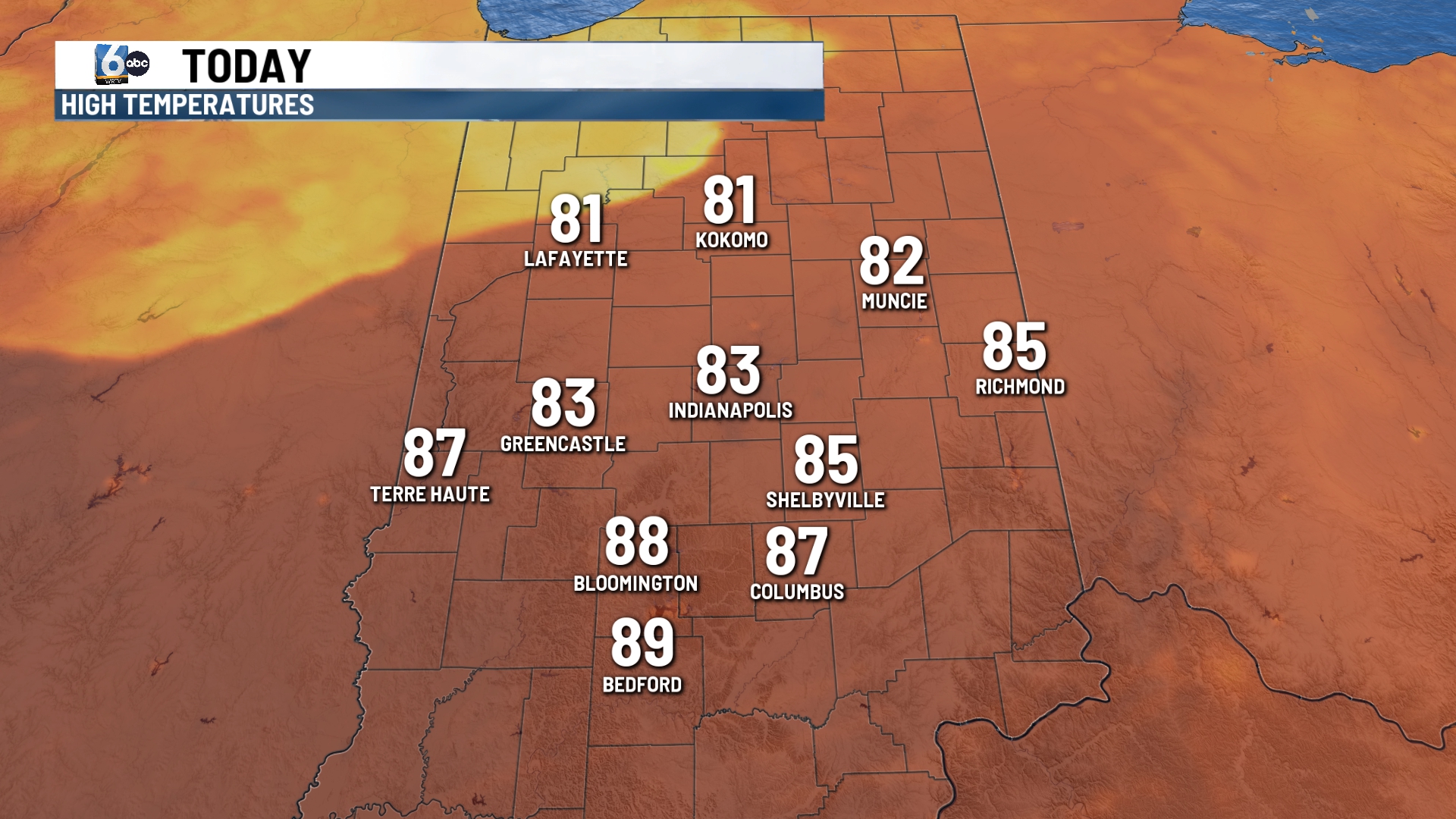
Due to the cloud cover and rain, temperatures will likely stay into the lower 80s.
TONIGHT:
More storms possible this evening. Lows fall into the upper 60s near 70.
TOMORROW:
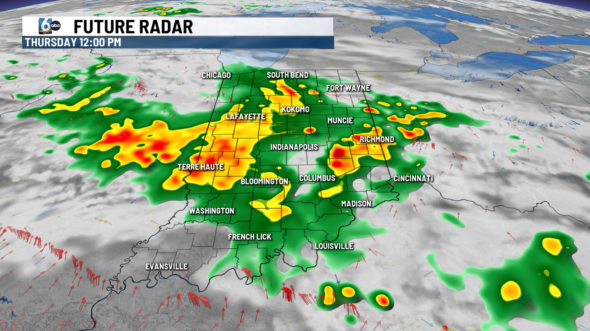
Another round of strong storms may be possible. A level 1 risk out of 5 is possible. Gusty winds and intense rain will be the main threats. Temperatures stay into the lower 80s with muggy conditions.
7 DAY EXTENDED FORECAST:
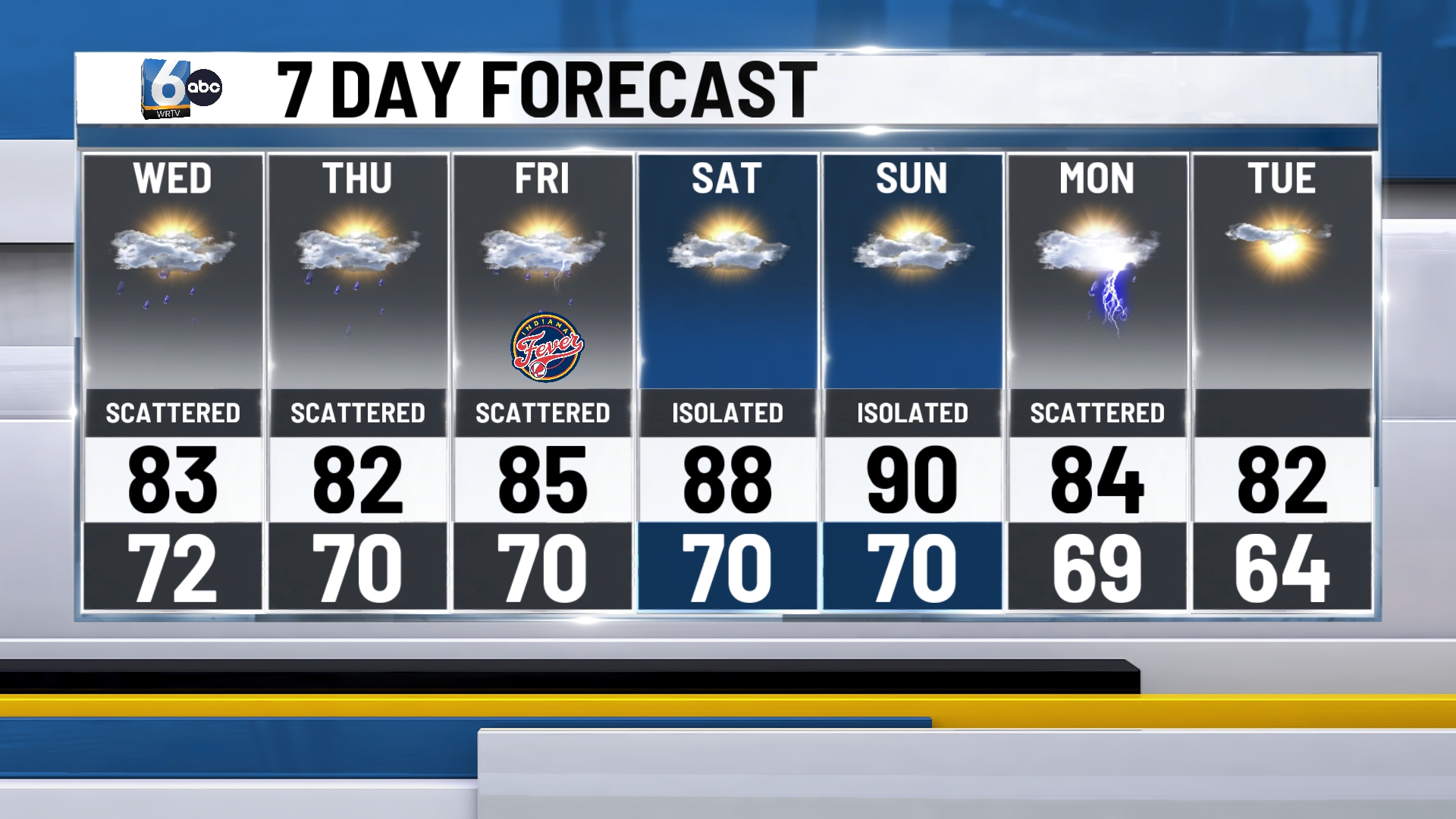
Scattered showers and storms possible again for Friday. Strong to severe thunderstorms are possible on Friday with a low-end severe weather risk.
This weekend turns hot with highs in the upper 80s near 90.
Temperatures drop back into the lower 80s next week.
