


Record high afternoon temps, storm chances in the evening

INDIANAPOLIS (WRTV) — Temperatures are making a run at record highs this afternoon. Our attention now turns to storm chances this evening into tonight.
TONIGHT
The Severe Thunderstorm Watch has been canceled for Central Indiana.
Later on tonight, strong showers and storms move into northern Indiana, damaging wind is the main concern. Central Indiana should be dry.
TOMORROW
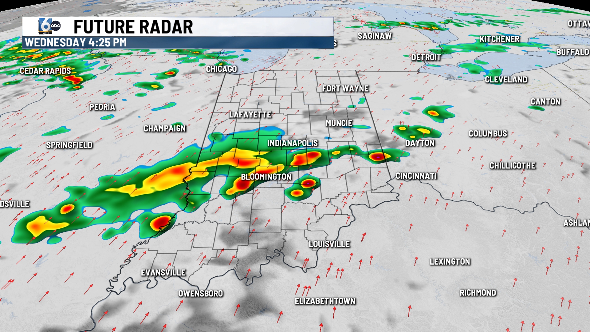
Scattered showers and storms, mainly in the afternoon and evening hours. A marginal (1/5) risk of severe storms is in place for wind. High temperatures in the low 80s.
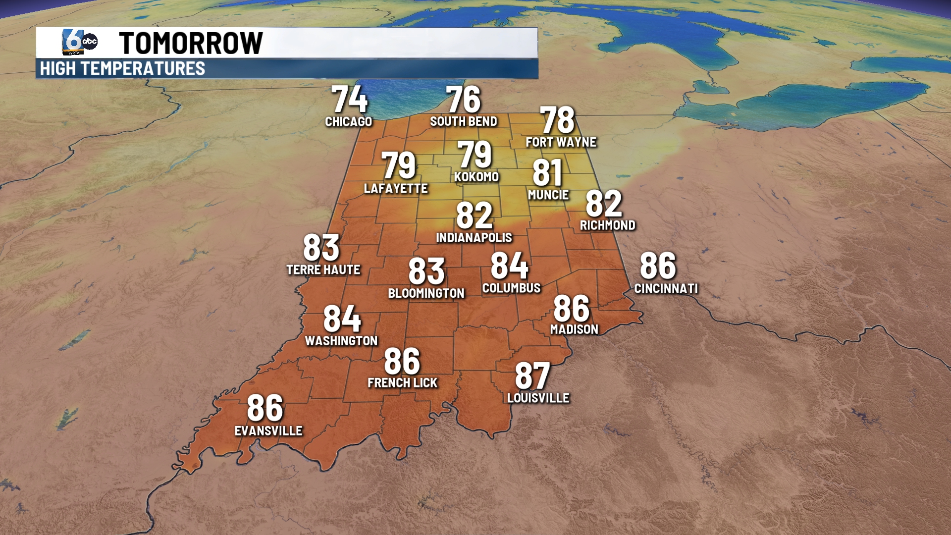
THURSDAY
Scattered showers and storms. High temperatures in the mid to upper 70s.
7-DAY FORECAST
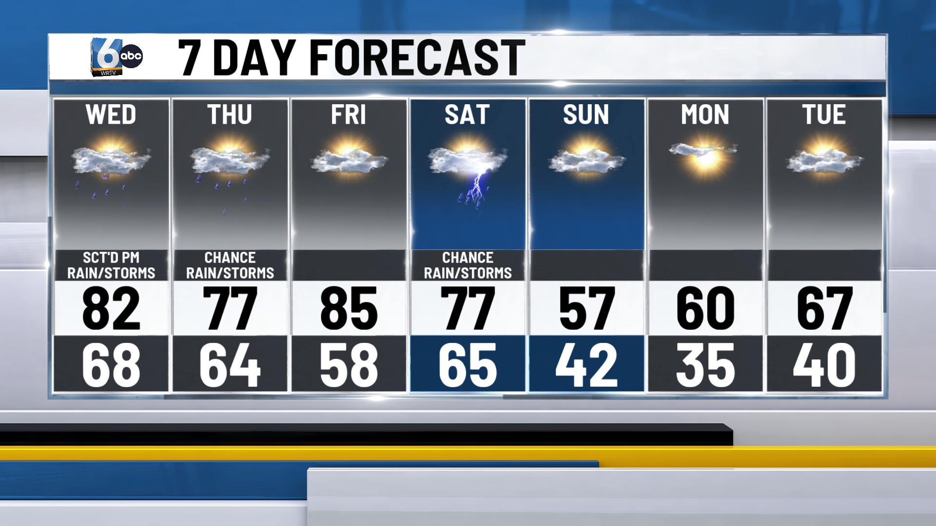
Friday looks to be dry in central Indiana with high temperatures pushing into the low to mid 80s. A slight risk of severe storms is in place on Saturday as a strong cold front pushes into the area. Much cooler air follows for Sunday & Monday. Low temperatures are expected to fall into the 30s on Monday morning.

__
