


Strong to severe storms this PM

INDIANAPOLIS (WRTV) — Following a calm start to the week,strong to severe storms will return for the middle of the week.
FLOOD WATCH:
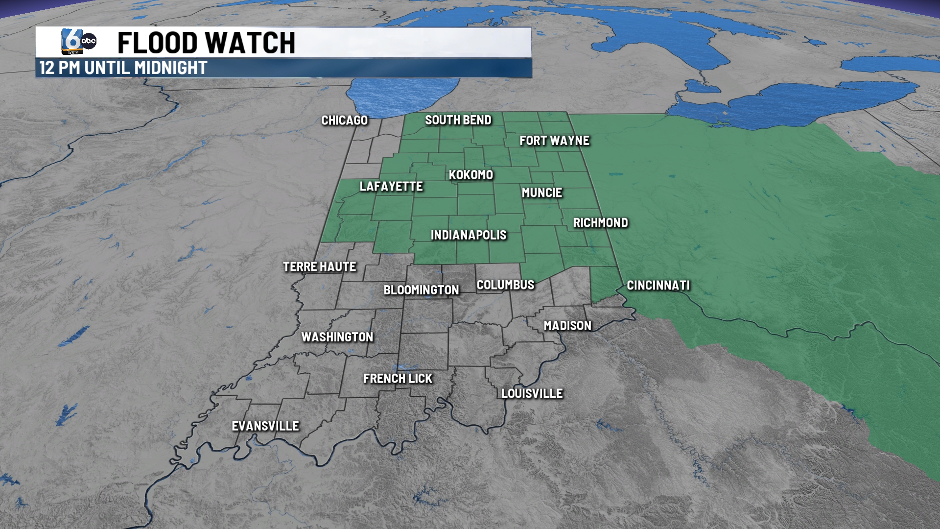
A Flood Watch will go into effect for counties along and north of I-70. 2-4″ rainfall is expected for much of the state with locally 4″+ through the end of the week.
TODAY:
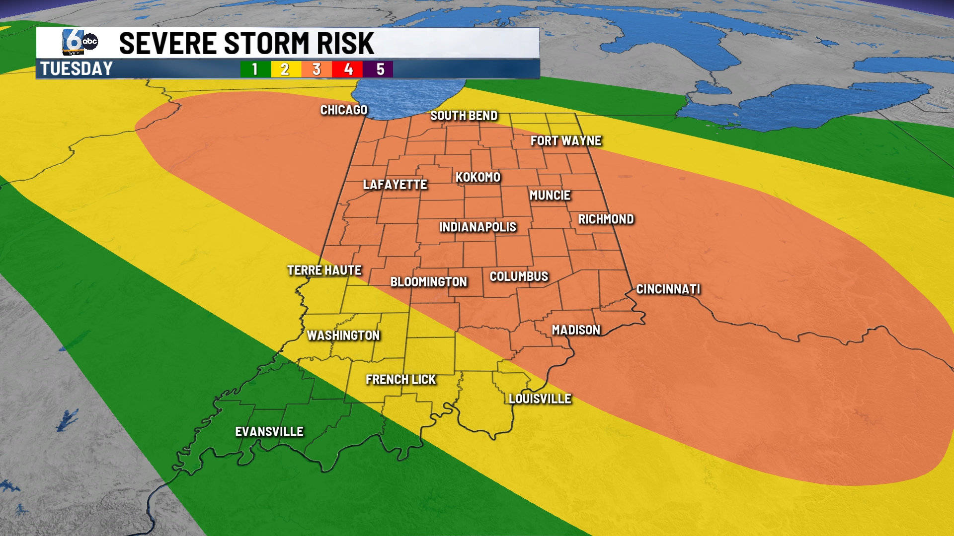
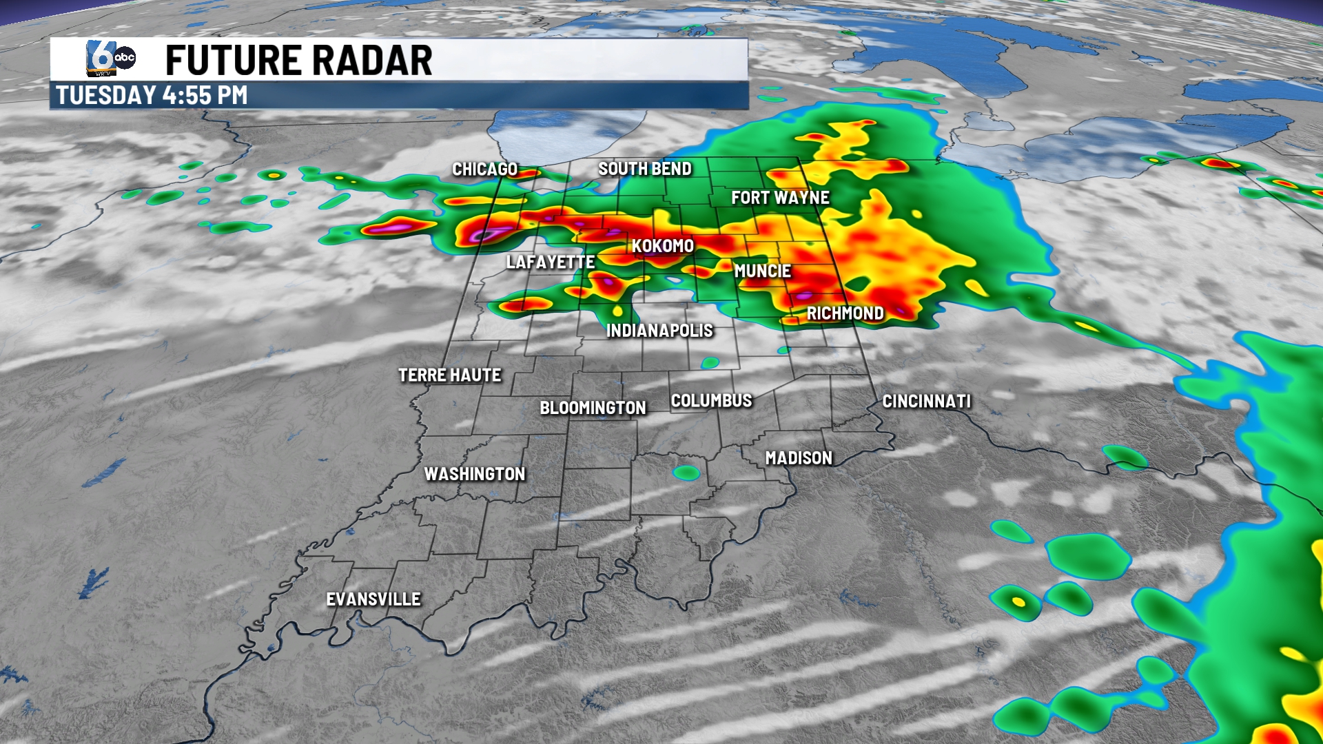
Much of the morning hours will remain dry for spots along and south of I-70. A few spotty storms will be possible north through sunrise. The best chance for storms will be this afternoon and evening. Any storms will have the risk of being strong to severe. All modes of severe weather will be in play. Damaging winds and heavy downpours will be the biggest risks, with a brief tornado or two possible.
TONIGHT:
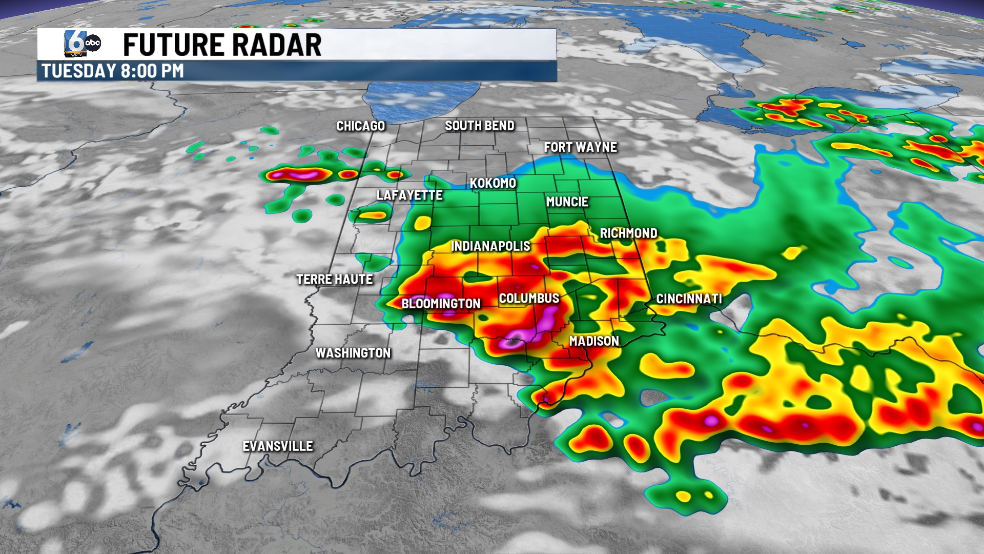
Showers and storms will quickly wrap up with most of the night remaining dry and warm. A round of clusters of showers and storms will return early tomorrow morning that could affect the morning commute and the bus stop.
TOMORROW:

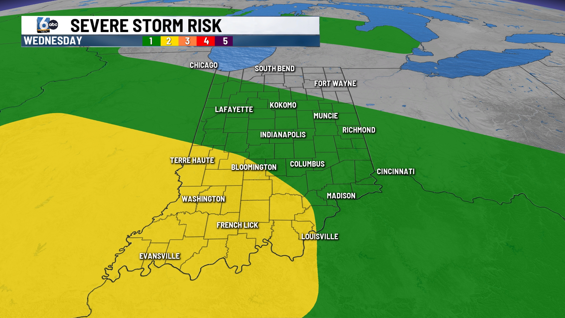
Storm chances continue tomorrow but coverage will be decreased. A few spotty to isolated storms are possible mainly in the PM hours. Any storm can be strong with gusty winds, heavy rain, and small hail.
7-DAY FORECAST:
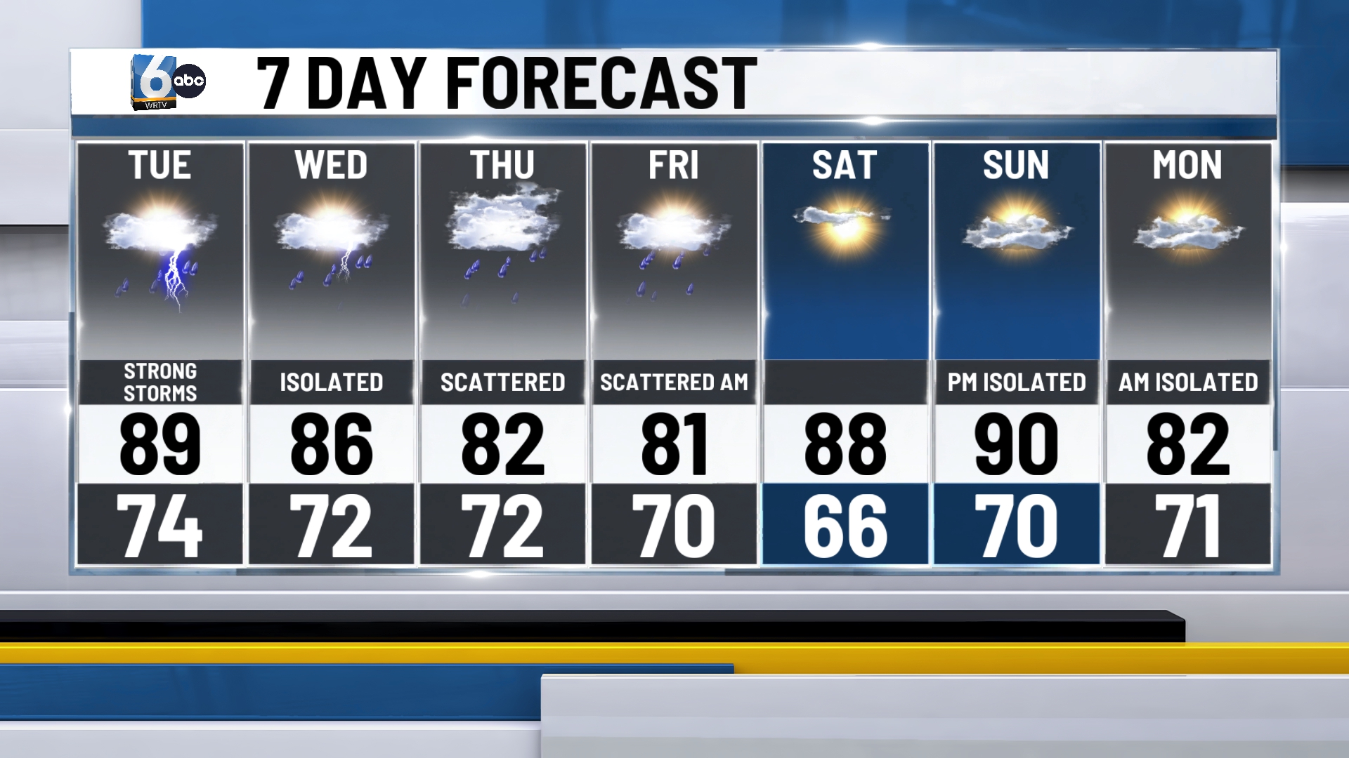
A few storms will linger through the area come Wednesday with the best chance for activity south of I-70. Another round of clusters of storms returns Thursday and Friday where each day can see on and off storms. Temperatures will remain in the low 80s to end the week. High pressure will build in for next weekend. This will return sunshine and will allow temperatures to return to the upper 80s.
