


Wet Wednesday with more rain on the way

INDIANAPOLIS (WRTV) — Dry to start the day but more wet weather moves into the state later this afternoon. Some areas may pick up moderate to heavy rainfall. We begin to dry out later in the week with temperatures a few degrees below normal for this time of the year.
TODAY:
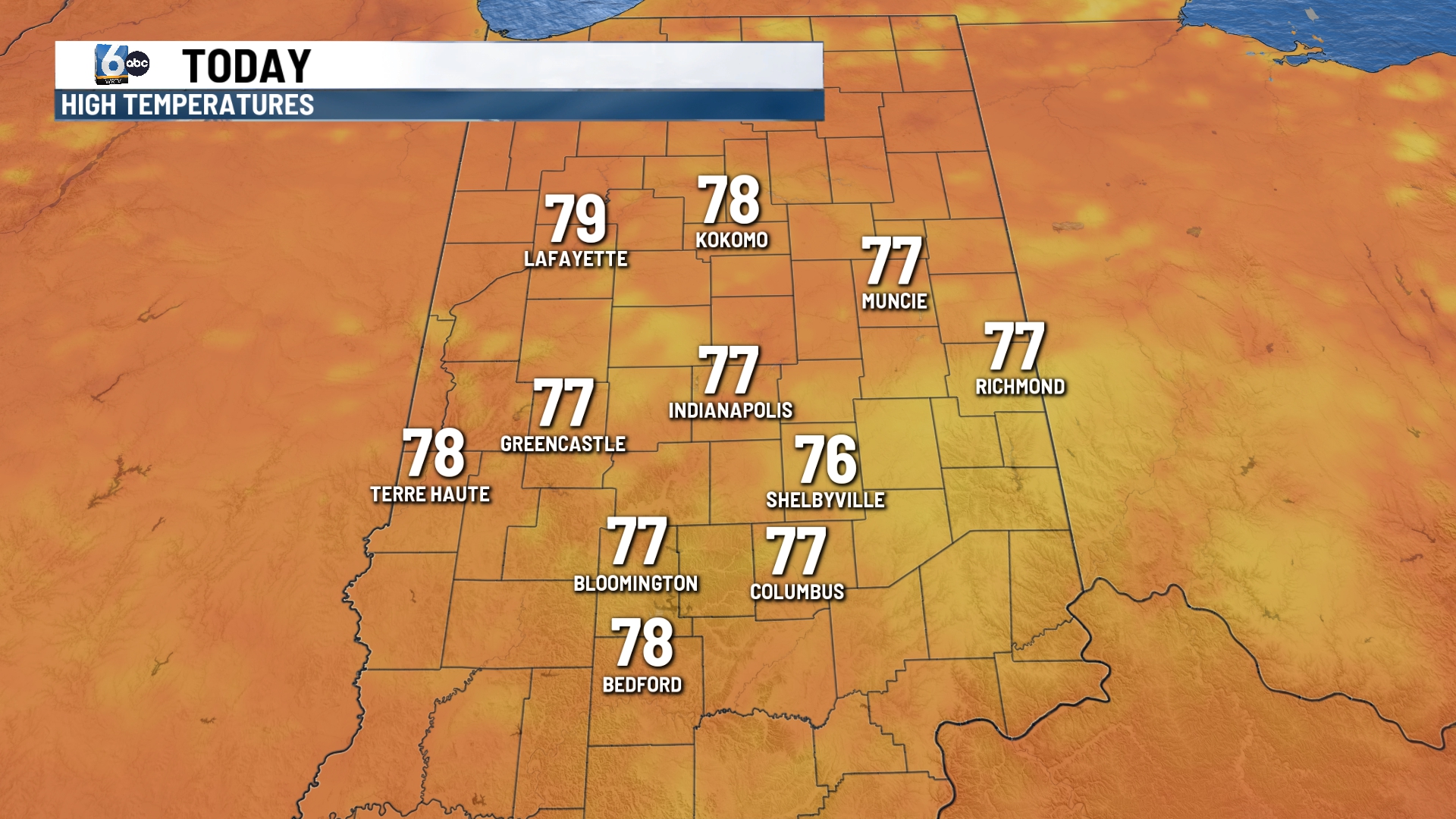
Dry conditions to start the day but showers and storms move into the state later this afternoon and evening. The best chance of rain will develop after 3 pm and continue into the overnight hours. A level 1 out of a level 5 severe weather risk is in place. The main threats will be gusty winds and heavy rainfall.
Some locations may pick up an additional half inch to an inch of rainfall.
Highs today will be in the upper 70s due to the cloud cover and rain.
TONIGHT:
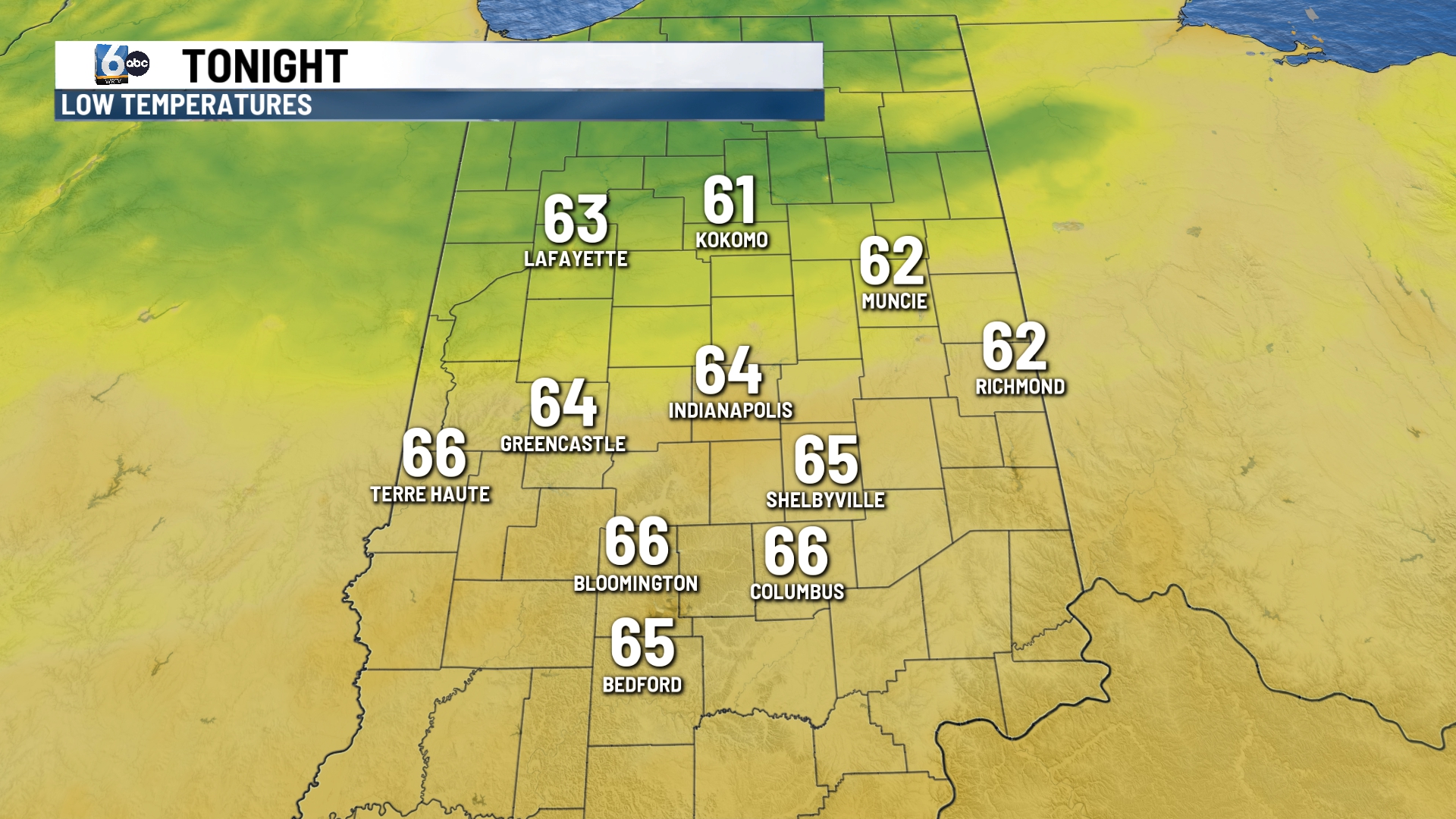
Moderate to heavy rain continues overnight. Lows will fall into the 60s.
TOMORROW:

We will see rain chances for the first part of the morning. Clouds decrease throughout the day with lots of sunshine for the afternoon.
Look for highs near 80.
7 DAY EXTENDED FORECAST:

Dry on Friday for the first night of those high school football games. We will see temperatures staying into the upper 70s for the weekend. An isolated shower may be possible late Saturday afternoon and evening.
