

INDIANAPOLIS (AP) — Indiana health officials are dropping the state’s color-coded map that rated each county’s risk of COVID-19 spread in favor of relying on a different federal rating system.
That is one of the significant changes the Indiana Department of Health announced Wednesday for its online COVID-19 dashboard.
Indiana's risk map was based on the number of new COVID-19 cases per capita and the percentage of tests confirming infections.
The map updated last week shows 87 of the state’s 92 counties at the lowest risk level.
The Centers for Disease Control and Prevention’s national risk map is based on COVID-19 hospitalizations. It showed all Indiana counties at low-risk levels as of Wednesday.
Latest Stories
-
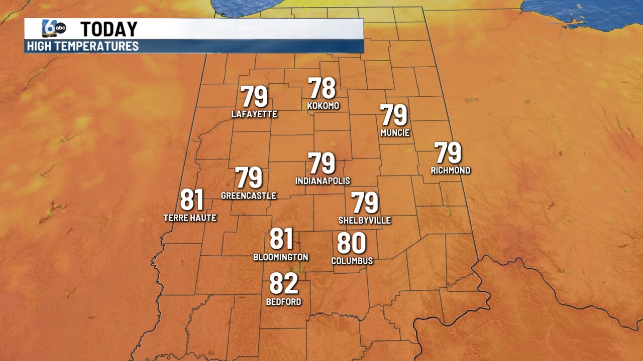
Wonderful Wednesday before rain, heat and high humidity return
A wonderful Wednesday with sunny skies and low humidity. Rain chances return later this week with high heat and oppressive humidity.
Beech Grove schools begin public push for 2026 referendum
Beech Grove City Schools launched a series of public meetings Tuesday night on the proposed 2026 operational referendum.
Indianapolis Urban League celebrates 60 years of service with awards luncheon
Tuesday was a milestone day for the Indianapolis Urban League, the local chapter of a national organization serving communities of color with housing and food assistance and scholarships.
Dave Schrage unretires to lead Guerin Catholic to first baseball state title
Guerin Catholic had never won a baseball state title in the school's 22 year history. That is until Friday.


