With two months left in what's already been one of the worst hurricane seasons in recent history, there's still time for more storms to form.
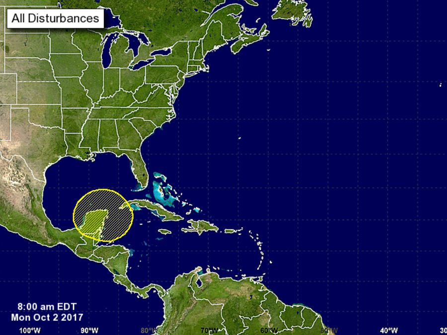
One of those disturbances is currently churning near Mexico’s Yucatan Peninsula.
At the moment, it's simply a very disorganized group of showers and thunderstorms.

The rain and thunder is the result of some stormy weather along a stationary front that stretches from Florida down to the Western Caribbean.
There's a possibility for some slow development and increased organization by the end of the week, according to the National Hurricane Center.
If the system grows and eventually becomes a tropical depression, it's likely to see some explosive growth in the warm waters of the Gulf of Mexico, which means anyone from Texas to Florida could see another tropical storm or hurricane making landfall.
RELATED: Track every tropical storm and hurricane with the Storm Shield app
Throughout the month of October, the Western Caribbean and the Gulf of Mexico are two of the more likely spots for tropical weather to form.
So far this hurricane season has produced 13 total tropical storms, eight of which became hurricanes. Five of those hurricanes reached Category 3 strength or higher.
The average season typically produces 12 named storms, three of which normally form in October and November.
RELATED: Hurricane vs. Typhoon vs. Cyclone: What's the difference?
Follow Storm Shield Meteorologist Jason Meyers via the Storm Shield app on Twitter, Facebook, and YouTube. Download the Storm Shield Weather Radio App for your iPhone or Android device and get severe weather alerts wherever you are. Named by Time.com one of the best weather apps for your iPhone.

