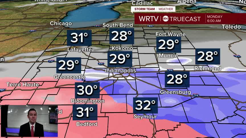


We're quickly heading into a much more active stretch of weather. Chances for rain and snow will carry into the Monday morning drive.
The main area of concern is along and south of I-70. That's where a Winter Weather Advisory is in effect until 9AM Monday. A band of about 1"-2" of snow is possible near I-70. There will be a sharp drop in snowfall north of this band. Across southern areas, snow may transition to sleet or freezing rain. This would limit snow potential, but could result in a light glaze of ice. A small shift in the track can have a big impact on totals. Be prepared for a slow commute Monday morning.

Anything that does accumulate will melt during the afternoon, so conditions should improve quickly. Temperatures make their way into the 40s under mostly cloudy skies.

We are warmer for the rest of the week, but we're also very wet. Rain develops Tuesday. We then carry a daily chance for rain through Saturday. Some of the rain could be heavy. There's the potential for widespread rainfall totals of 2"-4" over the next seven days. Some spots could see even higher totals. We are starting off with low river levels, so that should help in reducing the flood threat initially. That said, flooding could become an issue as the week goes along. We can't rule out a few strong to severe storms either.

Indianapolis Weather Forecast:
Tonight: Mostly cloudy with areas of snow and a wintry mix. Low: 29°
Monday: AM rain/snow. Mostly cloudy. High: 44°
Tuesday: Rain becomes likely. High: 56°
Wednesday: Rain likely. High: 65°
Indianapolis 7-Day Weather Forecast

