


The map below shows much of Central Indiana received 3"-6" of snow Saturday. That snow stays on the ground for a while as our focus shifts to frigid temperatures.

wrtv
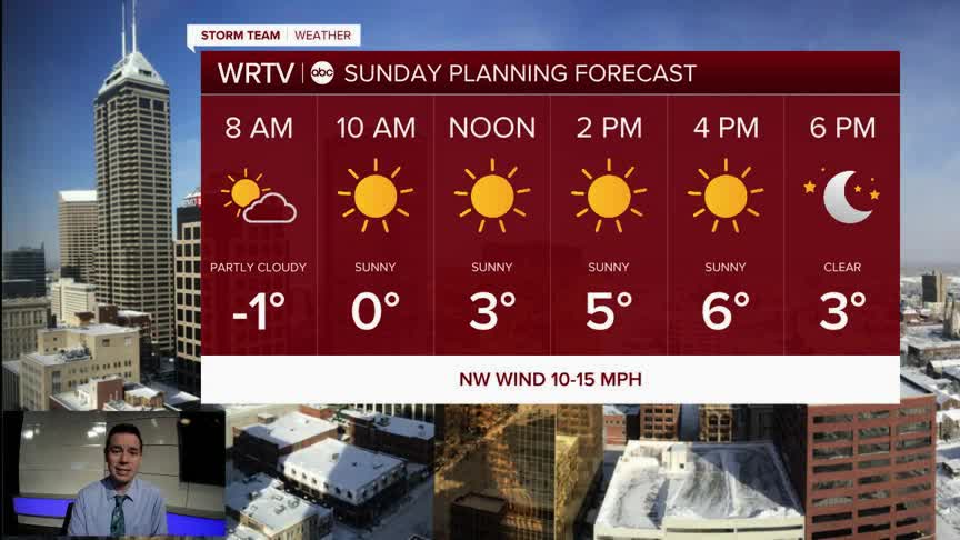
Wind chills stay below zero for most areas the entire day. If you can, avoid or limit your time outdoors. If you do have to go out, be sure to bundle up from head to toe. Also remember to limit your pet's time outdoors too.

wrtv
High temperatures only reach the single digits Sunday afternoon. We will see some sunshine. That combined with the fresh snow makes for a very bright day.

wrtv
Indianapolis Weather Forecast:
Sunday: Frigid, but dry. High: 8°
Monday: Partly sunny. High: 24°
Tuesday: Sun and clouds. High: 35°
Indianapolis 7-Day Weather Forecast

wrtv
