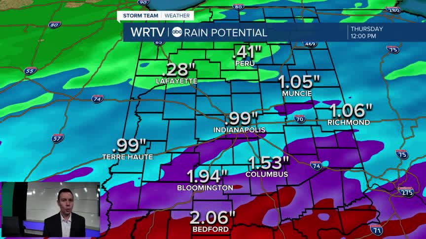


Areas of fog are limiting visibility where there are breaks in the rain. A Dense Fog Advisory is in effect until 5AM. Yet another round of rain is expected to develop overnight through Thursday morning. A Flood Watch continues along and south of I-70 through noon Thursday. Additional rainfall of up to 2" is possible in this area, which already received heavy rain the night before.

Following a wet start to our Thursday, the chance for additional rain and storms becomes much more scattered. With cloudy skies and a south breeze, we'll enjoy highs in the 60s.

Rain chances are looking lower for the end of the week. I don't think that's anything we'll be complaining about. Something else to look forward to is even warmer weather. Friday afternoon highs in the middle 70s will rival records!

Indianapolis Weather Forecast:
Tonight: Cloudy with rain and storms. Low: 54°
Thursday: AM rain. Scattered PM storms. High: 66°
Friday: A few t'storms. High: 76°
Saturday: Morning rain. High: 68°
Indianapolis 7-Day Weather Forecast

