
INDIANAPOLIS (WRTV) - A chilly morning and a cooler afternoon. High temps will stay below normal today. Warmer conditions for the end of the week with rain chances holding off until Friday
TODAY
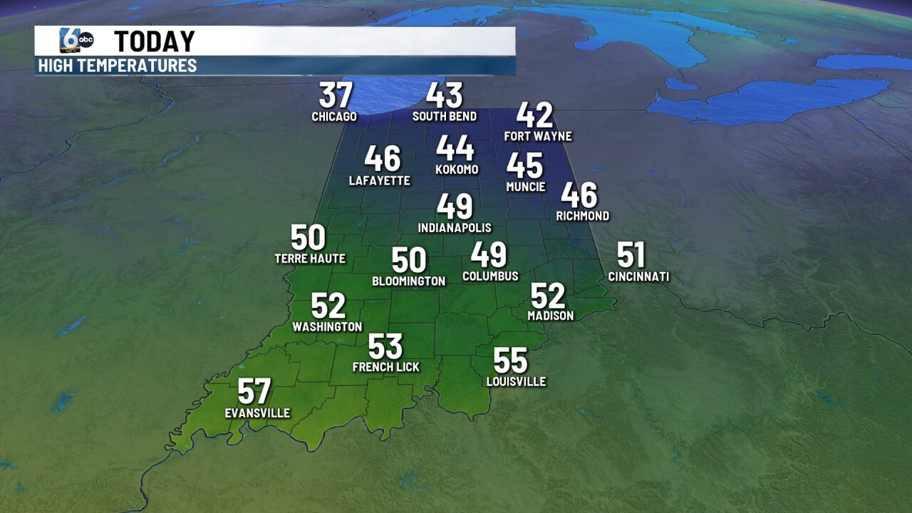
Sunshine for the first part of the day with partly cloudy conditions later in the afternoon. The high temperature will be close to 50 degrees later today. Normal high for this time of year right around 61 degrees. Winds will not be as breezy as they were yesterday afternoon. Winds will be out of the northeast around 5 to 10 mph.
TONIGHT

Clear and chilly once again across much of central Indiana. Low temperatures will fall near 34.
TOMORROW
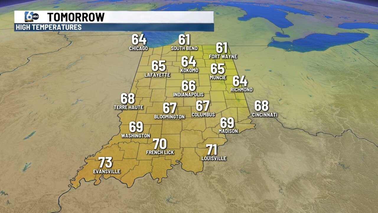
Another cool start for your Wednesday morning, so give the kids an extra layer at the bus stop in the morning. They won’t need those extra layers into the afternoon with mostly sunny skies and breezes out of the southeast. We will warm up near 66 for the afternoon. Winds may gust at times close to 20 mph out of the south and south east
7 DAY EXTENDED FORECAST
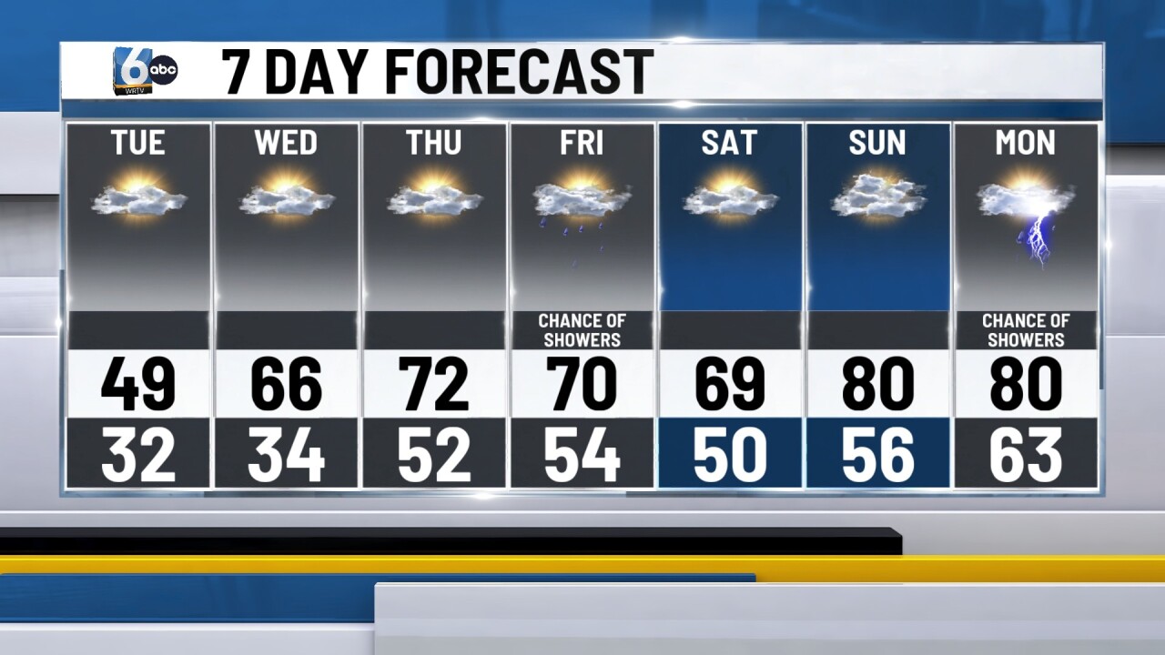
Temperatures continue to warm into the end of the week. On Thursday, look for partly cloudy skies with high temperatures around 72. Late Thursday night into early Friday we will see a system. Move through. Bring us a chance for some showers and maybe even a few rumbles of thunder. High temperatures will be close to 70 on Friday.
We may see an early morning shower on Saturday otherwise partly cloudy conditions for the afternoon. Look for highs close to 70 on Saturday.
High temperatures climb close to 80 on Sunday and Monday. Dry condition Sunday with partly cloudy skies but more rain chances arrive heading into the first part of the new work week.
