


Headlines
- ACCUMULATING SNOW OVERNIGHT
- ANOTHER ROUND OF SNOW SATURDAY
- FRIGID TEMPS FOR THE WEEKEND
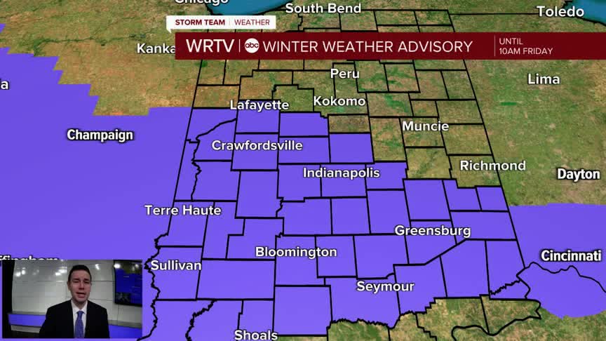
A Winter Weather Advisory is in effect for areas along and SW of a Tippecanoe to Rush County line until 10am Friday. Some moderate to heavy snow could reduce visibility and create slick conditions, especially as you travel SW across the state.
Areas north of the Advisory are likely to see less than 1" of snow. Much of the rest of Central Indiana can expect 1"-3", but there could still be a band of 3"-5" across west and southern spots.

The snow exits quickly, but still prepare for some challenging travel conditions early Friday. Skies stay cloudy with highs in the lower to middle 30s.

Yet another system brings the chance for accumulating snow Saturday. As of now, it's possible to see a swath of 3"-6" across part of Central Indiana. Stay tuned for updates on snowfall amounts. This system brings dangerously cold temperatures over the weekend. Wind chills will be near -20° by Sunday morning.

Indianapolis Weather Forecast:
Tonight: Cloudy with snow likely. Low: 27°
Friday: AM snow showers. Cloudy. High: 34°
Saturday: Snow likely. High: 28°
Sunday: Mostly sunny and very cold. High: 8°
Indianapolis 7-Day Weather Forecast

