

Thursday's rain and storms bring an end to the spring preview we've been enjoying the last couple of days. A seasonal chill returns to the air Friday. Temperatures don't move much through the day. Morning lows in the 30s only recover into the lower 40s. Clouds decrease through the day, so it should be a fairly bright finish to the week.
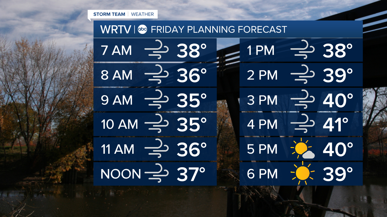
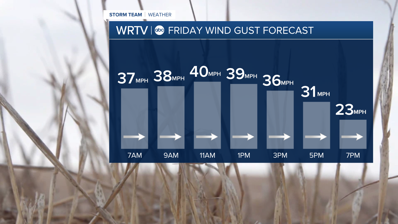
Adding to the chill will be a persistent west wind. Gusts between 30 and 40 mph will be common. That keeps our wind chills in the 20s for much of the day.
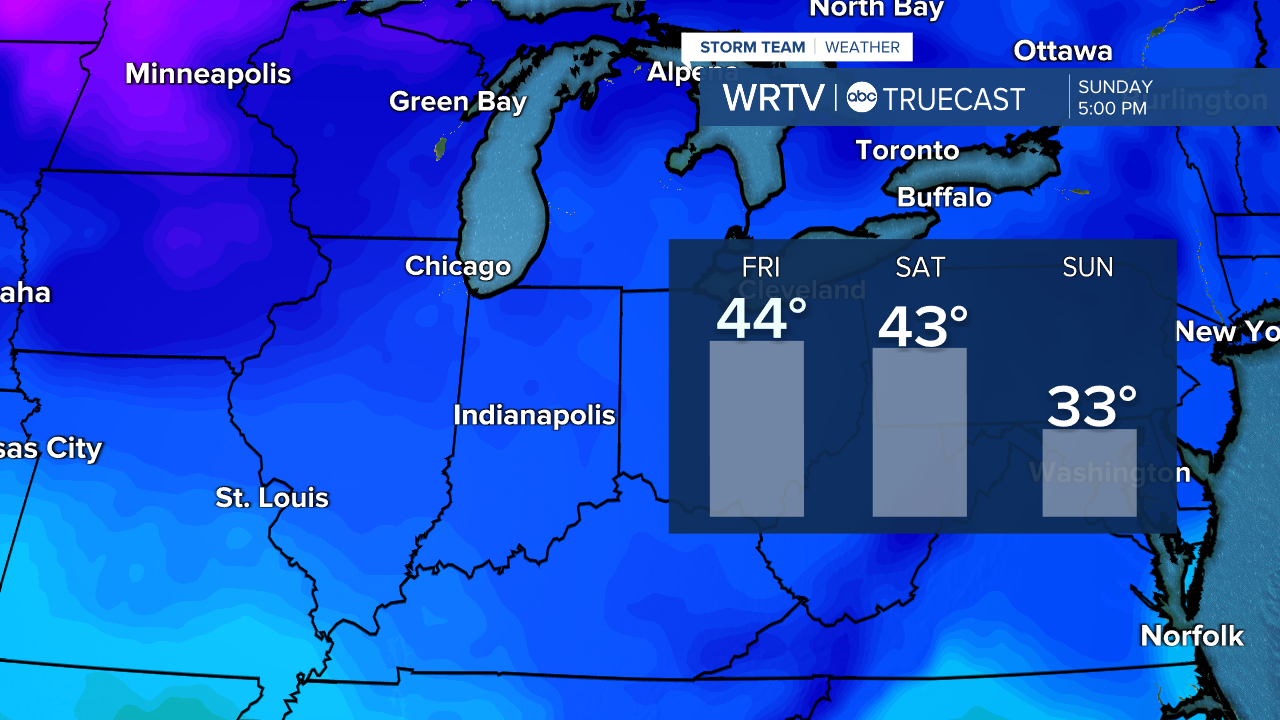
The temperature drop doesn't stop there. We continue to cool this weekend. Afternoon highs struggle to reach the freezing mark by Sunday.

The extra blast of cold air could be accompanied by a few snow showers or flurries Saturday night into Sunday. We aren't finished with winter just yet!

Indianapolis Weather Forecast:
Friday: Partly cloudy. Windy. High: 44°
Saturday: Sun & Clouds. High: 43°
Sunday: Mostly cloudy. Flurries. High: 33°
Indianapolis 7-Day Weather Forecast

