


Headlines
- TORNADO WATCH IN PLACE UNTIL NOON
- HEAVY RAIN & FLOODING POSSIBLE TODAY
- MUCH COLDER NEXT WEEK
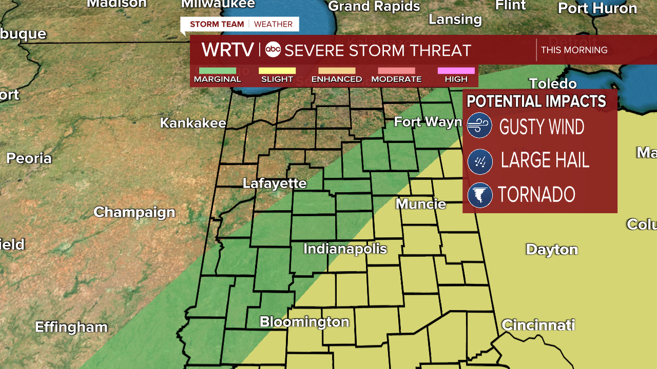
A tornado watch has been issued for most of our area until noon. A few single supercell storms are possible through the morning and have the potential to spin and produce a tornado. Make sure you have a way to get alerts and have your severe weather plan ready to go. Outside of that risk, widespread storms can produce strong winds and heavy rain. Flooding will also be a big concern most of Wednesday. There is a marginal (level 1 out of 5) and a slight risk (level 2 out of 5) in place today.
While the tornado watch will end at noon, storms stick around through the afternoon. Moderate to heavy rain will land on already saturated ground, leading to flooding concerns. Here is a snapshot at 3:30.

We expect a big temperature drop next week. As the jet stream buckles and dives south, we will see overnight lows drop back into the 20s! Some could even see a 40° drop in temperatures in a matter of hours.

That means that St. Patrick's Day is looking very cold for now.
Indianapolis Weather Forecast:
Today: Getting colder and windy. High: 69°
Overnight: Cold and clearing. Low: 31°
Tomorrow: Mostly sunny. High: 49°
Indianapolis 7-Day Weather Forecast

