

Headlines
- SCT. SNOW SHOWERS OVERNIGHT
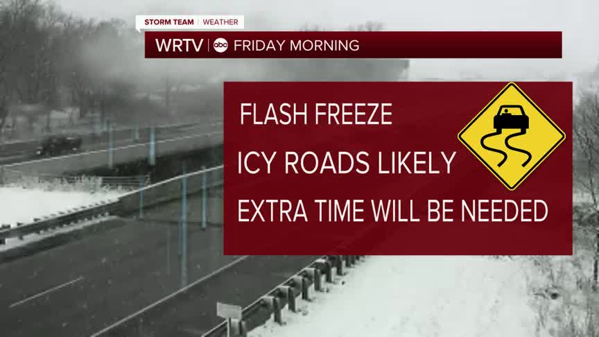
- FLASH FREEZE OVERNIGHT
- HIGHS IN THE 20'S FRIDAY
Temperatures will drop very quickly overnight, falling from the 50s into the teens and resulting in a flash freeze. This is not the same as a freezing rain event, but any moisture on the ground will freeze over. Treated roads should be okay, but you will need to be alert for the potential of slick spots.

Friday will be a cold day from start to finish, with highs only in the mid-20s. A few snow showers will be possible in the morning, with some minor accumulation expected. Once the snow showers end, skies will become mostly sunny in the afternoon. Wind chills will be in the teens through much of the afternoon, so be sure to bundle up.

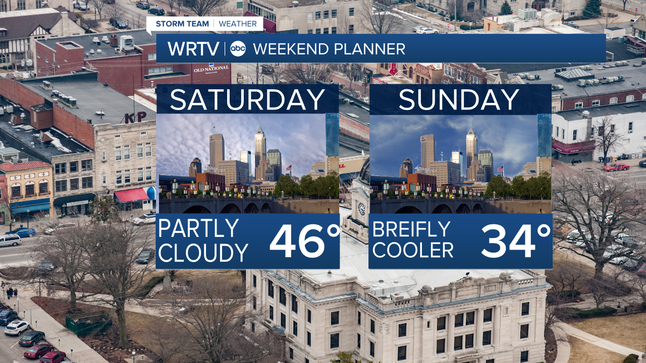
We rebound on Saturday in the mid 40s with partly cloudy skies. Sunday will be dry but colder again with highs in the mid 30s.
It does look like we moderate the temperatures close to 60° by Christmas Day.
Indianapolis Weather Forecast:
Overnight: Flash freeze. Temps tumble Low: 19°
Friday: Snow showers early. Partly cloudy & cold High: 26°
Saturday: Partly cloudy. High: 46°
Sunday: Mostly sunny. High: 34°
Indianapolis 7-Day Weather Forecast

