Weather

Actions

ALERT: Snow this evening, before transition to rain

KM2.png
Posted

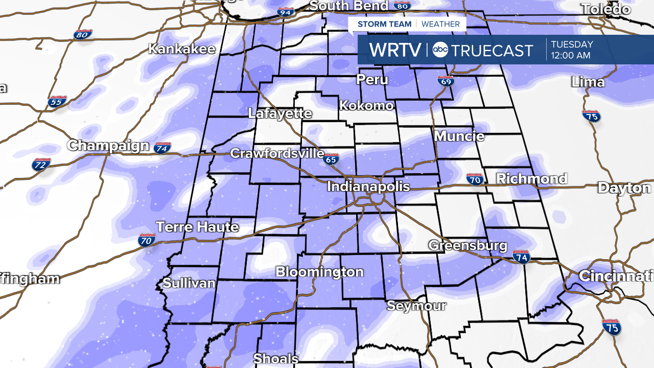
Our ongoing weather system has had its forecast challenges from the very beginning. The main area of uncertainty was with how far north dry air would work into the system, and thus cut off the snow. That line has worked its way north of I-70, which was not handled particularly well by many of the weather models. This does lower expected snowfall totals across portions of Central Indiana a bit. That said, it has been the expectation that the greatest snowfall rates would occur this evening. That has not changed. The map below shows expected additional snowfall Saturday afternoon through Saturday evening. Tonight, temperatures continue to warm with a transition to rain. This will also help to melt some of the accumulated snow.

KM6.png

The system pushes east by Sunday morning. We may still have some scattered flurries through the day. Temperatures start off around 30°, but will spend much of the day in the 20s.

KM3.png

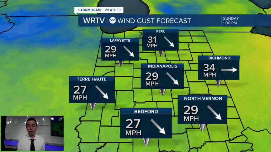
A cold west wind will gust around 30 mph through the day. You'll need all the winter layers to stay warm with wind chills in the teens.

KM5.png

Indianapolis Weather Forecast:
Tonight: Cloudy with rain and snow. Low: 29°
Sunday: Cloudy and breezy. Flurries possible. High: 30°, then temps fall.
Monday: Cloudy. Chance of light snow late. High: 32°
Tuesday: Mostly cloudy. High: 28°

Indianapolis 7-Day Weather Forecast

KM1.png