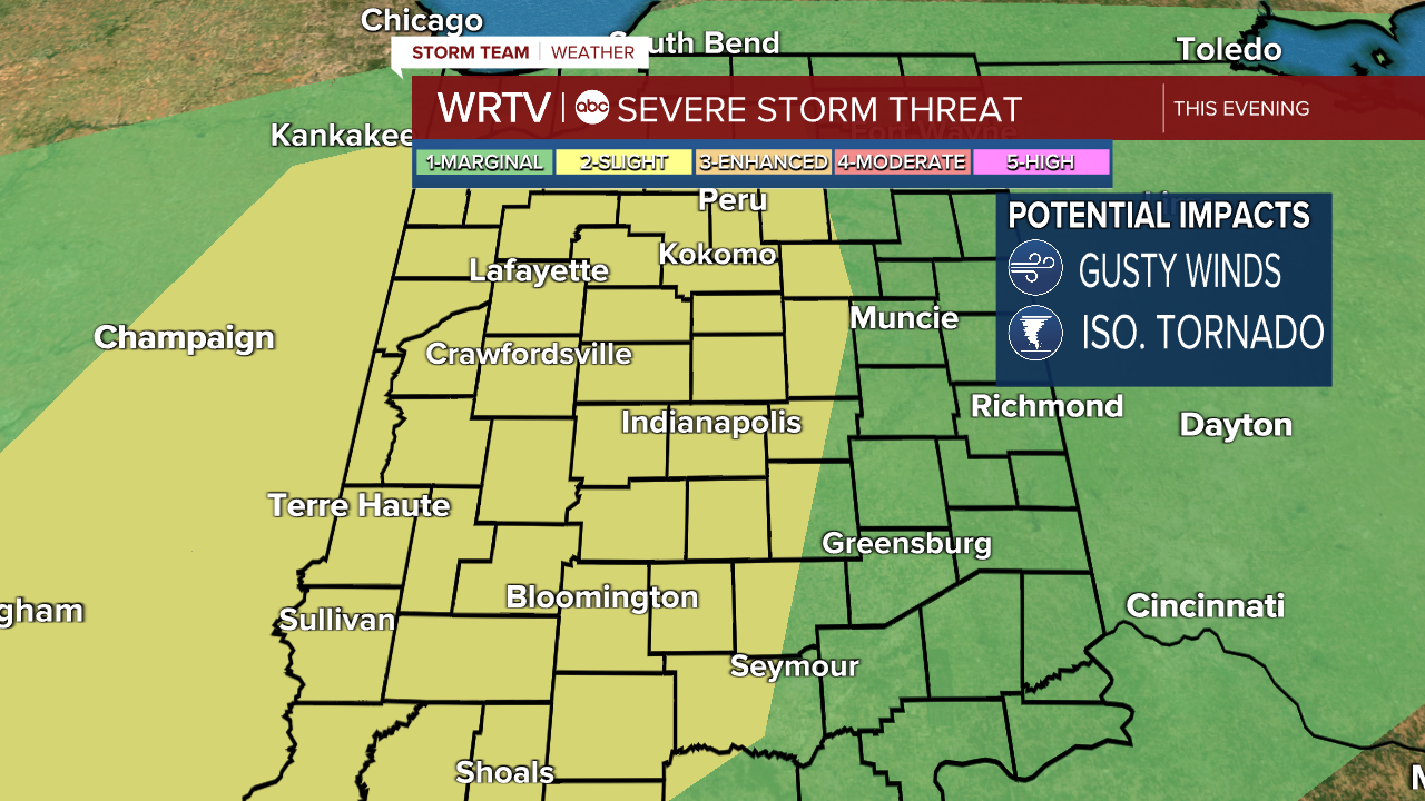
Update 4pm: Tornado Watch in effect for several counties - click here for latest alerts.
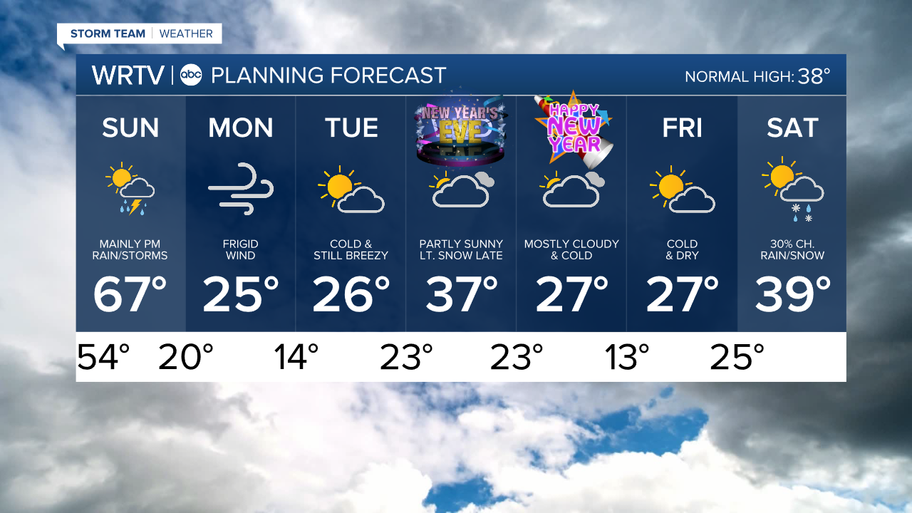
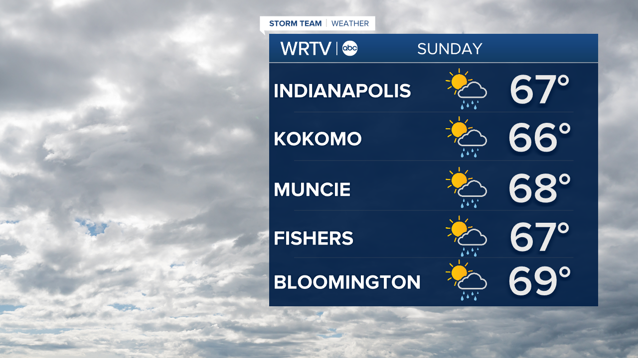
Sunday is likely to bring record setting warmth. We spend the day in the 60s. We're forecasting a high of 67° in Indy. That would break the current record of 65° set in 1984. The warmth comes with clouds and a noticeable mugginess in the air. We could have a few showers or rumbles of thunder through the day. Far northern locations have the highest chance of wet weather.
A powerful cold front approaches the area Sunday evening into Sunday night. This will bring more widespread rain to the area. There's also the chance we could have a few strong to severe storms develop. The western 2/3rds of Central Indiana is now under a Slight Risk (2/5) of severe weather. Damaging wind is the main threat, but an isolated tornado can't be ruled out. Be sure to have a way to get any weather alerts that may be issued. Less than a half inch of rain is expected for most areas.
Our weather changes come with some gusty winds Sunday through Monday. The strongest gusts are expected Monday.

The wind brings in much colder air. Temperatures will fall by more than 40° between Sunday evening and Monday morning. This could lead to a flash freeze of standing water creating some slick conditions. You'll need all of the winter layers again by Monday morning with wind chills dropping below zero.

Indianapolis Weather Forecast:
Sunday: Cloudy & breezy with areas of rain. High: 67°
Sunday Night: Rain and storms. Windy and turning much colder. Low: 20°
Monday: Very windy and frigid. High: 25°
Tuesday: Partly sunny. Still breezy. High: 26°
Indianapolis 7-Day Weather Forecast