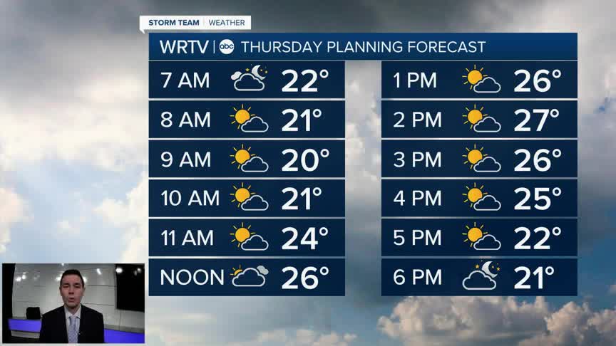


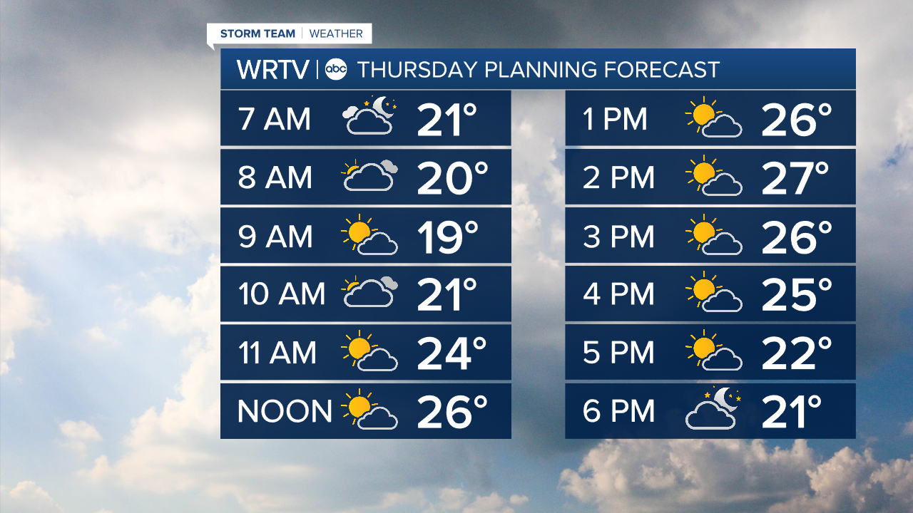
Yet another blast of cold air is settling in across Central Indiana. A NW wind of 5-10 mph will push feels like temperatures into the single digits Thursday morning. Be sure to minimize time outside, and cover up from head to toe when you do venture out. Wind chills stay in the teens through the afternoon.

wrtv
We should see some sunshine finally mix in with the clouds Thursday. That said, it's still a very cold day. Highs in the mid 20s come in about 20° below average.
wrtv
Indianapolis Weather Forecast:
Thursday: Partly sunny and very cold. High: 25°
Friday: Partly sunny. High: 31°
Saturday: Mostly cloudy. High: 33°
Indianapolis 7-Day Weather Forecast

wrtv
