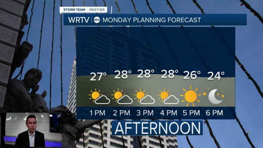


Much of our Monday comes with mostly cloudy skies. That said, we should see a little more sunshine working in than what we had over the weekend. Temperatures stay cold with highs in the upper 20s north and lower 30s south.

We get a brief warm-up Tuesday. A SW breeze at 10-20 mph does take some of the "warmth" out of the air, but it gets our highs around 40°. That's our warmest so far this month! Feels like temperatures stay in the 30s.

A few rain and snow showers are possible Wednesday with highs in the lower 40s. After that, we're back into the deep freeze.
Indianapolis Weather Forecast:
Monday: Mostly cloudy. High: 30°
Tuesday: Mostly cloudy and breezy. High: 40°
Wednesday: A few rain/snow showers. Breezy. High: 42°
Indianapolis 7-Day Weather Forecast

