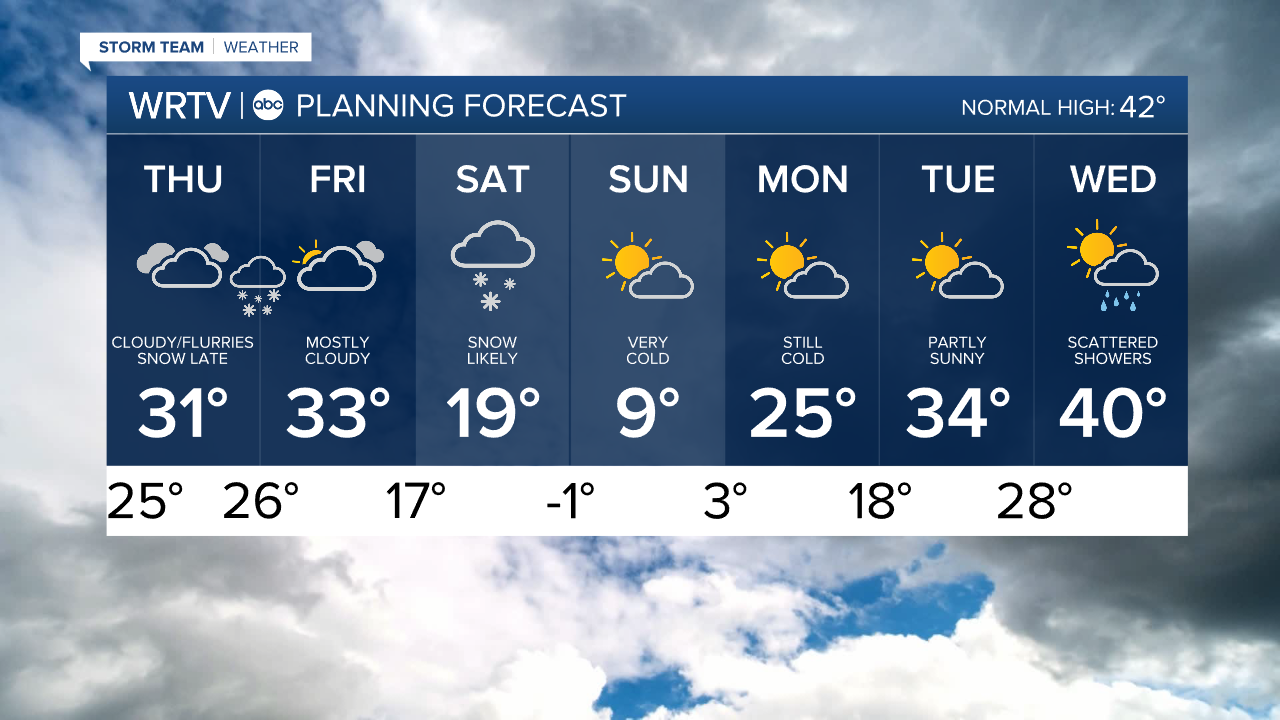
Thursday is another gray and cloudy day for us. We can't rule out seeing some flurries, but much of the day is quiet. Temperatures only warm around the 30° mark. Thankfully, wind will be much less of an issue than it was Wednesday.
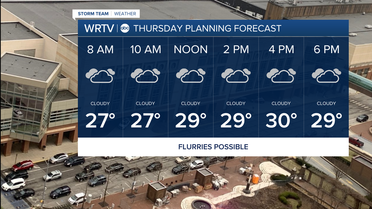
Our next weather system enters the picture Thursday evening. It could bring some snow to impact the evening commute, especially in western areas. A Winter Weather ADVISORY is in effect 5pm Thursday to 10am Friday for areas along and SW of a Tippecanoe to Rush Co. line. Snow overspreads much of Central Indiana Thursday night.

As of now, it appears we'll have a band of 2"-4" of snow along and SW of a Lafayette to Richmond line with lesser amounts to the north. An area of 3"-5" of snow is possible across central or southern parts of the area, but the exact location is still in question.

Another batch of light snow is possible Saturday. That one comes with the coldest air yet. Highs are only in the single digits Sunday with even colder wind chills.

Indianapolis Weather Forecast:
Thursday: Cloudy with flurries possible. High: 31°
Thursday Night: Snow likely. Low: 26°
Friday: Mostly cloudy. High: 33°
Saturday: Light snow likely. High: 19°
Indianapolis 7-Day Weather Forecast