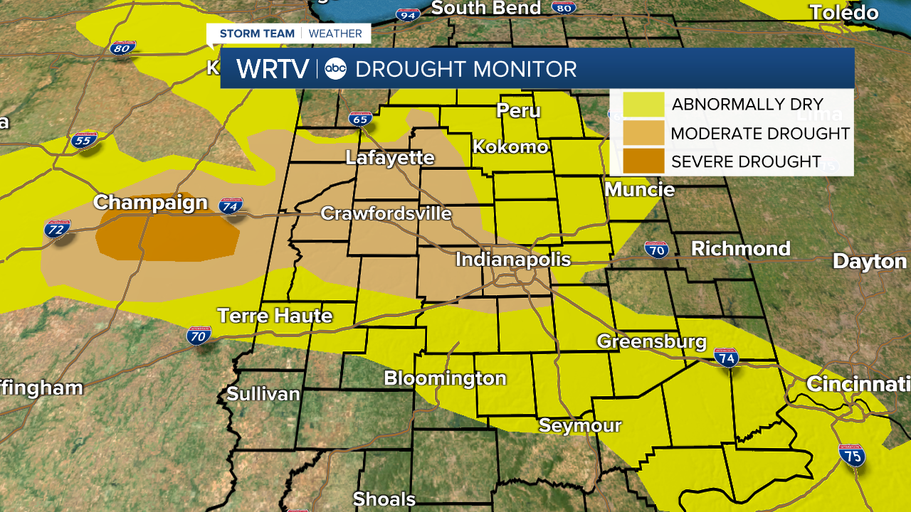
Looking across central Indiana, many spots are noticing improvements in the very dry conditions we've been dealing with for much of the summer. For the first time in a while, you may need to mow the lawn again. So, you might be surprised to learn we have seen very little change in the US Drought Monitor released Thursday. Below are the maps to compare last week's conditions to this week.
Map issued July 21st:

Map issued July 28th:

The only places to see improvement in moderate drought are across the southern half of Putnam County and western White County. There are a couple of reasons for this. The first is that although the maps come out on Thursdays, the cut-off for the rainfall data used is Tuesday mornings.
Less than two tenths of an inch of rain fell in Indy between the morning of Tuesday, July 19th and the morning of Tuesday, July 26th. That's not going to move the needle in a positive direction at all.
The map below shows the rainfall we've received since Tuesday morning (and thus not included in the drought map). Indy picked up more than one inch of additional rainfall while some southern spots received between four and five inches of rain.

The second reason for little change in our drought conditions is that many areas are still running more than four inches below average with rainfall since the start of June. While the rain mentioned above will certainly help us out with next week's report, it's tough to say whether abnormally dry and moderate drought conditions will change much.

Our drought situation also depends on how much rain we see over the coming days. The outlook from the Climate Prediction Center shows we're trending back toward a rather dry weather pattern over the next couple of weeks.


