


Headlines
- ENHANCED RISK FOR SEVERE STORMS
- POTENTIAL RECORD BREAKING HEAT
- COOLING THIS WEEKEND
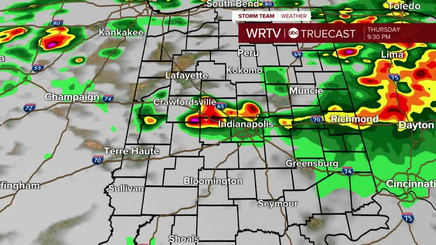
ALERT DAY: Severe weather looks likely Thursday evening. Central Indiana is under an "enhanced" risk or a level 3 out of 5 for severe weather. Large damaging hail is the highest threat with these storms. Damaging wind and flooding look likely as well. There is a tornado risk with these storms, especially isolated storms that get going early.

Timing looks late Thursday night. Our initial storms fire up around sunset and drift south. That would be the greatest threat for hail and a tornado or two. A line of storms then forms into the early morning hours of Friday. Flooding will become the primary concern through the Friday morning commute.

Not to get lost in the shuffle, it is important to note how hot Thursday will get. We are on record watch with temperatures surging into the mid 80s. Anything over 80° would break the current record. Our forecast is 83°.

Indianapolis Weather Forecast:
Today: Evening severe storms. High: 83°
Overnight: Heavy rain. Low: 43°
Tomorrow: Much cooler. High: 49°
Indianapolis 7-Day Weather Forecast

