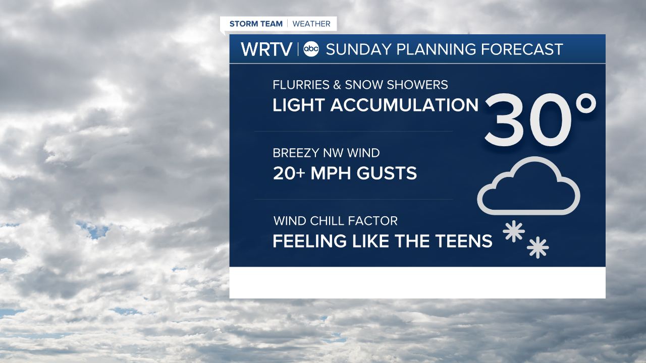


- SCATTERED SNOW SHOWERS TODAY
- LIGHT ACCUMULATION
- UP AND DOWN TEMPS THIS WEEK
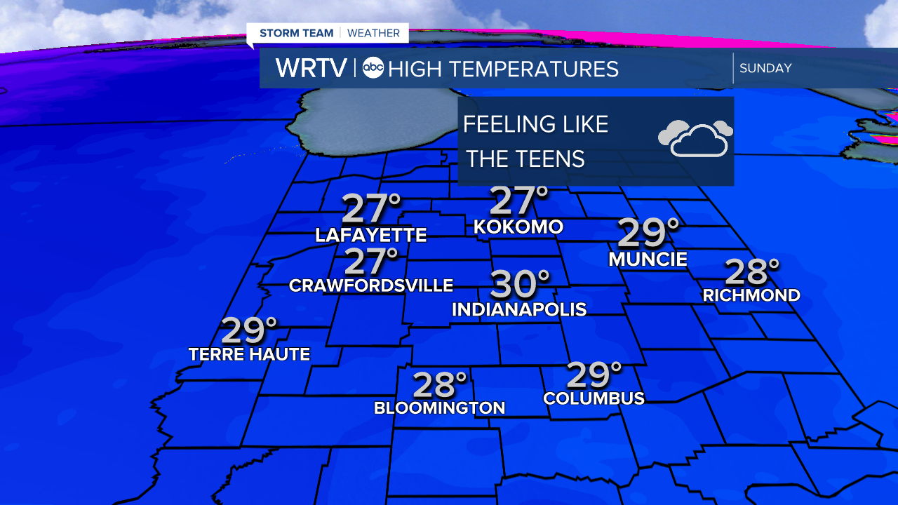
Skies stay cloudy through our Sunday with scattered snow showers, especially across NE areas. Temperatures spend the day in the 20s. However, it's going to feel even colder. A NW wind of 10-20 mph comes with gusts around 25 mph. Bundle up, because that means our wind chills stay in the teens.
WRTV
We're cold and breezy again Monday. After that, we see a quick climb to some warmer weather. However, it may come with more active weather. We are watching a chance for rain and snow across the area Thursday.

wrtv
Indianapolis Weather Forecast:
Sunday: Cloudy with scattered snow showers. Breezy. High: 30°
Monday: Mostly cloudy. Flurries possible. High: 31°
Tuesday: Mostly cloudy. High: 40°
Indianapolis 7-Day Weather Forecast

wrtv
