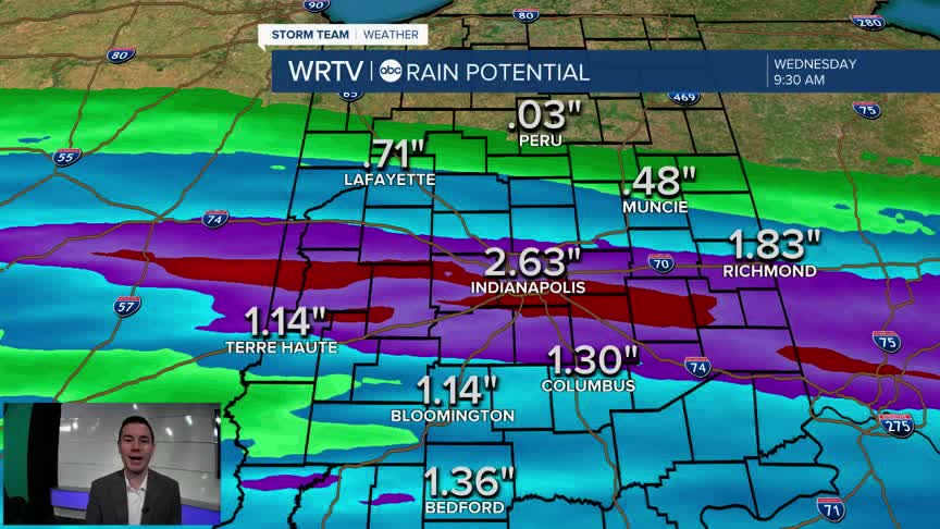


Rain continues to fall across much of Central Indiana. Some of it could be heavy, and move over the same spots for several hours. That's why the National Weather Service has issued a Flood Watch through Wednesday morning for areas along and south of I-70. If you come across a flooded road, find another way around. In the heaviest band, more than 2" of rain is possible.

Following any lingering rain early Wednesday morning, we should see a cloudy period with just a few showers. However, more rain is expected late Wednesday afternoon through the evening. High temperatures climb close to 60°.

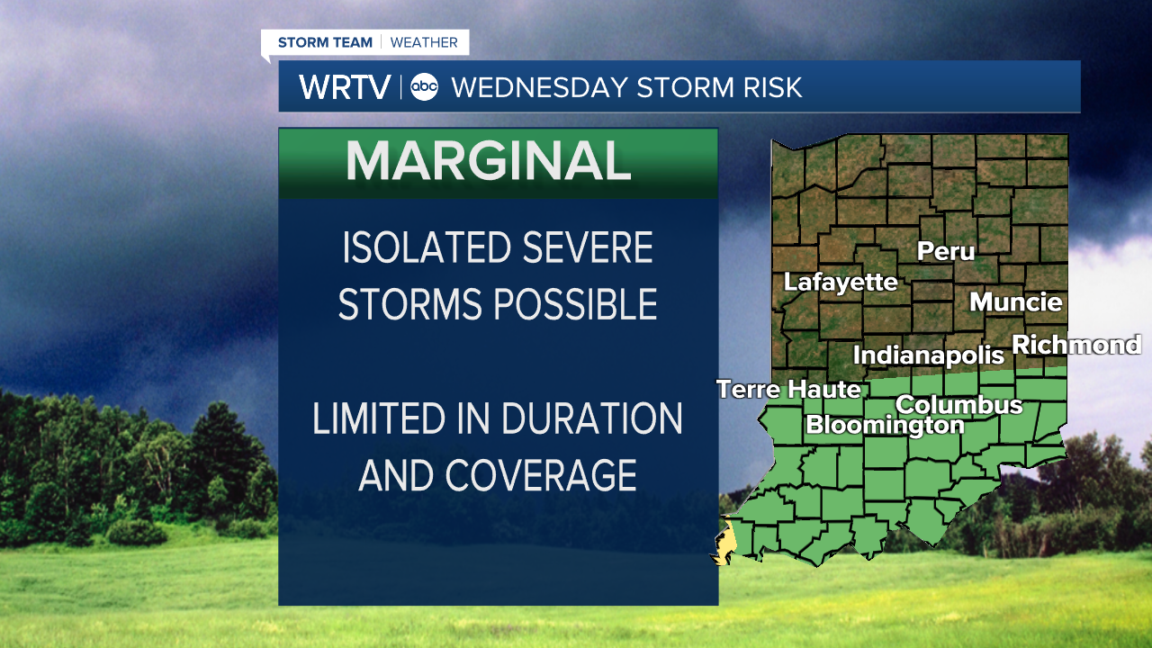
There is a Marginal Risk (Level 1/5) for a few strong or severe storms Wednesday. Hail and some gusty winds would be the main threats with a focus south of I-70.
Indianapolis Weather Forecast:
Wednesday: Cloudy. Mainly PM rain and storms. High: 59°
Thursday: Scattered rain and storms. High: 67°
Friday: Scattered showers. High: 75°
Indianapolis 7-Day Weather Forecast

