


INDIANAPOLIS (WRTV) — Quiet conditions for today and Wednesday before rain moves into the state for the end of the week. Temperatures continue to be at or above normal with muggy conditions for the rest of the week.
TODAY
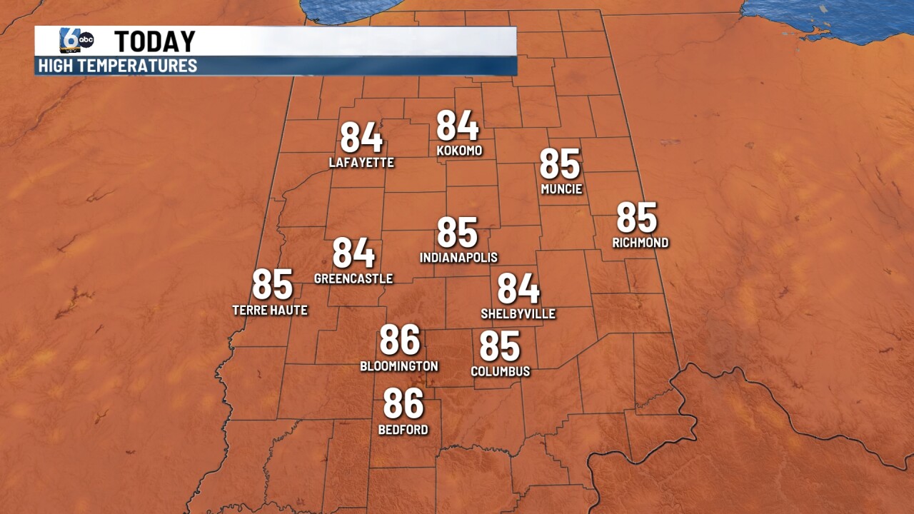
A little bit of patchy fog possible early this morning, otherwise partly cloudy conditions for the afternoon. It will still be on the humid side, but not as impressive as what it was last week. Temperatures will climb into the mid 80s, which is right around normal for this time of the year.
TONIGHT
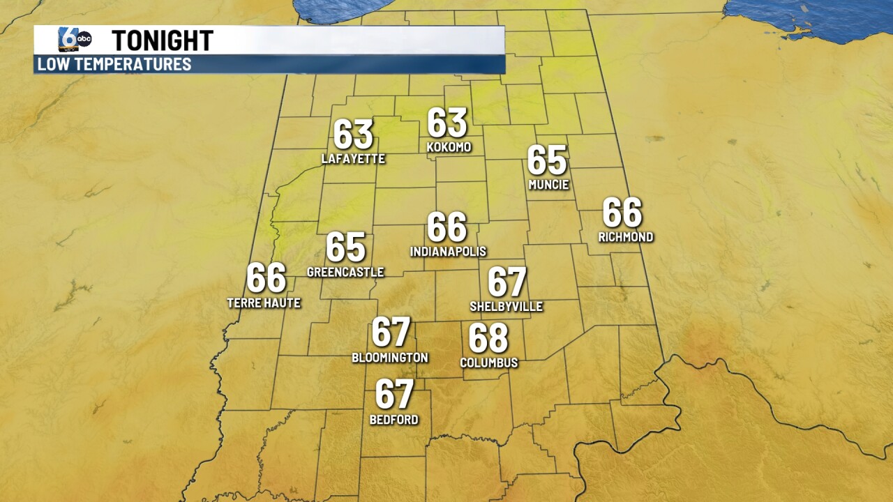
If you’re heading to the Indianapolis Indians game this evening, it will be dry and on the humid side. First pitch temperatures will be into the 80s and falling into the 70s by the end of the game. Overnight look for a few clouds with temperatures into the upper 60s.
TOMORROW

Another dry day on Wednesday but warmer. Look for a mix of sun and clouds into the afternoon with high temperatures climbing into the upper 70s flirting with 90.
7 DAY EXTENDED FORECAST

As we approach the end of the week, we will look for a frontal boundary to stall out across parts of Indiana. This will bring us a chance for some showers and thunderstorms late Thursday. The rain chances continue into Friday and Saturday. Some of the rain could be moderate to heavy at times which may lead to some areas getting a lot of rain in a short period of time. This could produce some flash flooding concerns.
Temperatures will climb into the upper 80s, flirting with 90 on Thursday. Weekend temperatures will be right around normal into the mid 80s.
