INDIANAPOLIS (WRTV) — Thursday starts off quiet before showers and storms move in late in the day.
TONIGHT:
Partly cloudy skies remain. Isolated showers and storms stay down in southern Indiana. Low temperatures in the upper 60s.
TOMORROW:
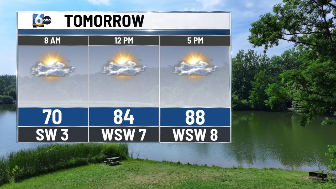
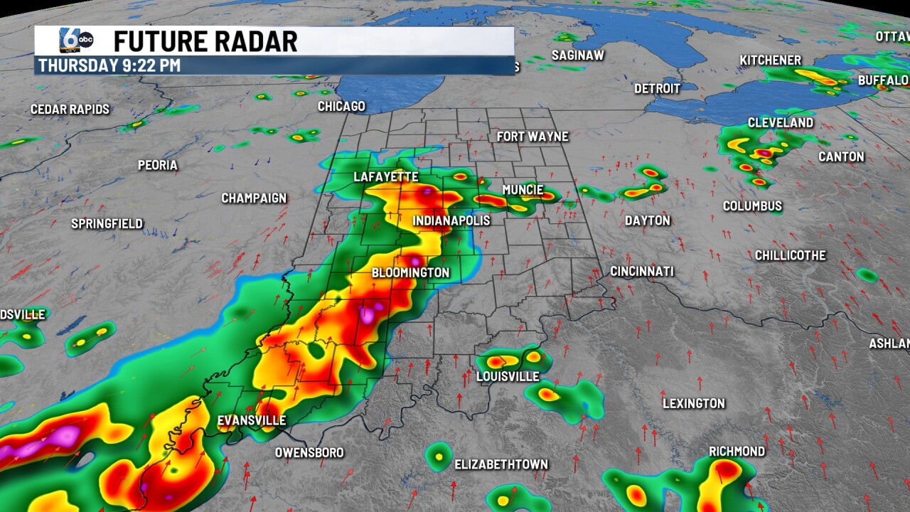
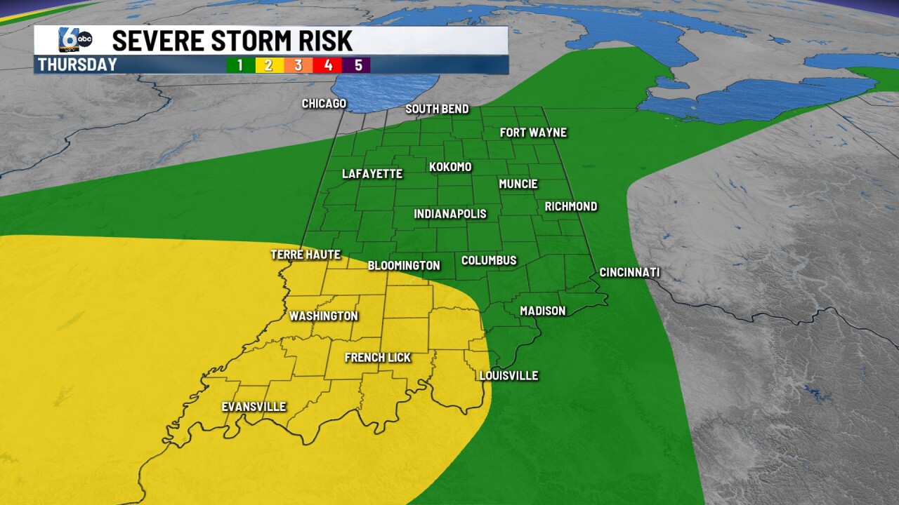
Partly cloudy skies. Isolated pop-up showers and storms are possible in the evening, but the better rain chance arrives Thursday night. Scattered showers and storms are expected in this round. A slight (2/5) risk of severe storms is in place for southwestern Indiana, primarily for strong winds. A flood watch has been issued for southern Indiana until early Sunday morning. High temperatures in the upper 80s.
FRIDAY:
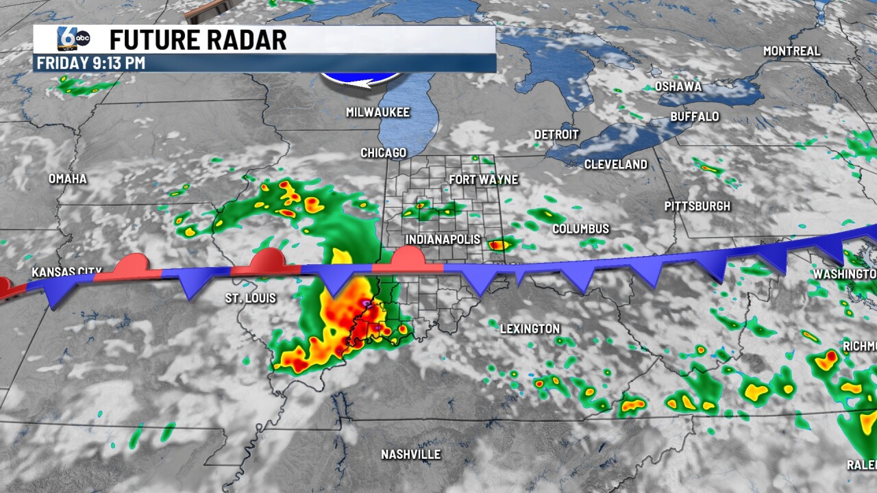
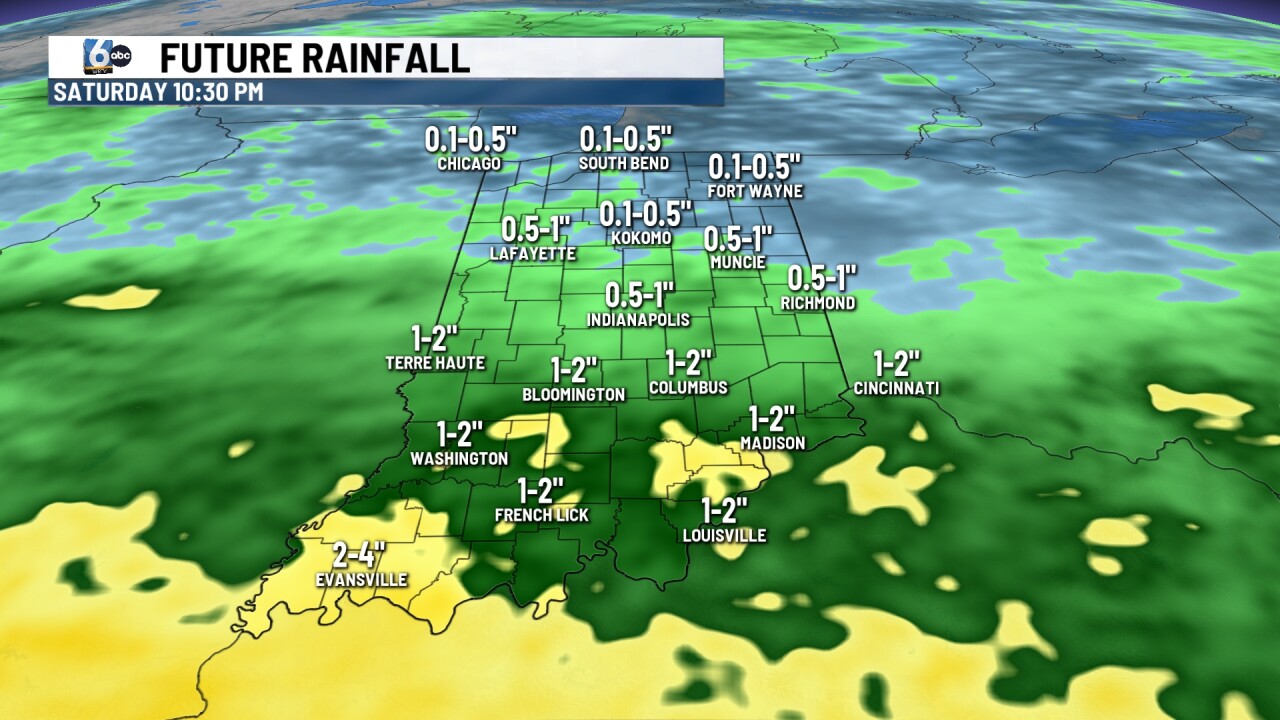
Scattered on/off showers and storms linger. The highest odds for rain will be in the southern half of the state along the stalled frontal boundary. High temperatures in the mid-80s.
7-DAY FORECAST:
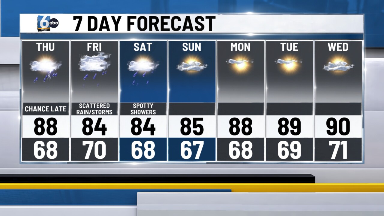
Spotty showers and storms are still possible along the same front on Saturday. Rain chances dwindle late week into early next week. High temperatures will be near 90 degrees for multiple days.