


INDIANAPOLIS (WRTV) — A much cooler start this morning with temperatures into the 50s. Another beautiful day with sunshine, low humidity and below normal temperatures. The heat and humidity return just in time for the weekend.
TODAY:

Even though we have a cool start, it will be a beautiful afternoon. Expect sunny skies and wonderfully low humidity throughout your Thursday, making it an ideal day to get outside. Highs will comfortably top out near 79 degrees.
TONIGHT:
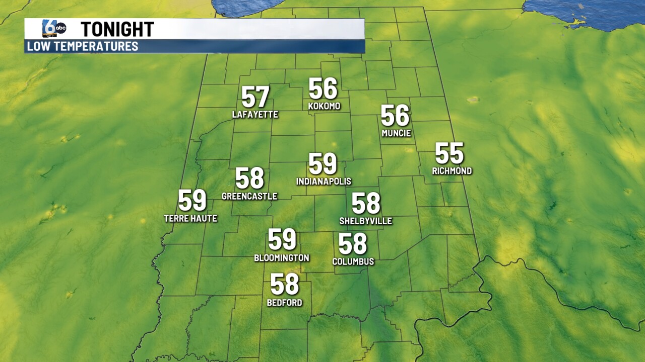
As we head into tonight, those clear skies will transition to partly cloudy. It will be a fantastic evening to leave the windows open, with comfortable overnight lows dipping down to near 59 degrees.
TOMORROW:
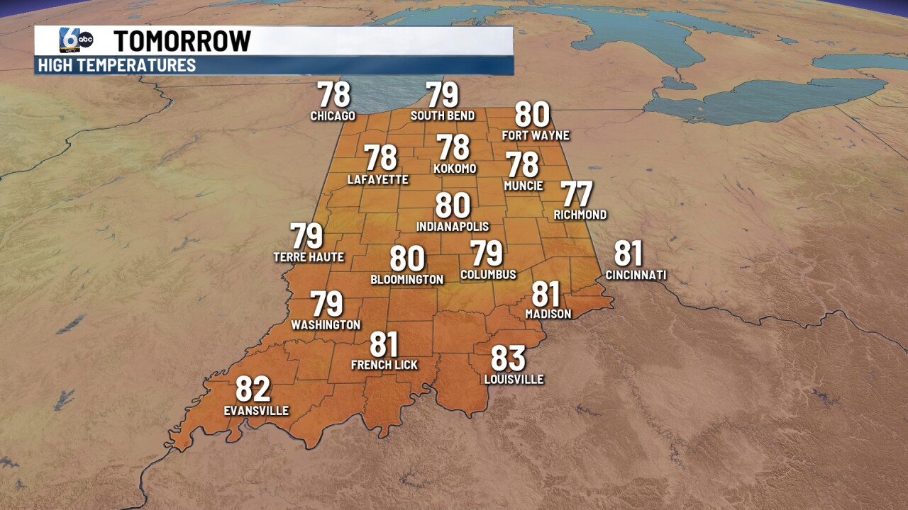
As we close out the workweek on Friday, we'll see partly cloudy skies with temperatures bumping up slightly to near 80 degrees. Most of us will stay completely dry, but don't be entirely surprised if an isolated shower pops up on the radar.
7 DAY EXTENDED FORECAST:
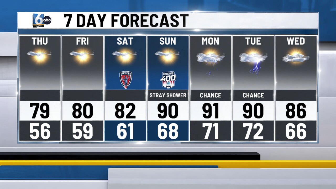
If you’re heading to the Indianapolis Motor Speedway this weekend, we are tracking a noticeable shift in the weather pattern. The heat and humidity are making a comeback just in time for the busy weekend.
The humidity starts to increase Saturday with partly cloudy skies and highs near 82.
Hot and humid on Sunday with highs near 90. Heat indices will be near the middle 90s for the afternoon.
That summer heat isn't going anywhere fast. As we head into Monday and Tuesday, the hot and muggy conditions stick around with highs remaining near the 90-degree mark. Along with the heat, rain chances are possible as we reintroduce scattered showers and storms both days.
