
INDIANAPOLIS (WRTV) — High heat and high humidity will continue through the rest of the week.
TONIGHT:

Calm weather is in store for the evening. Don’t expect much relief from the heat as overnight lows will only dip into the low 70s.
HEAT WARNING:
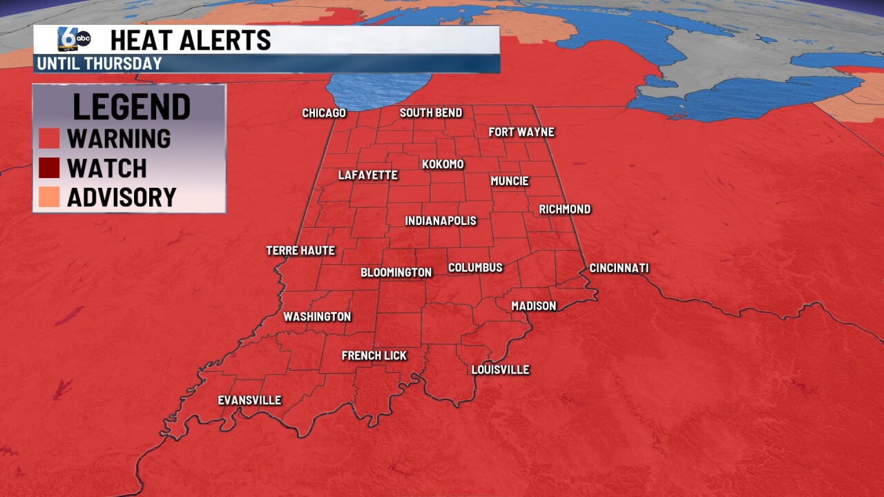
The National Weather Service out of Indianapolis has issued a Heat Warning that will run through 8 PM Thursday.
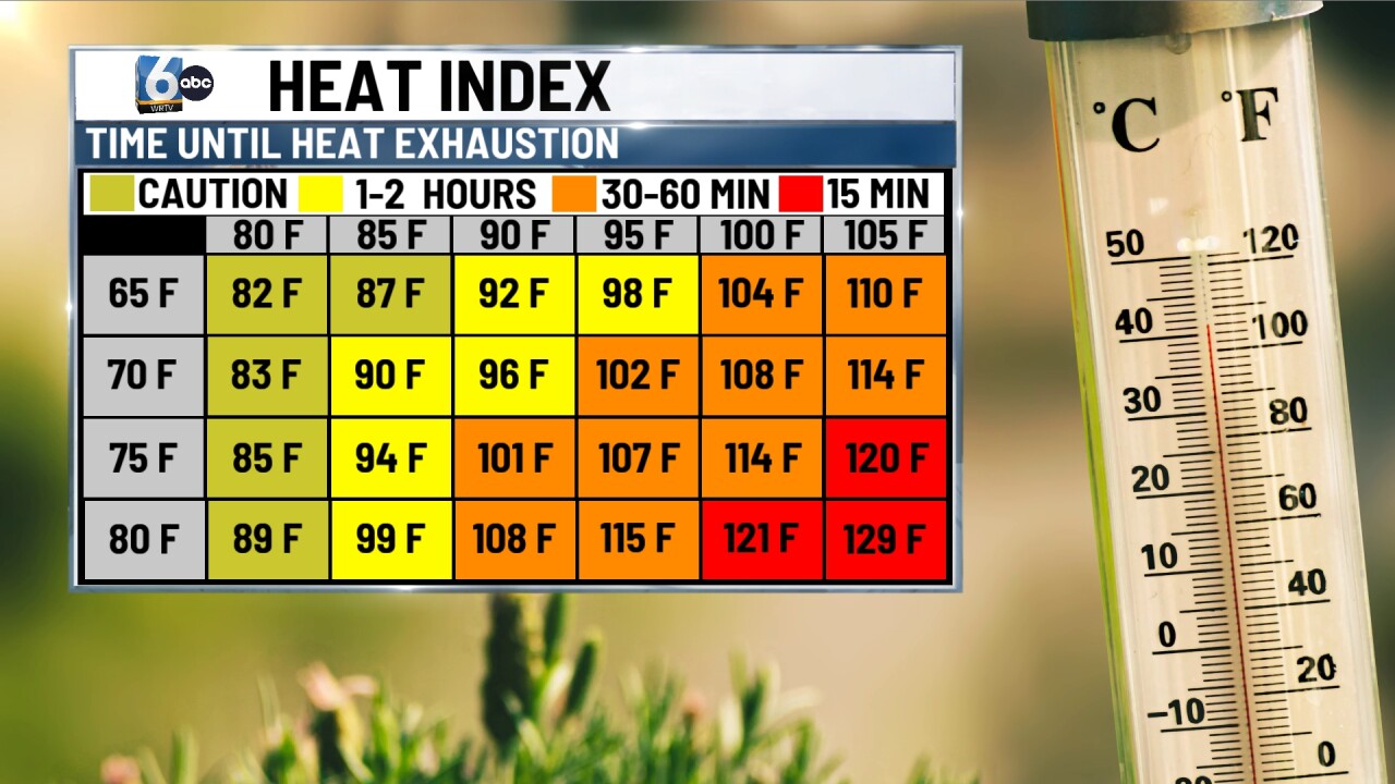
A warning means that temperatures in the 90s with dew points in the 70s, will lead to Heat Index values reaching 106. Hot temperatures and high humidity may cause heat illnesses.
Drink plenty of fluids, check up on relatives and neighbors, stay in an air-conditioned room when possible. If outside for extended periods of time, make sure to take frequent breaks in the shade as much as you can.
TOMORROW:

Copy and paste forecast for Wednesday. Skies will remain mainly clear with temperatures warming into the mid to low 90s. Heat index values will again push 100.
7-DAY FORECAST:

Sunshine and just as warm for the day on Thursday, however a stray pop-up shower or storm will be possible especially for spots south of I-70. More isolated storm chances will return Friday afternoon and last through Tuesday next week. No day will be a washout. Best chances will be Saturday and Sunday as a cold front will try to move through the region. This will allow temperatures to drop back into the mid-to-upper 80s.
