

INDIANAPOLIS (WRTV) — A dry day for your Thursday before more rain returns for race weekend. It will be warm and humid throughout the holiday weekend with several rounds of rain possible.
TODAY

A cool and cloudy start for your Thursday. Winds will be breezy out of the east and may gust at times near 20 mph. We will see cloudy conditions through much of the day with some peeks of sun possible into the afternoon. High temperatures will climb into the middle and upper 60s.
TONIGHT

Partly to mostly cloudy overnight. Low temperatures will fall into the lower 50s. Some spots drop into the upper 40s.
TOMORROW
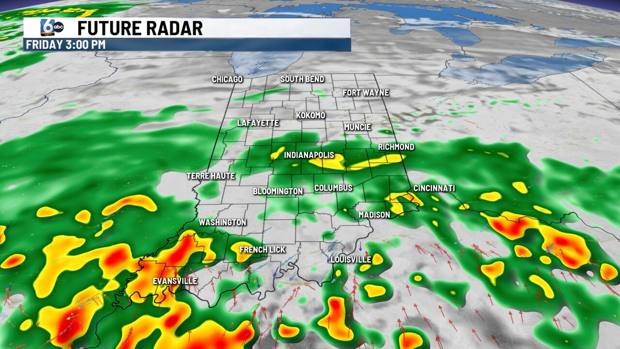
Rain chances develop by late morning and early afternoon. It will be a close call for carb day and practices. Rain is set to develop in southern Indiana and move across parts of Central Indiana by late morning and into the early afternoon. Rain chances will continue throughout the rest of your Friday. Humidity values begin to rise. Temperatures climb into the '70s. Rain will continue throughout the day Friday and into the evening hours.
7 DAY EXTENDED FORECAST

Spotty showers and even a few thunderstorms are possible for your Saturday. It looks like Friday will be the wetter of the two days. We will see lots of dry time on Saturday.
Highs Saturday climb into the upper 70s. Higher humidity arrives and sticks around all weekend long.
Race day will start off dry. Mild and muggy Sunday morning with temperatures in the 60s by daybreak. Highs reach the 80-degree mark for the afternoon. There is a rain chance but it looks like rain will hold off until later in the afternoon and evening.
Memorial Day looks soggy with highs near 80. More scattered rain chances Tuesday. Temperatures continue to stay into the lower 80s for the first part of the new workweek.
